29 m away
Pearl Pass
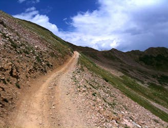
The iconic 4x4 road ride the helped launch the sport of mountain biking.
Difficult Mountain Biking
- Distance
- 61 km
- Ascent
- 1.6 km
- Descent
- 1.9 km
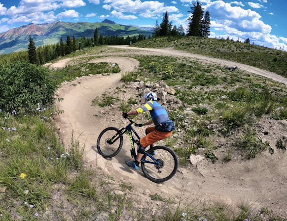
Crested Butte's newest trail is an instant classic!
Mountain Biking Difficult

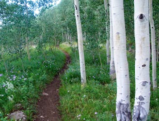
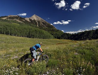
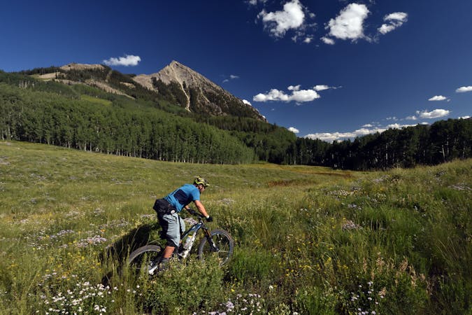
The newest trail in Crested Butte that's not just a mere reroute is known as "Baxter Gulch." Just finished in late 2018, Baxter Gulch allows riders to create an epic loop with the Green Lake and Carbon trails that's accessible directly from downtown Crested Butte.
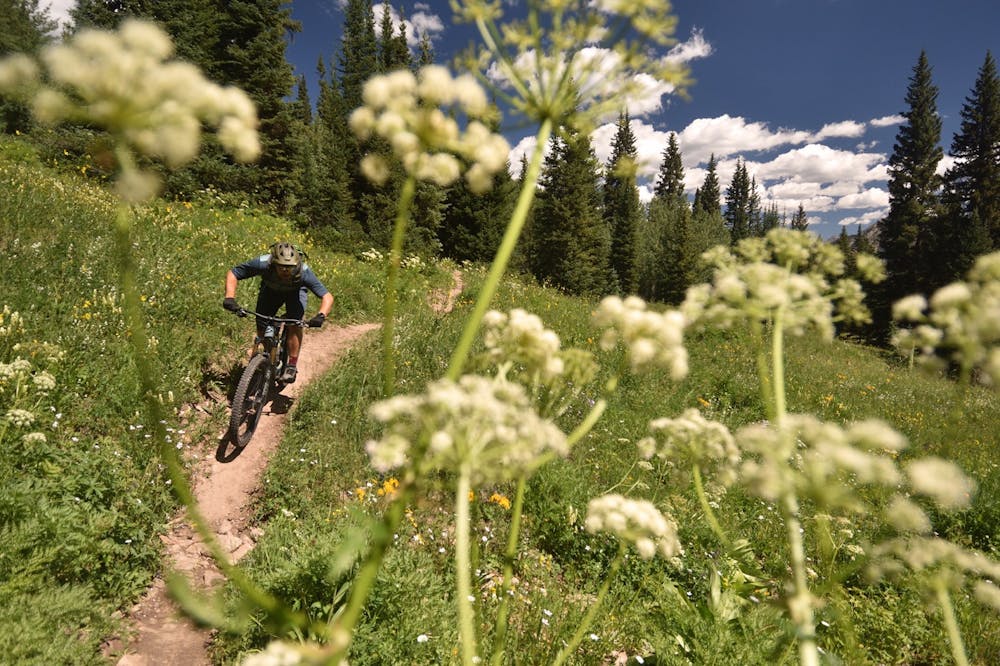
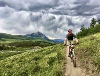
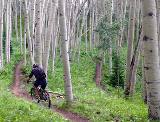
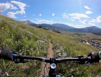
While you can pedal this loop in either direction, it's difficult to argue with the quality of the downhill on the fresh Baxter Gulch trail. This newly-dug singletrack swoops and flows through trees and alpine meadows, railing through perfectly-sculpted corners and several sets of low, flow-inducing berms.
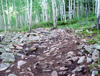
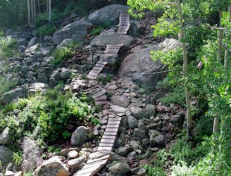
Lower down, the bench cut singletrack weaves across the mountainside, alternating between deep, dark forest and sunny fields of wildflowers. This hand-built trail took years to complete! "Traversing across the hillside, bench cut trail has been tediously put in through drains and steep embankments over the course of 6 years to get to the USFS boundary and some more tame terrain to work with," said Dave Ochs in an interview with Singletracks.com.
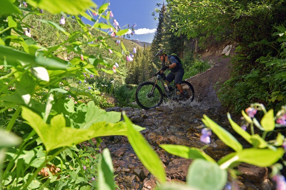
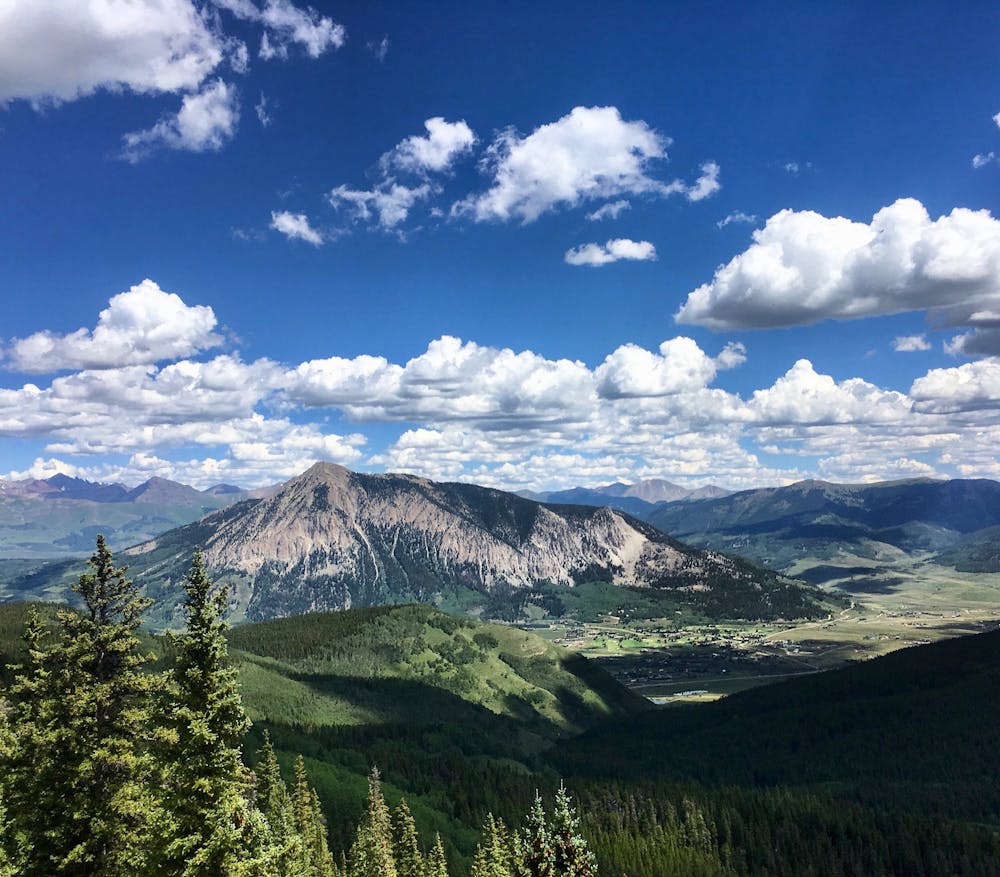
To get to this epic descent, climb up the Green Lake trail from downtown Crested Butte. This trail can be steep and awkward in places, which makes getting it out of the way first a blessing in disguise. If you want to visit the lake, carry on past the Carbon trail all the way to Green Lake itself, located in a bowl below a massive, rocky alpine ridge.
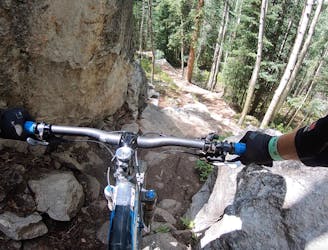
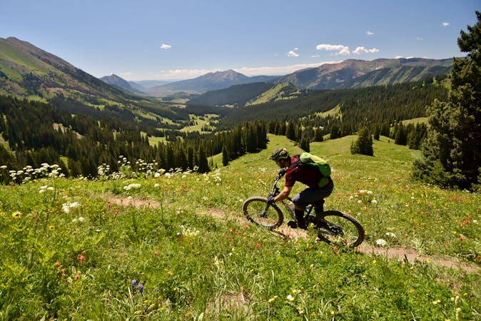
Once done with your snack at the lake, turn left on the Carbon Trail and head toward Baxter Gulch. Some of the climbs along this section of singletrack are quite rocky and difficult, but the tough climbs lead to stupendous views of Whestone Mountain, Mount Crested Butte, and the entire valley spread out below you!
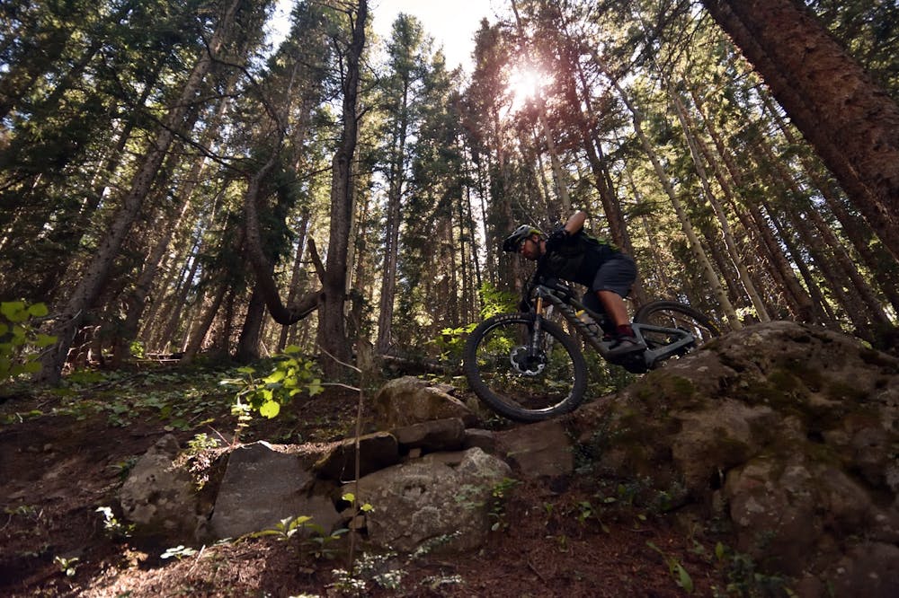
Once you've passed the epic viewpoint, it's all about that sweet, sweet descent down Baxter Gulch. Enjoy!
Difficult
Mostly stable trail tread with some variability featuring larger and more unavoidable obstacles that may include, but not be limited to: bigger stones, roots, steps, and narrow curves. Compared to lower intermediate, technical difficulty is more advanced and grades of slopes are steeper. Ideal for upper intermediate riders.

The trail contains some obstacles such as outcroppings and rock which could cause injury.

Little chance of being seen or helped in case of an accident.
29 m away
The iconic 4x4 road ride the helped launch the sport of mountain biking.
Difficult Mountain Biking
29 m away
Despite being easily-accessible, Upper Loop can be a punishing ride.
Severe Mountain Biking
111 m away
While the Lower Loop may be the easiest singletrack trail in Crested Butte, the flow is sweet and the scenery is unreal!
Easy Mountain Biking
111 m away
A rewarding loop from downtown Crested Butte with flowy singletrack and beautiful views.
Moderate Mountain Biking
3.8 km away
A grueling cross country trail that rewards the rider with beautiful wild flowers and stunning views.
Difficult Mountain Biking
3.9 km away
A new school tech line that serves as a superb alternate while shredding an Avery lap.
Severe Mountain Biking
4.2 km away
Hands-down the most technical, sketchy trail in the CBMR bike park.
Extreme Mountain Biking
4.3 km away
Relatively approachable for most riders, except for one massive rock garden in the middle.
Extreme Mountain Biking
4.3 km away
An absolutely fantastic rip that may have you wondering what the point of pedaling up Schofield Pass is.
Difficult Mountain Biking
4.3 km away
Stunning rip down two-way singletrack that returns you to the bottom of the chairlift.
Difficult Mountain Biking
12 routes · Mountain Biking
12 routes · Mountain Biking
5 routes · Mountain Biking

6 routes · Mountain Biking
3 routes · Mountain Biking · Hiking · Trail Running