0 m away
Pearl Pass
The iconic 4x4 road ride the helped launch the sport of mountain biking.
Difficult Mountain Biking
- Distance
- 61 km
- Ascent
- 1.6 km
- Descent
- 1.9 km
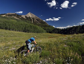
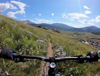
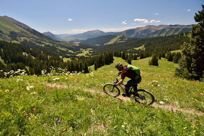
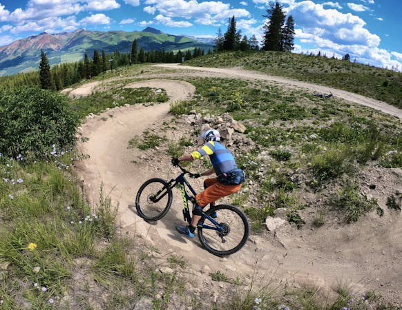
Despite being easily-accessible, Upper Loop can be a punishing ride.
Mountain Biking Severe
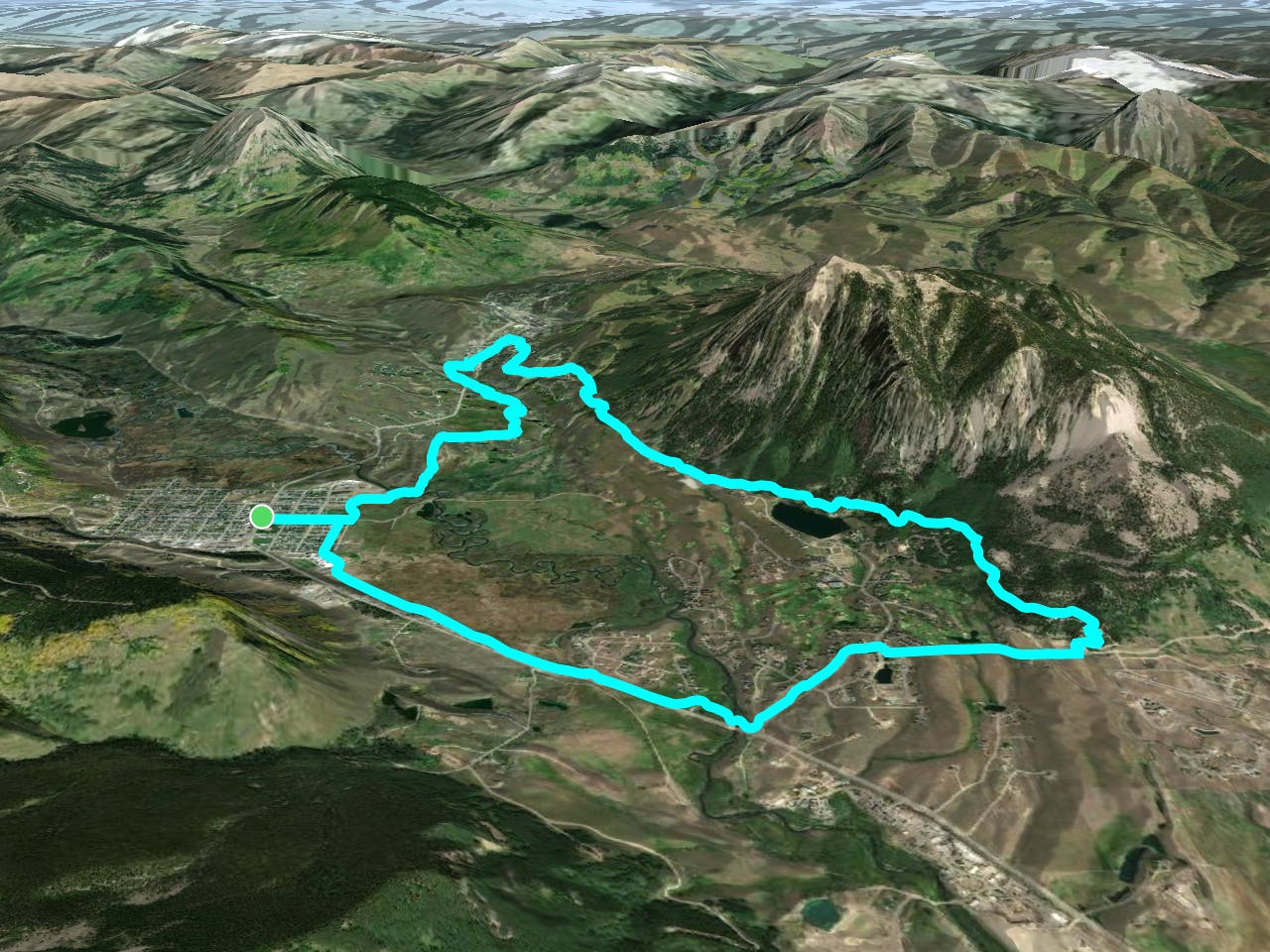
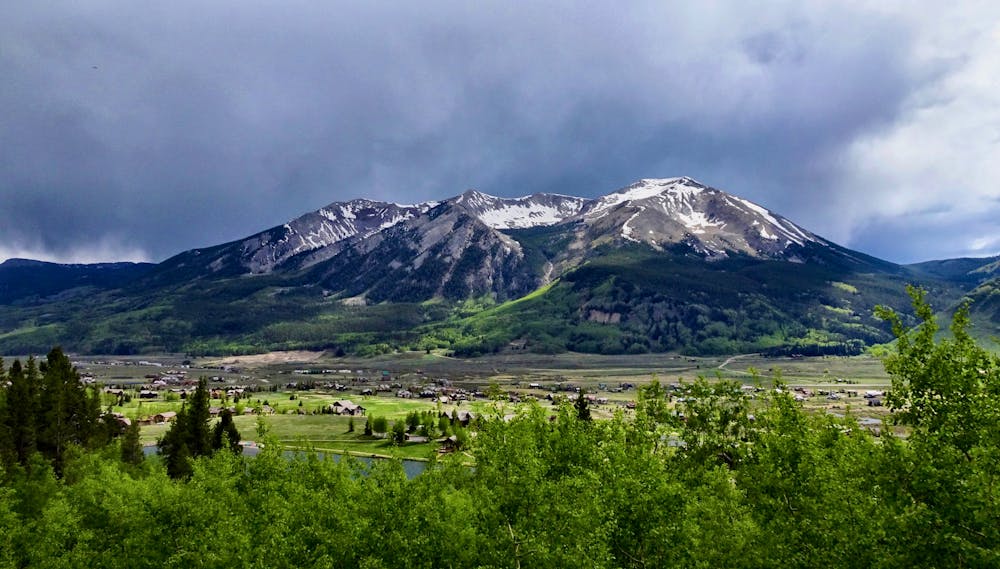
Upper Loop is easily-accessible from both the town of Crested Butte and the resort town of Mount Crested Butte. Shown here is a loop route, but riders can also use the free bus to get a lift up the mountain.
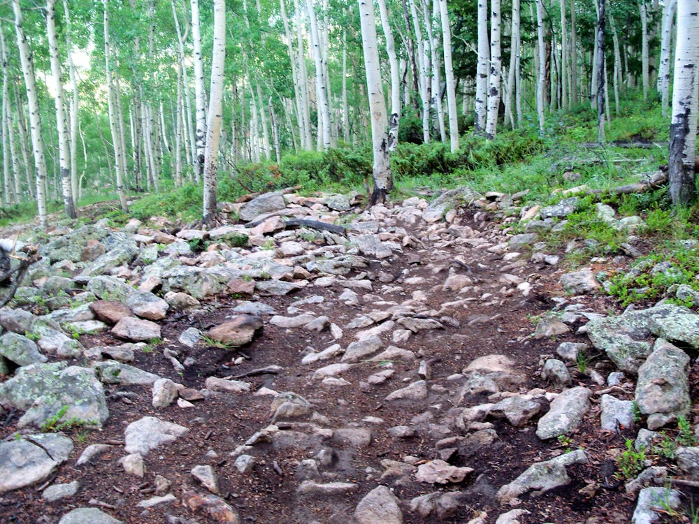
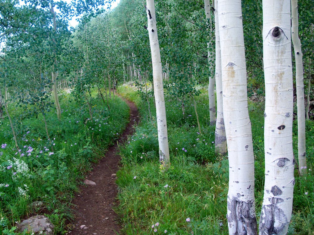
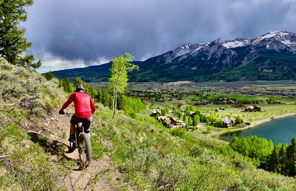
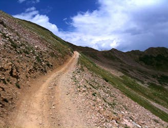
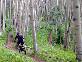
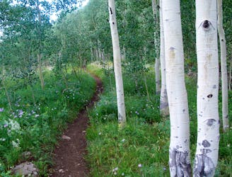
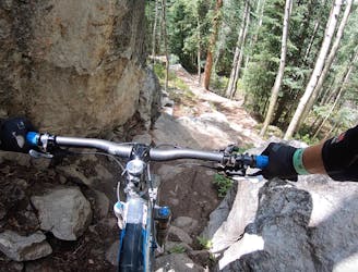
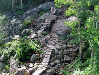
While Upper Loop is easily accessible via a variety of means, that doesn't mean this trail is easy. Yes, some sections are flowy, but many others are filled with rocks and roots, including some long, gnarly rock gardens. Technical up-and-down sections can prove punishing, with techy climbs out of gullies. Where the singletrack crosses old rock slides and washouts, scree fills the trail.
That's not to say this trail isn't high quality singletrack—far from it! The narrow bench cut trail clings to the steep sides of Mount Crested Butte, providing gorgeous views of the town of Crested Butte below and the surrounding mountains. The final rip down Whetstone Vista included in this route is an enduro rider's dream, making this a rewarding after work or evening ride for the advanced mountain biker.
For riders searching for a true beginner mountain bike experience, check out the Lower Loop trail on the other side of Crested Butte.
Severe
Widely variable, narrow trail tread with steeper grades and unavoidable obstacles of 15in/38cm tall or less. Obstacles may include unavoidable bridges 24in/61cm wide or less, large rocks, gravel, difficult root sections, and more. Ideal for advanced-level riders.

The trail contains some obstacles such as outcroppings and rock which could cause injury.
0 m away
The iconic 4x4 road ride the helped launch the sport of mountain biking.
Difficult Mountain Biking
29 m away
Crested Butte's newest trail is an instant classic!
Difficult Mountain Biking
84 m away
While the Lower Loop may be the easiest singletrack trail in Crested Butte, the flow is sweet and the scenery is unreal!
Easy Mountain Biking
84 m away
A rewarding loop from downtown Crested Butte with flowy singletrack and beautiful views.
Moderate Mountain Biking
3.7 km away
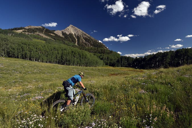
A grueling cross country trail that rewards the rider with beautiful wild flowers and stunning views.
Difficult Mountain Biking
3.9 km away
A new school tech line that serves as a superb alternate while shredding an Avery lap.
Severe Mountain Biking
4.2 km away
Hands-down the most technical, sketchy trail in the CBMR bike park.
Extreme Mountain Biking
4.3 km away
Relatively approachable for most riders, except for one massive rock garden in the middle.
Extreme Mountain Biking
4.3 km away
An absolutely fantastic rip that may have you wondering what the point of pedaling up Schofield Pass is.
Difficult Mountain Biking
4.3 km away
Stunning rip down two-way singletrack that returns you to the bottom of the chairlift.
Difficult Mountain Biking
12 routes · Mountain Biking
12 routes · Mountain Biking
5 routes · Mountain Biking

6 routes · Mountain Biking
3 routes · Mountain Biking · Hiking · Trail Running