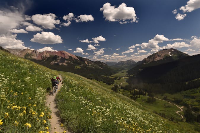
Trail 403 Loop
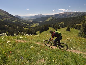
A long climb leads to one of Crested Butte's rowdiest descents!
Severe Mountain Biking
- Distance
- 30 km
- Ascent
- 895 m
- Descent
- 895 m
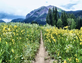
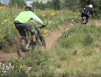
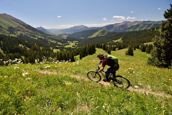
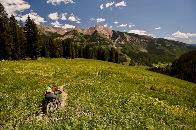
A beautiful high-alpine trail connected into a mega loop.
Mountain Biking Severe

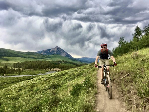
There's no way around it: 403 is a difficult trail to access. Whether you can talk a friend into shuttling you up to the trailhead or you turn it into an epic loop like the one mapped here, 403 requires intention and dedication to access.
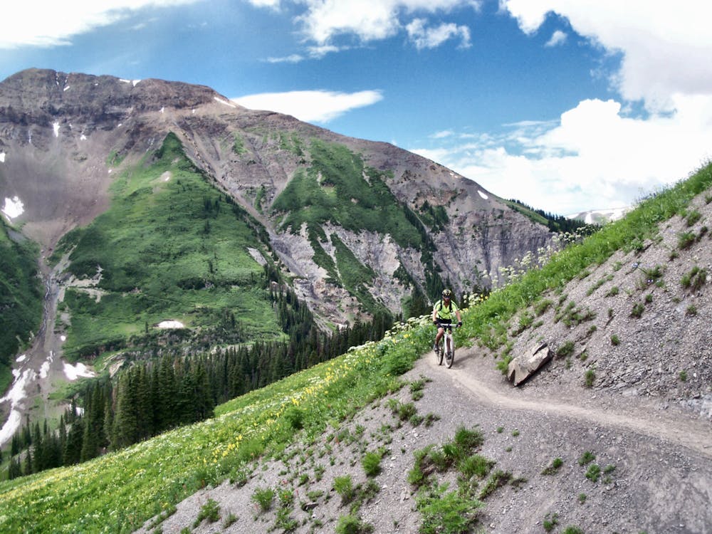
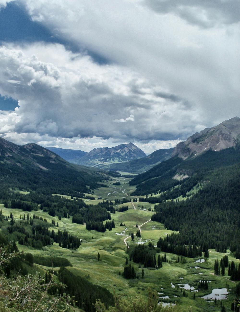
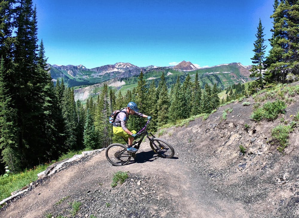
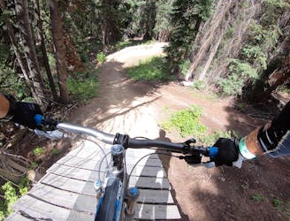
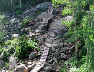
If you put forth the effort, 403 will reward you with stunning views of the surrounding mountains and a high-speed descent down to Schofield Pass. The descent is steep and rowdy, following the fall line most of the time. The singletrack is alternately loose, rocky, and root-filled. Demanding total attention, this descent is for advanced riders only.
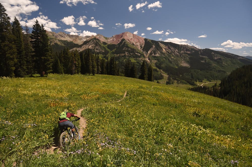
The loop shown here also incorporates the iconic 401 trail and the beginner-friendly Snodgrass trail. Combining 401 and 403 is known as the 804 ride, "a local’s right of passage" according to MTBHome.com
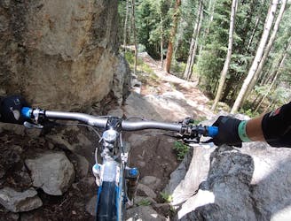
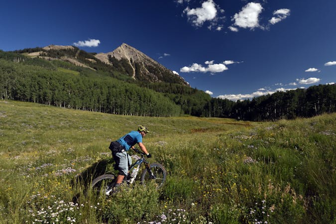
By itself, 401 is arguably the most beautiful trail in North America. Not only does it offer epic views of the Elk Range, but Trail 401 is also one of the oldest and best-known mountain bike trails in the world.
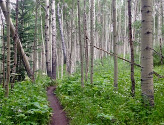
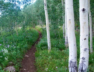
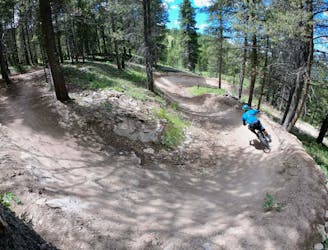
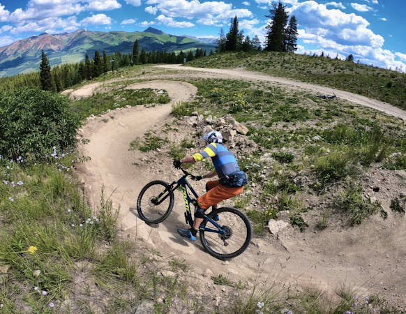
Snodgrass is similarly famous, but for different reasons. The Snodgrass trail provides flowy black dirt winding its way through an aspen grove at the base of Snodgrass Mountain. The singletrack on Snodgrass is very beginner-friendly, making for a great ending to a tiring ride.
Note that Snodgrass crosses some private ranch land and as a result, a seasonal closure begins every year on August 14, according to Travel Crested Butte.
Sources: https://crestedbuttemountainbike.com/rides/expert-snodgrass-403-401-mountain-bike-loop-crested-butte-co/ https://mtbhome.com/trail-area/crested-butte/ https://travelcrestedbutte.com/crested-butte-trails-snodgrass-trail/
Severe
Widely variable, narrow trail tread with steeper grades and unavoidable obstacles of 15in/38cm tall or less. Obstacles may include unavoidable bridges 24in/61cm wide or less, large rocks, gravel, difficult root sections, and more. Ideal for advanced-level riders.

Some trail sections are extremely exposed where falling will almost certainly result in serious injury or death.
In the high mountains or remote conditions, all individuals must be completely autonomous in every situation.
A long climb leads to one of Crested Butte's rowdiest descents!
Severe Mountain Biking
3 m away
Flowy black dirt winds its way through an aspen grove at the base of Snodgrass Mountain.
Moderate Mountain Biking
3.9 km away
A grueling cross country trail that rewards the rider with beautiful wild flowers and stunning views.
Difficult Mountain Biking
4.9 km away
A new school tech line that serves as a superb alternate while shredding an Avery lap.
Severe Mountain Biking
4.9 km away
Arguably the most beautiful trail in North America, with epic views of the Elk Range, Trail 401 is also one of the oldest and best-known trails in the world.
Moderate Mountain Biking
5.1 km away

A switchback-filled intermediate trail.
Moderate Mountain Biking
5.1 km away
Old school DH line with massive wooden drop features.
Severe Mountain Biking
5.2 km away
Old school DH line with two _massive_ wall rides.
Severe Mountain Biking
5.5 km away
One of the most dialed flow trails in the bike park.
Moderate Mountain Biking
5.7 km away
Hands-down the most technical, sketchy trail in the CBMR bike park.
Extreme Mountain Biking
12 routes · Mountain Biking

25 routes · Mountain Biking
12 routes · Mountain Biking
5 routes · Mountain Biking
6 routes · Mountain Biking
6 routes · Mountain Biking
10 routes · Mountain Biking

24 routes · Mountain Biking