3 m away
Bear Creek Out-and-Back
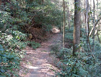
A classic North Georgia singletrack ride along a rushing mountain stream.
Difficult Mountain Biking
- Distance
- 20 km
- Ascent
- 628 m
- Descent
- 628 m
One of North Georgia's longest, gnarliest, and most remote singletrack descents.
Mountain Biking Severe

Mountaintown Creek is one of the most remote singletrack trails in the entire state of Georgia. This 7-mile descent is filled with an endless array of steep, challenging gnar that will entertain even the most advanced mountain bikers.
To access this 7-mile singletrack, you'll have to pedal a 20-mile loop with gravel roads, including the brutal climb up Potatopatch Mountain. But once it's time to descend Mountaintown, it's all gravy!
It's all gravy, that is, if you enjoy steep singletrack, tough rock gardens, rolling baby head rocks, root drops, and deep stream crossings.
And I'm not just talking about one or two stream crossings, either. Rather, the trail crosses its namesake creek a total of 21 times, guaranteeing riders a thorough drenching even during the driest of seasons. As a result of this constant drenching, this ride isn't recommended in the winter.
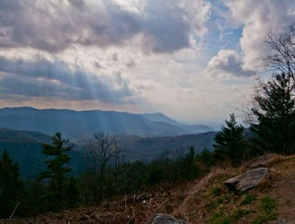
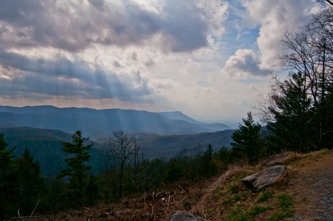
The brutal challenge of this trail coupled with the ultra-long pedal just to access it provides an extremely isolated feeling in this deep, dark valley that's rare in the Southeastern USA. It's highly unlikely that you'll encounter any other riders on this trail, so be sure to pack everything that you could possibly need to survive in the backcountry. In fact, this trail is so little-used that you can expect to encounter downed trees and other trail debris.
For riders who are up to the technical challenges of the singletrack, the physical challenges of climbing high into the mountains, and the outfitting challenges of surviving in the backcountry, Mountaintown Creek is an absolute gem of an epic ride.
Severe
Widely variable, narrow trail tread with steeper grades and unavoidable obstacles of 15in/38cm tall or less. Obstacles may include unavoidable bridges 24in/61cm wide or less, large rocks, gravel, difficult root sections, and more. Ideal for advanced-level riders.

The trail contains some obstacles such as outcroppings and rock which could cause injury.

In the high mountains or remote conditions, all individuals must be completely autonomous in every situation.
3 m away
A classic North Georgia singletrack ride along a rushing mountain stream.
Difficult Mountain Biking
3.8 km away

A short, twisty singletrack descent beginning at a beautiful vista.
Moderate Mountain Biking
4.3 km away
An epic ride on some of the best singletrack North Georgia has to offer.
Difficult Mountain Biking
8.2 km away

An isolated singletrack loop at the Pinhoti Trail's northern terminus.
Moderate Mountain Biking
9.7 km away

A technical, remote shuttle in the Cohutta Mountains.
Severe Mountain Biking
8 routes · Mountain Biking

24 routes · Mountain Biking