2.7 km away
Mores Mountain Interpretive Trail
A pleasant loop in the forest reaching the top of Mores Mountain, high above the heat in Boise
Moderate Hiking
- Distance
- 3.4 km
- Ascent
- 172 m
- Descent
- 172 m
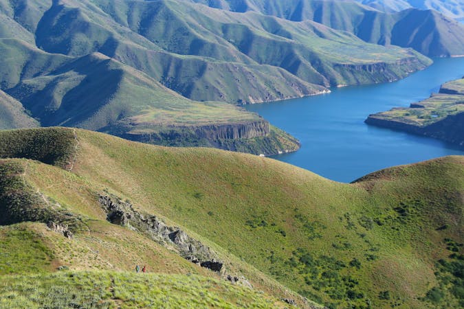
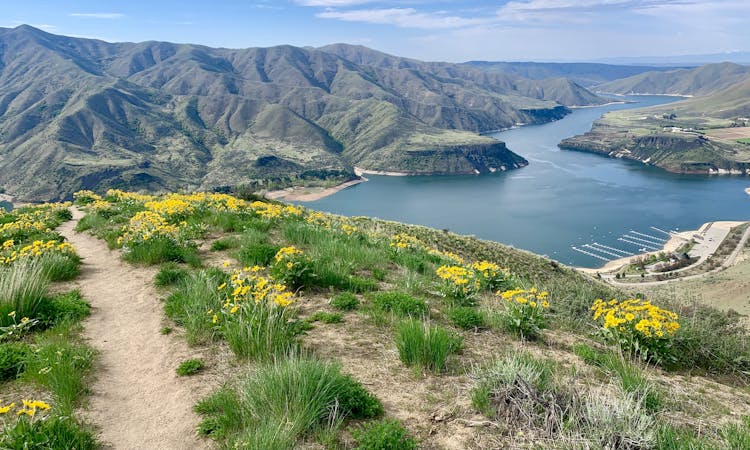
A scenic hike through Bogus Basin to the highest point along the Boise Ridge.
Hiking Moderate

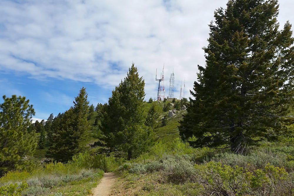
Shafer Butte is the highest point along the Boise Ridge, which forms the mountain backdrop to the city. It’s also the tallest summit within Bogus Basin Recreation Area. Chairlifts deliver skiers to the top all winter, but the rest of the year, the way to go is on foot. For how popular hiking is at Bogus Basin, relatively few people reach the actual summit of Shafer Butte. That is partially because no trail goes directly to the top and also because the top is occupied by radio towers and buildings.
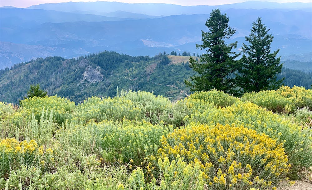
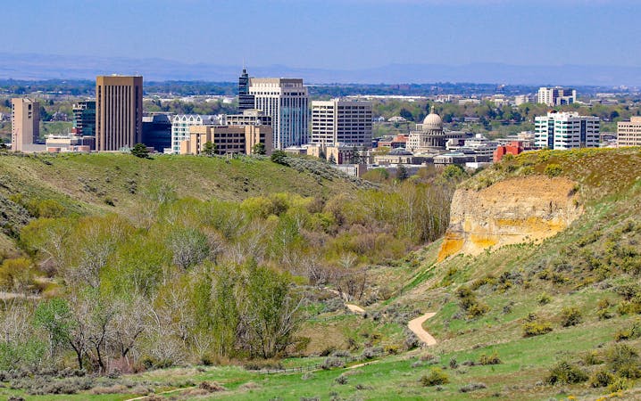
Despite the industrial appearance, hikers are welcome to stand atop mountain, and one rocky outcrop makes a point distinctly hiker than the rest. You can perch here and look over the ski resort, with a huge view that includes the city far below. There is a picnic table nearby, in case you want to linger longer and take it all in.
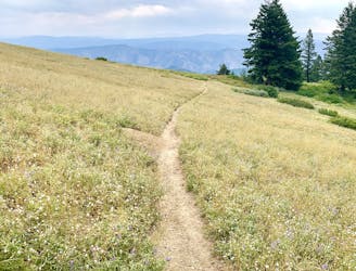
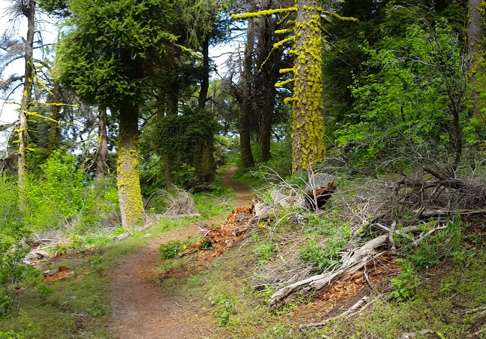
Among the web of trails and service roads at Bogus Basin, there are many ways to reach the summit of Shafer Butte. However, the route shown here is one of the best for hiking. It is not the shortest or most direct way you could go, but it’s ideal for scenery and exercise in a moderate hike. Starting from the main parking at Simplot Lodge, you’ll walk through the grassy base area and find the Deer Point Trail. Follow this as it switchbacks up the meadowy mountainside, soon entering cool forest of huge firs and leafy understory. The trail crosses some ski runs with wide open views, and ducks into other patches of forest before gaining a ridge and meeting a dirt road.
This road makes an easy and panoramic walk to the summit of the mountain. After enjoying the breeze and the views on top, you might go down a different way––as shown here with The Face trail. This footpath makes a roundabout but much more scenic route. It loops beneath a rock-studded ridgeline and across the sunny south face of the butte. Eventually, it connects back with the dirt road from before. Then you can choose to retrace your path down as mapped, or explore to find a steeper route back to the lodge.
Moderate
Hiking along trails with some uneven terrain and small hills. Small rocks and roots may be present.

The trail contains some obstacles such as outcroppings and rock which could cause injury.

Close to help in case of emergency.
2.7 km away
A pleasant loop in the forest reaching the top of Mores Mountain, high above the heat in Boise
Moderate Hiking
3.8 km away
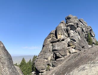
A hike through mountainside meadows and conifer forest high above Boise, overlooking the valley and reaching a stand-out rock formation at the end.
Moderate Hiking
10 routes · Hiking
10 routes · Hiking
8 routes · Hiking · Trail Running