1 m away
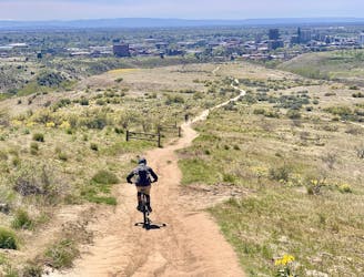
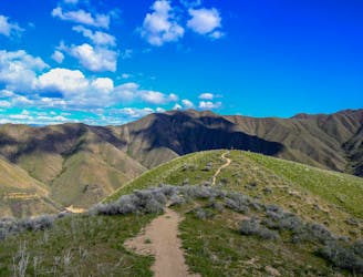
Table Rock Tram and Quarry Loop

A stout climb and demanding downhill on the slopes of Boise's #1 landmark.
Severe Mountain Biking
- Distance
- 5.1 km
- Ascent
- 264 m
- Descent
- 264 m
Advanced tech trails through the boulder fields on Table Rock.
Mountain Biking Severe

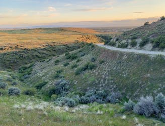
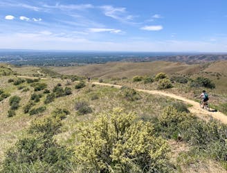
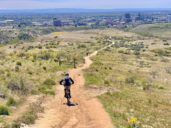
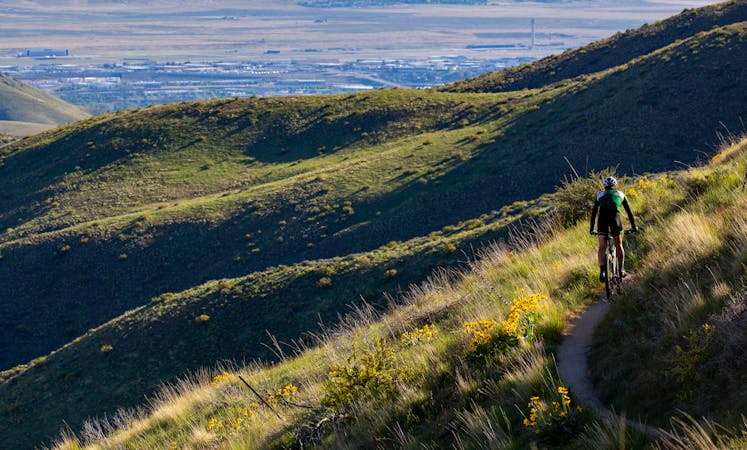
Mesa Reserve is Boise’s best place for techy trail riding, with a purpose-built track among boulder fields on the side of Table Rock. The Rock Island trails even flip the typical etiquette, asking that all users yield to bikers on these trails only. They are riddled with natural and constructed rock features, plus a mix of banked turns and flowy track, all among elevated views over the city
With a handful of trails in the network, multiple variations are possible. The route mapped here climbs on Tram Trail and Rock Island East, then descends Rock Island West to Rock Garden and back to Tram. The initial uphill is a bit burly, but then you’ll get full-on technical downhill the rest of the way. Expect moderate to advanced maneuvers, some of which are unavoidable and others optional. There’s a huge variety of features packed into these concise loops, so you could lap it more than once and try new moves every time.
Source: https://www.ridgetorivers.org/trails/detailed-area-descriptions/table-rock-area/
Severe
Widely variable, narrow trail tread with steeper grades and unavoidable obstacles of 15in/38cm tall or less. Obstacles may include unavoidable bridges 24in/61cm wide or less, large rocks, gravel, difficult root sections, and more. Ideal for advanced-level riders.

Some trail sections have exposed ledges or steep ascents/descents where falling could cause serious injury.

Close to help in case of emergency.
1 m away
A stout climb and demanding downhill on the slopes of Boise's #1 landmark.
Severe Mountain Biking
3.5 km away
A go-to quick lap with a sporty downhill at Military Reserve.
Moderate Mountain Biking
3.7 km away

A showcase combo of stellar trails, starting from Military Reserve near downtown Boise.
Difficult Mountain Biking
4.1 km away
A decent climb and a flow trail that are good for building skills.
Easy Mountain Biking
4.6 km away

A linkup of the two best trail rides at the foot of Lucky Peak.
Difficult Mountain Biking
5.8 km away
A double loop combining two of the best short descents in the lower foothills.
Difficult Mountain Biking
6.6 km away
A favorite in the lower foothills, done as part of a loop or with a shuttle.
Moderate Mountain Biking
7.4 km away
Big vertical from the bottom to the top of Lucky Peak, with huge views the entire way.
Difficult Mountain Biking
9.1 km away
A huge climb up to the Boise Ridge, then a big bomb down on stellar singletrack.
Difficult Mountain Biking
12 routes · Mountain Biking
6 routes · Mountain Biking