1 m away
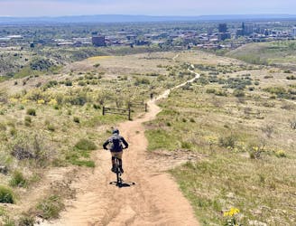
Rock Island Loops

Advanced tech trails through the boulder fields on Table Rock.
Severe Mountain Biking
- Distance
- 4.9 km
- Ascent
- 175 m
- Descent
- 175 m
A stout climb and demanding downhill on the slopes of Boise's #1 landmark.
Mountain Biking Severe

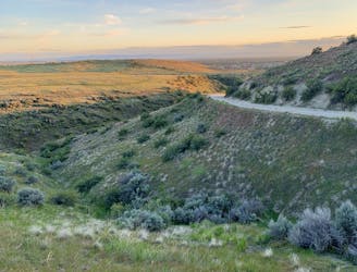
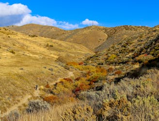
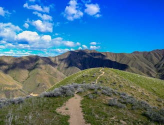
Mesa Reserve is the trail system on Table Rock, which is Boise’s most iconic landmark. It’s also home to some of the town’s best riding, and to purpose-built trails where bikes have the right of way. The loop mapped here uses some of those, but you’ll need to watch for signs that denote what’s what.
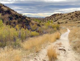
Tram Trail makes an efficient but very tough climb up the mesa. It starts with a meandering ascent along the side of the hill, then cuts a beeline toward the top that gets progressively steeper. There’s a big reward coming, however, for those who like techy downhill, and the views make an added bonus. After the grunt up Tram you’ll turn downhill on Quarry Trail. As the name suggests, this track weaves through a maze of blasted stone.
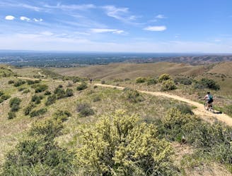
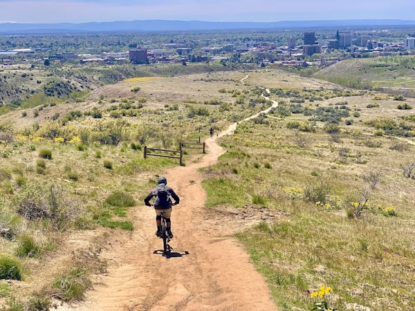
Quarry starts with a series of super tight moves among blocks and ledges, but then opens up to faster riding across a panoramic bench. The city splays out below and bluffs tower overhead. A fast downhill contour delivers Quarry Trail to the main Table Rock trail, which can be a fun downhill with water bars, but it’s often crowded with hikers. You also don’t want to miss the connector for Rock Island, which comes up fast.
The Rock Island trails are a cluster of connected loops where you can choose your own adventure. Mapped here is the “jump line” which has fast banked turns and tabletops. All the trails in the cluster are loaded with techy rock features, and some are tougher than others. You could pick another variation instead, or make a loop to try more than one. Eventually you’ll find your way back to Tram to retrace the meandering incline to the trailhead.
Source: https://www.ridgetorivers.org/trails/detailed-area-descriptions/table-rock-area/
Severe
Widely variable, narrow trail tread with steeper grades and unavoidable obstacles of 15in/38cm tall or less. Obstacles may include unavoidable bridges 24in/61cm wide or less, large rocks, gravel, difficult root sections, and more. Ideal for advanced-level riders.

The trail contains some obstacles such as outcroppings and rock which could cause injury.

Close to help in case of emergency.
1 m away
Advanced tech trails through the boulder fields on Table Rock.
Severe Mountain Biking
3.5 km away
A go-to quick lap with a sporty downhill at Military Reserve.
Moderate Mountain Biking
3.7 km away

A showcase combo of stellar trails, starting from Military Reserve near downtown Boise.
Difficult Mountain Biking
4.1 km away
A decent climb and a flow trail that are good for building skills.
Easy Mountain Biking
4.6 km away

A linkup of the two best trail rides at the foot of Lucky Peak.
Difficult Mountain Biking
5.8 km away
A double loop combining two of the best short descents in the lower foothills.
Difficult Mountain Biking
6.6 km away
A favorite in the lower foothills, done as part of a loop or with a shuttle.
Moderate Mountain Biking
7.4 km away
Big vertical from the bottom to the top of Lucky Peak, with huge views the entire way.
Difficult Mountain Biking
9.1 km away
A huge climb up to the Boise Ridge, then a big bomb down on stellar singletrack.
Difficult Mountain Biking
12 routes · Mountain Biking
6 routes · Mountain Biking