659 m away
Bucktail Easy Loop
A decent climb and a flow trail that are good for building skills.
Easy Mountain Biking
- Distance
- 6 km
- Ascent
- 146 m
- Descent
- 146 m
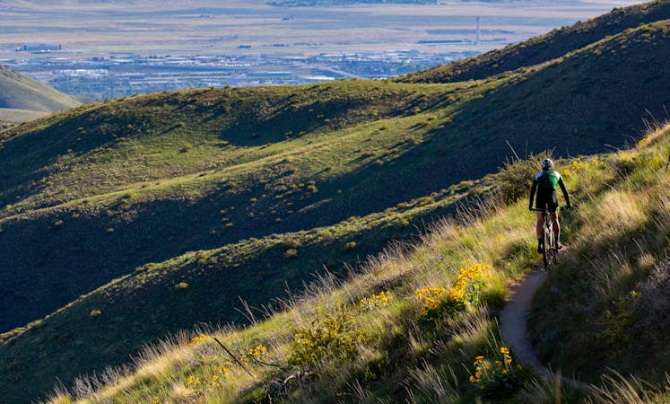
A showcase combo of stellar trails, starting from Military Reserve near downtown Boise.
Mountain Biking Difficult

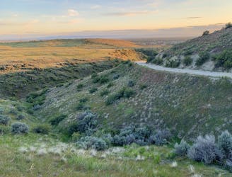
This loop combines a lot of the best trails near Military Reserve in the lower foothills. As mapped here, it begins from Freestone Creek trailhead, but you could just as well start from another parking along this road. To start out, use the road or Mountain Cove trail to get to Military Reserve connector. This is a steep and somewhat sandy climb that puts you on Crestline. Then it’s a much easier and more scenic uphill to Sidewinder.
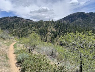
On Sidewinder you’ll really feel like you’re getting up there in the foothills. It twists along a panoramic ridgeline with views into the creek valleys on either side. This smooth trail makes a good downhill as well, but is more commonly used for climbing.
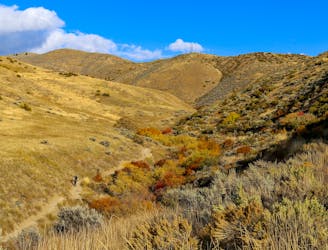
You’ll lose some of that vertical on a quick and fun descent on Motorcycle Trail, then hop onto Fat Tire Traverse for a real treat. This benchcut singletrack dips through gullies and curves around hillsides that are so steep, some of the turns feel like there’s air underneath them. It’s easy riding, but you’ll want to be sure to stay in control!
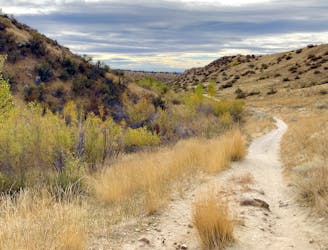
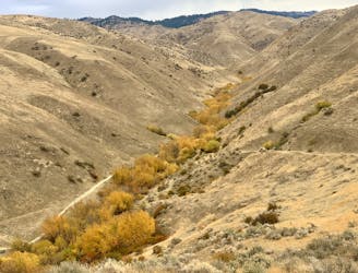
Next comes Freestone Ridge, which is a fast and very scenic descent. It’s not as smooth as it could be, due to washboarding and ruts, but it’s still a good time. At the bottom you have several options for finishing the loop. The route mapped here adds some more action with Shane’s Loop and Central Ridge. To get there, turn and go up Three Bears, which is a dirt road that turns into narrower trail. This becomes a pretty steep climb, but for a short distance, before tipping downhill and meeting Shane’s.
Shane’s Loop is smooth singletrack that curves around a hill, through idyllic grassland and with great views toward Table Rock. It then takes a sharp descent with some rocks, and meets the big trail junction at the top of Central Ridge.
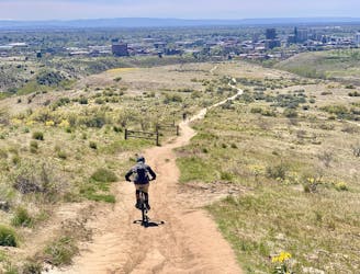
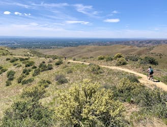
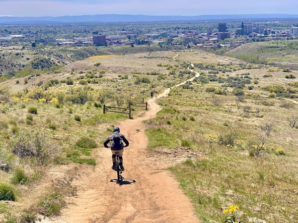
Central Ridge is a super fun downhill, with a steep section pointing directly at a vista of downtown Boise. It’s very popular with walkers and also uphill riders though, so you might not be able to hold all the speed you want. A good alternative is to take Bucktail, an easy flow trail, to go downhill instead and return to the start.
Difficult
Mostly stable trail tread with some variability featuring larger and more unavoidable obstacles that may include, but not be limited to: bigger stones, roots, steps, and narrow curves. Compared to lower intermediate, technical difficulty is more advanced and grades of slopes are steeper. Ideal for upper intermediate riders.

Some trail sections have exposed ledges or steep ascents/descents where falling could cause serious injury.

Away from help but easily accessed.
659 m away
A decent climb and a flow trail that are good for building skills.
Easy Mountain Biking
733 m away
A go-to quick lap with a sporty downhill at Military Reserve.
Moderate Mountain Biking
2.1 km away
A double loop combining two of the best short descents in the lower foothills.
Difficult Mountain Biking
3.7 km away
A favorite in the lower foothills, done as part of a loop or with a shuttle.
Moderate Mountain Biking
3.7 km away

Advanced tech trails through the boulder fields on Table Rock.
Severe Mountain Biking
3.7 km away

A stout climb and demanding downhill on the slopes of Boise's #1 landmark.
Severe Mountain Biking
5.4 km away
A huge climb up to the Boise Ridge, then a big bomb down on stellar singletrack.
Difficult Mountain Biking
7.4 km away

A locals' go-to loop in the foothills, close to Eagle and Meridian.
Moderate Mountain Biking
7.5 km away
A grueling combo of two favorite area trails.
Severe Mountain Biking
7.5 km away
A big climb and glorious downhill in the upper Foothills, with water crossings and miles of lush forest.
Severe Mountain Biking
12 routes · Mountain Biking
6 routes · Mountain Biking