1 m away
Hard Guy - Dry Creek Loop
A grueling combo of two favorite area trails.
Severe Mountain Biking
- Distance
- 24 km
- Ascent
- 828 m
- Descent
- 828 m
A big climb and glorious downhill in the upper Foothills, with water crossings and miles of lush forest.
Mountain Biking Severe

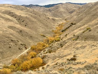
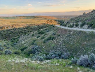
This is undoubtedly one of the best loops in the Boise Foothills. It’s a grueling climb up Shingle Creek, into the cool pines Boise National Forest, then a bomber downhill on Dry Creek, with lots of splashes through the stream which is not actually dry! There’s a sprinkling of technical obstacles throughout, but for the most part, it’s smooth singletrack for nearly 2500 feet up and down. The distance and difficulty of the climbing keeps this loop feeling exclusive, though the lower reaches can get congested with hikers.
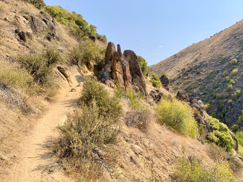
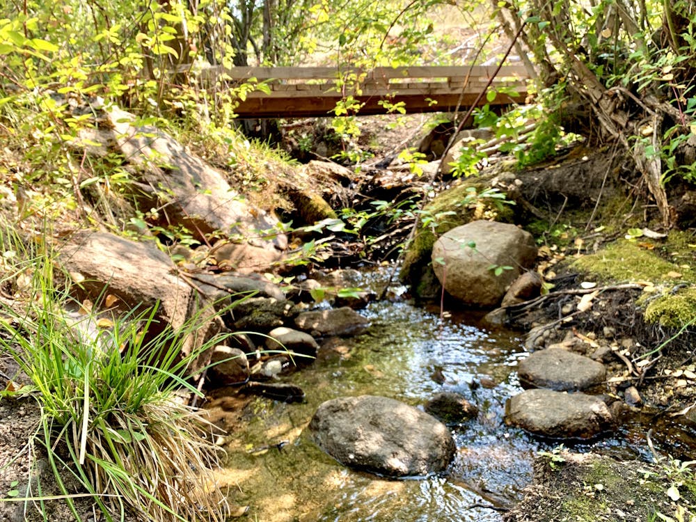
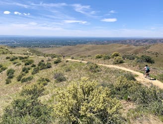
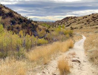
Start from a large pullout on Bogus Basin Road, and get there early if you want to beat the hiker crowds as well as the heat. A majority of the climb on Shingle Creek is exposed to the sun. You’ll start with a quick drop into the canyon, which is quite picturesque with granite outcrops all around. The trail then starts an ascent that’s mostly mellow, but with some tough sections cutting through the rocks. The gorge actually widens a bit farther up, and the trail gets easier. It winds through sagebrush meadows and crosses the creek a couple times on footbridges.
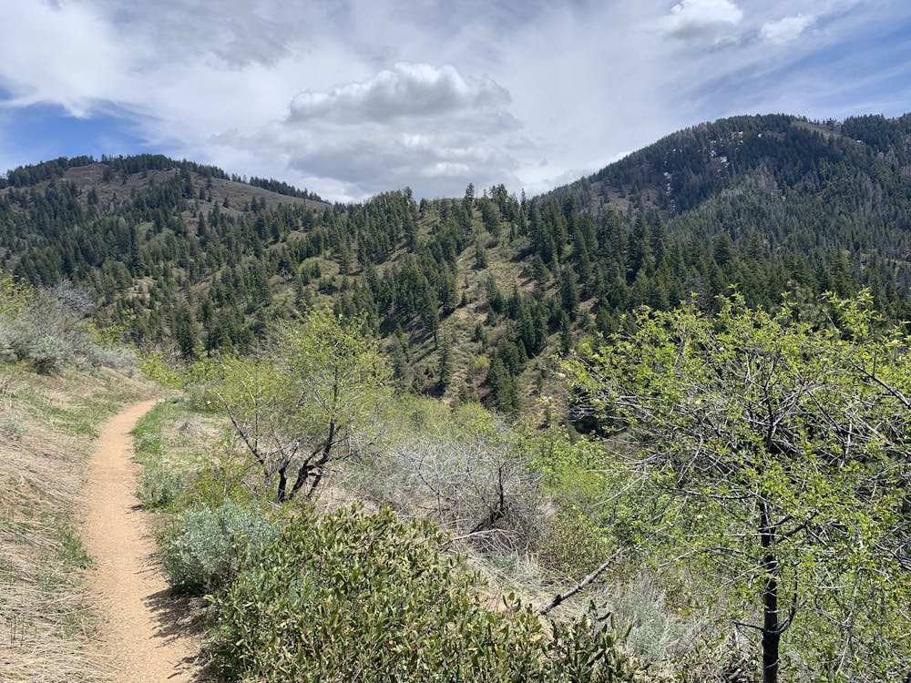
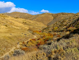
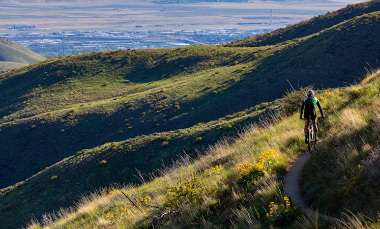
At the junction with Shingle Creek is where things get tougher. You should be warmed up by now, so turn on Shingle Creek and start pumping. This trail is almost all climbing, and has some fairly technical sections. It goes in and out of forest around the creek, and bounces through the water a few times. The steepest sections are just before reaching the switchbacks. Then, as the trail twists up toward the divide, it breaks onto meadowy slopes where you’ll enjoy hard-earned views over the foothills. Where the trail turns and makes a north-facing traverse, be prepared to plunge through piles of snow in April and early May.
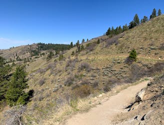
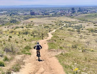
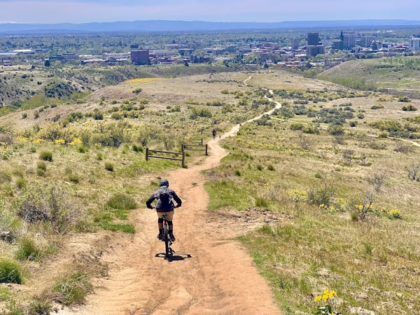
The Dry Creek junction marks the start of the glorious downhill. This trail dives through deep forest for more than 1000 feet of elevation, with surprisingly smooth turns in between splashes through the creek. Expect to get a little wet! The next 1000 feet takes you in and out of the trees, as the slopes become more open farther down. The trail remains beautiful singletrack through the meadows, all the way back to the Shingle Creek junction. From there you’ll enjoy the rest of the descent down the canyon (watch out for hikers) before the final short climb back up to the road.
Severe
Widely variable, narrow trail tread with steeper grades and unavoidable obstacles of 15in/38cm tall or less. Obstacles may include unavoidable bridges 24in/61cm wide or less, large rocks, gravel, difficult root sections, and more. Ideal for advanced-level riders.

Some trail sections have exposed ledges or steep ascents/descents where falling could cause serious injury.
Little chance of being seen or helped in case of an accident.
1 m away
A grueling combo of two favorite area trails.
Severe Mountain Biking
2 km away
A huge climb up to the Boise Ridge, then a big bomb down on stellar singletrack.
Difficult Mountain Biking
4.6 km away

A locals' go-to loop in the foothills, close to Eagle and Meridian.
Moderate Mountain Biking
5.3 km away
A favorite in the lower foothills, done as part of a loop or with a shuttle.
Moderate Mountain Biking
5.5 km away
A double loop combining two of the best short descents in the lower foothills.
Difficult Mountain Biking
6.5 km away
A scenic romp through mountainside meadows and montane forest, with bonus views from the iconic Stack Rock formation.
Moderate Mountain Biking
6.5 km away

A big downhill ride with a shuttle, and a step up in difficulty over most trails in the area.
Severe Mountain Biking
7 km away
A decent climb and a flow trail that are good for building skills.
Easy Mountain Biking
7.5 km away

A showcase combo of stellar trails, starting from Military Reserve near downtown Boise.
Difficult Mountain Biking
7.9 km away
A go-to quick lap with a sporty downhill at Military Reserve.
Moderate Mountain Biking
12 routes · Mountain Biking
6 routes · Mountain Biking