4.7 km away
Hulls Gulch Downhill
A favorite in the lower foothills, done as part of a loop or with a shuttle.
Moderate Mountain Biking
- Distance
- 4.3 km
- Ascent
- 0 m
- Descent
- 274 m
A big downhill ride with a shuttle, and a step up in difficulty over most trails in the area.
Mountain Biking Severe

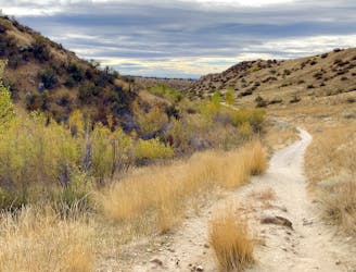
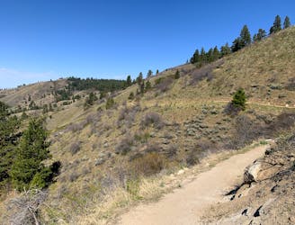
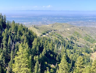
Trail #4, AKA 8th St Moto, draws a steep line from the bottom to the top of the Boise Ridge. It would be a true beast to ride uphill, but can be shuttled fairly easily using 8th St. Extension (4WD recommended, opens seasonally May 15). There is a trailhead near the top of this road that starts the ride, as mapped here.
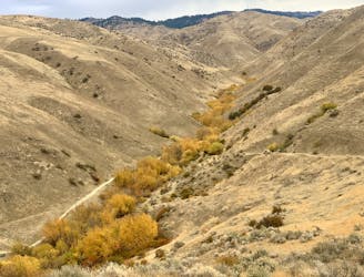
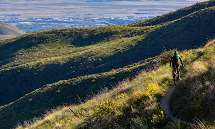
Trail #4 begins as a rolling, upward traverse through patchy forest and sagebrush slopes overlooking the city. But soon enough the bottom drops out, and the trail plummets down a twisting ridge crest for several more miles. There are water bars, ledges, rock stairs, and sand pits scattered throughout the descent, including some mandatory drops. It’s about as close as it gets to a full-on downhill MTB track in the Boise foothills! This trail is generally best in late spring/early summer, when it’s dry but not yet too loose and chunky from motorcycle traffic.
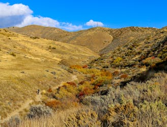
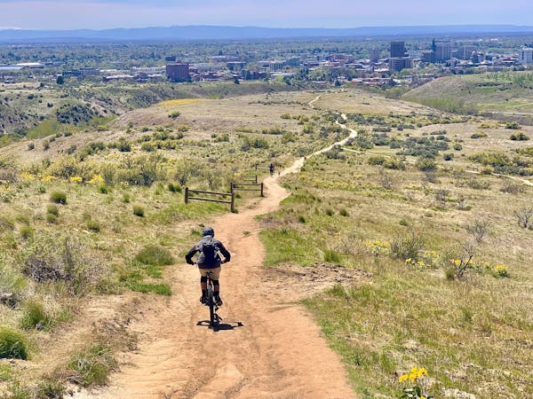
To finish out the ride you have a few options on where to go. As mapped, the route finishes with Lower Hull’s Gulch, which is only open to downhill bike traffic on odd-numbered calendar days. Hulls will maximize the quality of downhill riding and finish neatly near the bottom of 8th St. Extension, but on an even-numbered day, you’ll have to go somewhere else. You could instead turn at the junction with Femrite’s Patrol or at Sidewinder for an alternate route through the lower foothills. Both of these will involve more pedaling but they remain really fun rides going down.
Sources: https://boisetrails.com/trail/trail-4-8th-st-motorcycle-trail/ https://www.ridgetorivers.org/
Severe
Widely variable, narrow trail tread with steeper grades and unavoidable obstacles of 15in/38cm tall or less. Obstacles may include unavoidable bridges 24in/61cm wide or less, large rocks, gravel, difficult root sections, and more. Ideal for advanced-level riders.

Some trail sections have exposed ledges or steep ascents/descents where falling could cause serious injury.

Away from help but easily accessed.
4.7 km away
A favorite in the lower foothills, done as part of a loop or with a shuttle.
Moderate Mountain Biking
6.2 km away
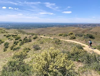
A huge climb up to the Boise Ridge, then a big bomb down on stellar singletrack.
Difficult Mountain Biking
6.5 km away
A grueling combo of two favorite area trails.
Severe Mountain Biking
6.5 km away
A big climb and glorious downhill in the upper Foothills, with water crossings and miles of lush forest.
Severe Mountain Biking
6.5 km away
A scenic romp through mountainside meadows and montane forest, with bonus views from the iconic Stack Rock formation.
Moderate Mountain Biking
7.6 km away
A double loop combining two of the best short descents in the lower foothills.
Difficult Mountain Biking
7.7 km away
A decent climb and a flow trail that are good for building skills.
Easy Mountain Biking
8.3 km away

A showcase combo of stellar trails, starting from Military Reserve near downtown Boise.
Difficult Mountain Biking
9 km away
A go-to quick lap with a sporty downhill at Military Reserve.
Moderate Mountain Biking
9.4 km away
Awesome shuttle ride from the pines of Bogus Basin into the prairie of the foothills.
Difficult Mountain Biking
12 routes · Mountain Biking
6 routes · Mountain Biking