1 m away
Turtlehead Peak
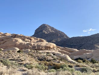
This upthrust rock formation stands prominently by itself, providing an unbelievable 360-degree view from the summit!
Extreme Hiking
- Distance
- 7.3 km
- Ascent
- 606 m
- Descent
- 606 m
A popular and stunning, yet somewhat technical, hike in Red Rocks.
Hiking Severe

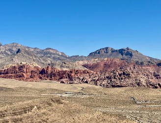
The Calico Tanks trail is probably the most popular trail in the Red Rocks Canyon Conservation Area. Undoubtedly, the trailhead it begins from is the most popular, as it's shared with nearby Turtlehead Peak. To score a parking spot on the weekend, you'll have to arrive early in the morning, and it's best if you get there at or before sunrise. Even during the week, parking spots are competitive.
Further complicating matters, the conservation area recently instituted an hour-by-hour reservation system for getting into the park. To get your reservation, go to the Recreation.gov app and search for "Red Rock Canyon National Conservation Area Scenic Drive Timed Entry." Without a national parks pass, the entry fee is $15 at the time of this writing. With an America the Beautiful pass, it's only $2.
On this hike, you'll cover a quick 2.2 miles and 400 feet of climbing round-trip in a stunning setting to reach seasonally-filled tanks of water high in the sandstone hills, and ultimately, an expansive view of Las Vegas.
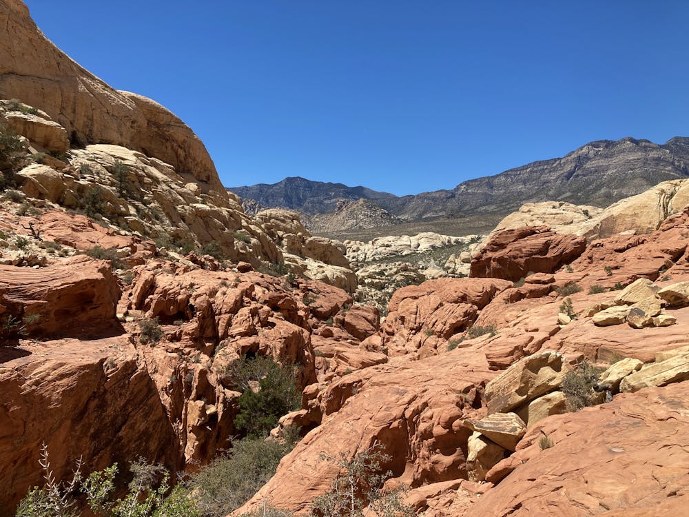
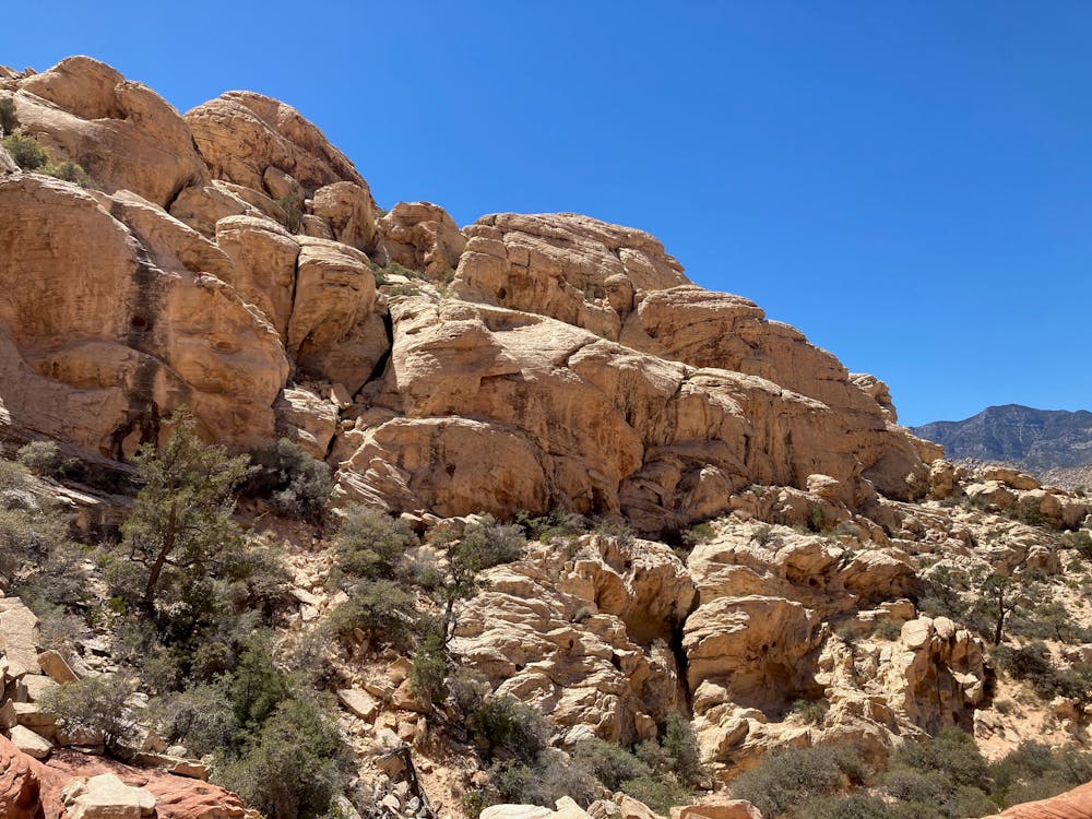
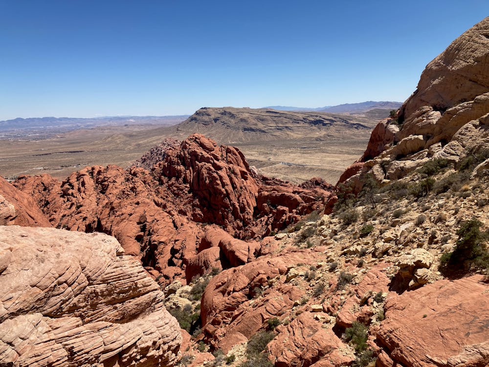
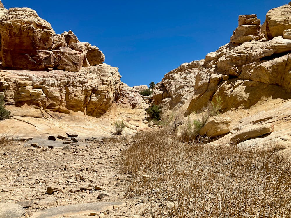
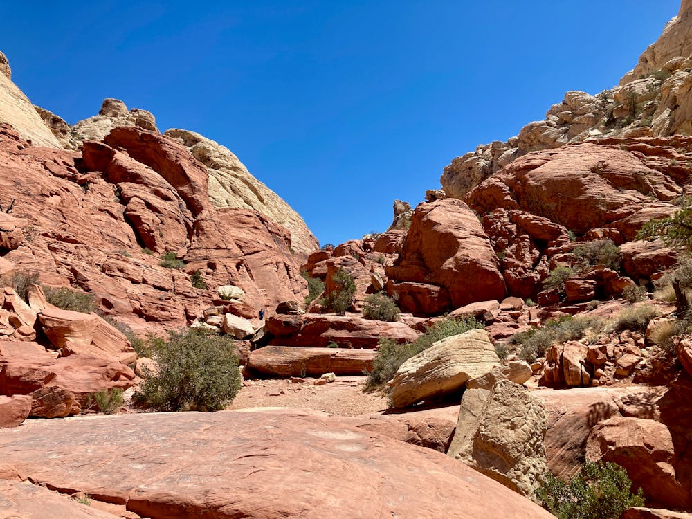
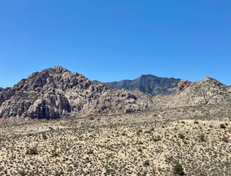
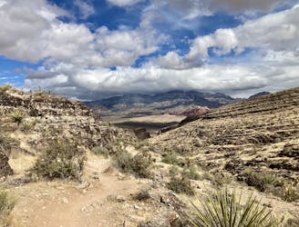
The entire hike offers stunning vistas of sandstone cliffs as you slowly make your way up a low wash to reach the tanks. The cliffs soar above you in a multi-colored array of vaulted domes. You'll marvel at the forces of nature that gave rise to these beautiful formations!
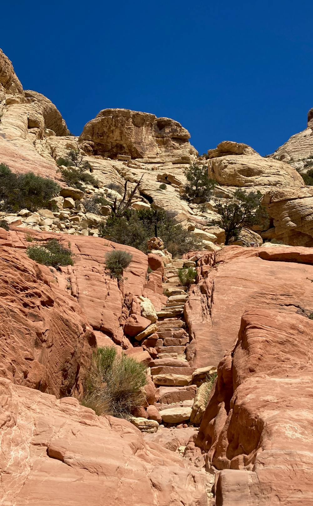
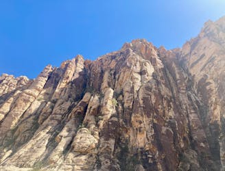
While this hike is only 2.2 miles round-trip, I've given it a "Severe" difficulty rating in FATMAP. While it's not particularly aerobic, this hike is actually quite technical. While climbing through the wash, a series of steep staircases have been chiseled into the sandstone to provide upward passage through the rocks. Even still, you'll have to use your hands to scramble up several small cliffs, to negotiate the staircases, and to make forward progress through several choke points. While some sections offer stairs, others do not, and you'll be forced to use all of your limbs to scramble up the rocks.
In some areas, these slabs of rocks are relatively exposed, and while a fall might not prove deadly, it could easily cause a serious injury. At times you are scrambling above these exposed sections.
As a result, many people think they can handle this mere 2.2-mile hike, but then get turned around long before reaching the end objective. But if you're willing to have an adventure, you'll love Calico Tanks!
Severe
Hiking challenging trails where simple scrambling, with the occasional use of the hands, is a distinct possibility. The trails are often filled with all manner of obstacles both small and large, and the hills are very steep. Obstacles and challenges are often unexpected and can be unpredictable.

Some trail sections have exposed ledges or steep ascents/descents where falling could cause serious injury.

Away from help but easily accessed.
1 m away
This upthrust rock formation stands prominently by itself, providing an unbelievable 360-degree view from the summit!
Extreme Hiking
2.5 km away
Visually-stunning hike along the base of Calico Hills.
Moderate Hiking
2.7 km away
A remote loop circumnavigating a beautiful peak.
Moderate Hiking
3.3 km away
Hike up a rough trail into a stunning canyon.
Difficult Hiking
4.8 km away
A beautiful hike near Red Rocks that doesn't require a reservation.
Difficult Hiking

5 routes · Hiking

8 routes · Hiking
5 routes · Hiking

10 routes · Hiking