2.7 km away
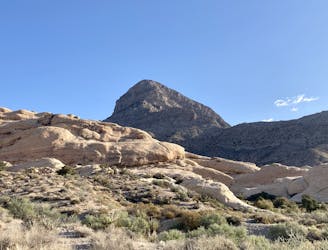
White Rock Loop
A remote loop circumnavigating a beautiful peak.
Moderate Hiking
- Distance
- 9.9 km
- Ascent
- 350 m
- Descent
- 350 m
Hike up a rough trail into a stunning canyon.
Hiking Difficult

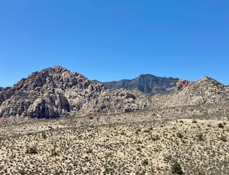
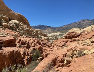
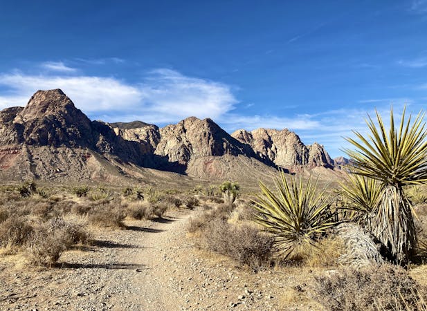
Ice Box Canyon is routinely ranked as one of the best hikes in the Red Rock Canyon Conservation Area, but it receives much less traffic than other trails. If you're looking to escape some of the crowds, head for this trail!
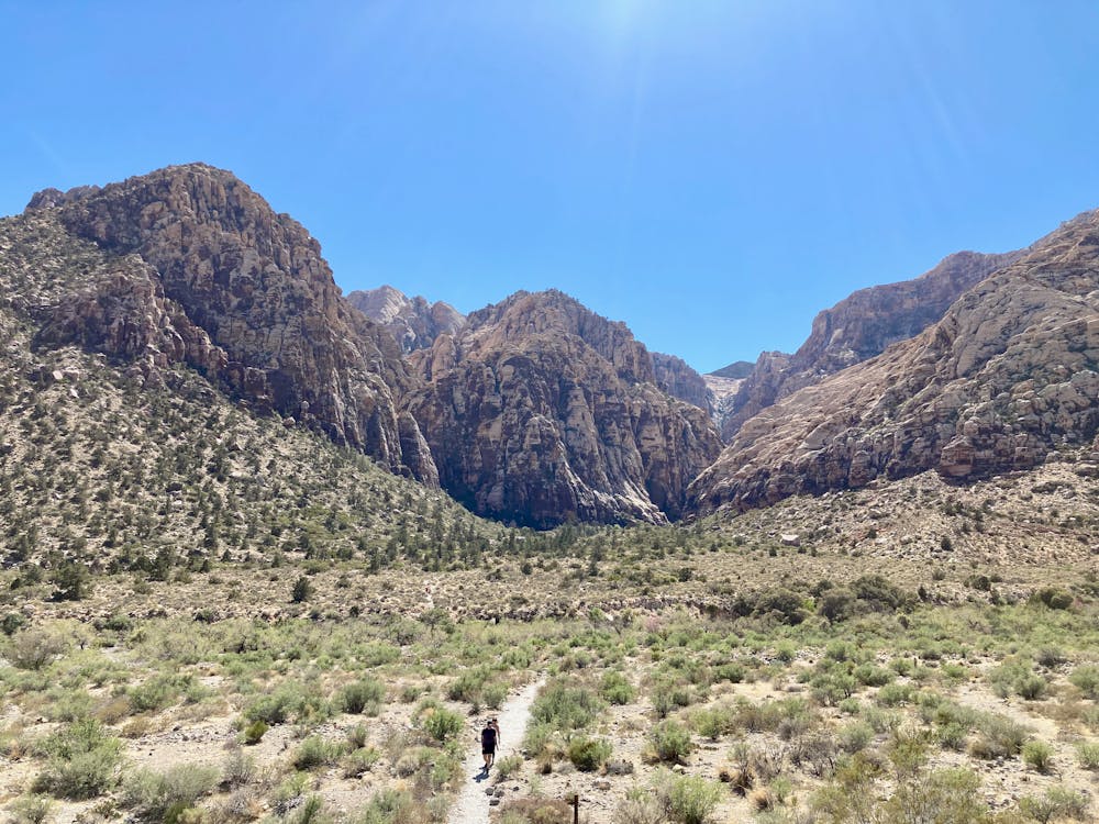
Due to the lesser traffic, the route into Ice Box Canyon is much less defined. The trail splits and braids the entire way, but you can always see the objective of the canyon mouth in front of you—keep heading straight on.
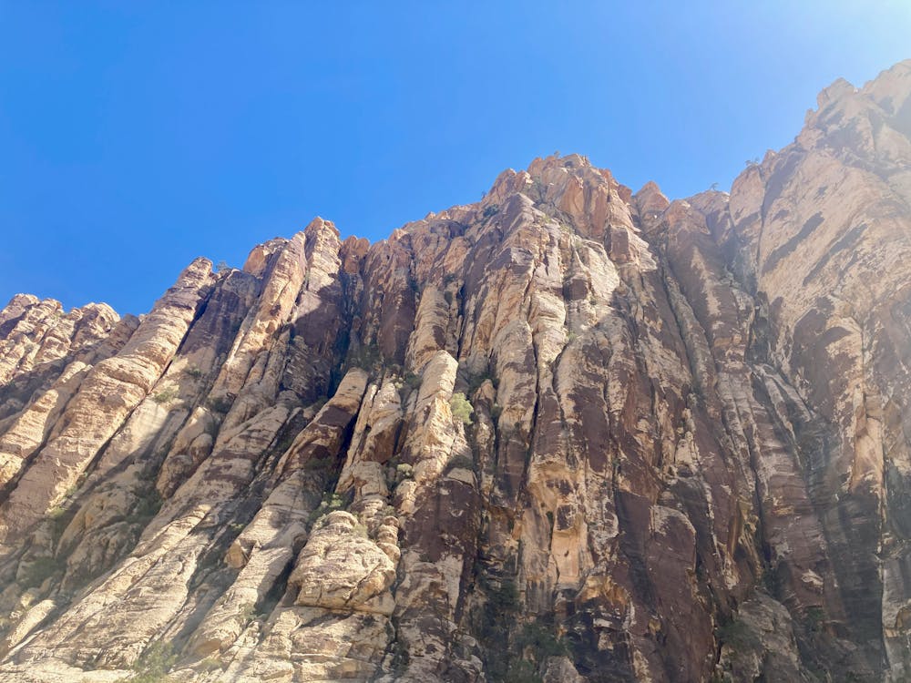
Underfoot, the trail consists of a massive conglomeration of stones and boulders. Unlike other hikes in the area, you won't be hiking on slabs of sandstone but rather hopping from rock to rock and from boulder to boulder for miles on end. This can be quite strenuous, especially for those who are unsure of their footing. With this type of hiking, it's easy to turn an ankle (or worse), so be sure to come equipped with proper footwear.
As you enter the mouth of the canyon, you'll be astonished by the sheer-sided sandstone cliffs of the canyon soaring hundreds of feet into the air! You'll often be able to watch rock climbers as they ascend the vertical cliffs.
The hike continues deep into the canyon, but the trail continues to split and braid. However, your goal is simply to hike as far as you'd like into the canyon, enjoy the beauty, and then turn around. Whenever you turn around is up to you—the marked turnaround point on this map is just a suggestion. You could easily hike further or turn around sooner.
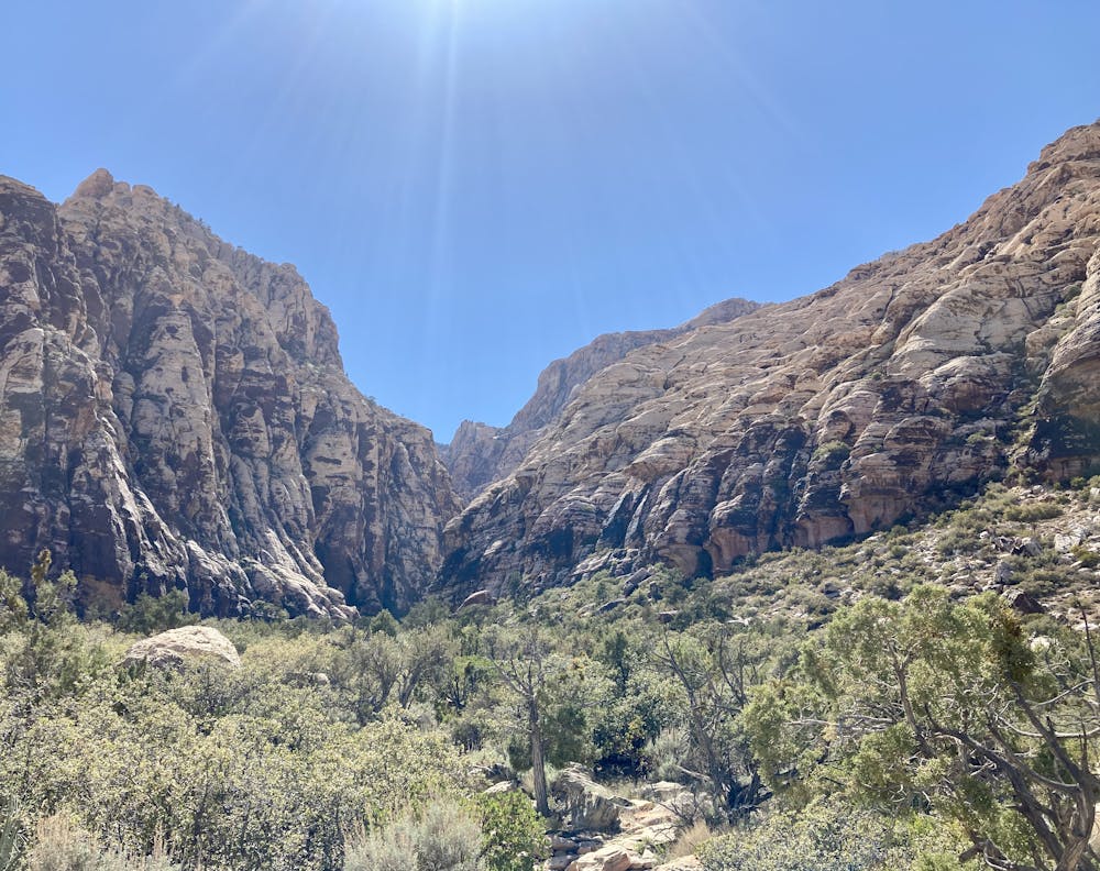
The deeper you get into the canyon, the fainter (and rougher) the route gets. Eventually, you'll find yourself simply following the wash and clambering around and over massive boulders weighing many tons. Eventually, making forward progress will become very arduous, so simply turn around whenever you've had your fill.
Note that this hike has been given a "Difficult" FATMAP rating, but if you continue scrambling down the wash, in the far reaches of the canyon this hike will reach a "Severe" rating.
Difficult
Hiking trails where obstacles such as rocks or roots are prevalent. Some obstacles can require care to step over or around. At times, the trail can be worn and eroded. The grade of the trail is generally quite steep, and can often lead to strenuous hiking.

The path is on completely flat land and potential injury is limited to falling over.

Away from help but easily accessed.
2.7 km away
A remote loop circumnavigating a beautiful peak.
Moderate Hiking
3.3 km away
This upthrust rock formation stands prominently by itself, providing an unbelievable 360-degree view from the summit!
Extreme Hiking
3.3 km away
A popular and stunning, yet somewhat technical, hike in Red Rocks.
Severe Hiking
4.8 km away
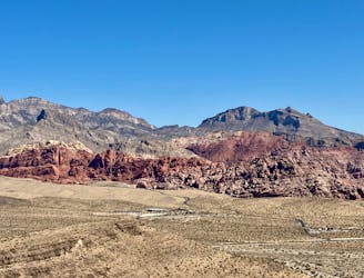
Visually-stunning hike along the base of Calico Hills.
Moderate Hiking
5.5 km away
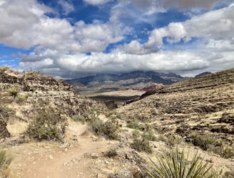
A beautiful hike near Red Rocks that doesn't require a reservation.
Difficult Hiking

5 routes · Hiking

8 routes · Hiking
5 routes · Hiking

10 routes · Hiking