1 m away
Calico Tanks
A popular and stunning, yet somewhat technical, hike in Red Rocks.
Severe Hiking
- Distance
- 3.8 km
- Ascent
- 123 m
- Descent
- 123 m
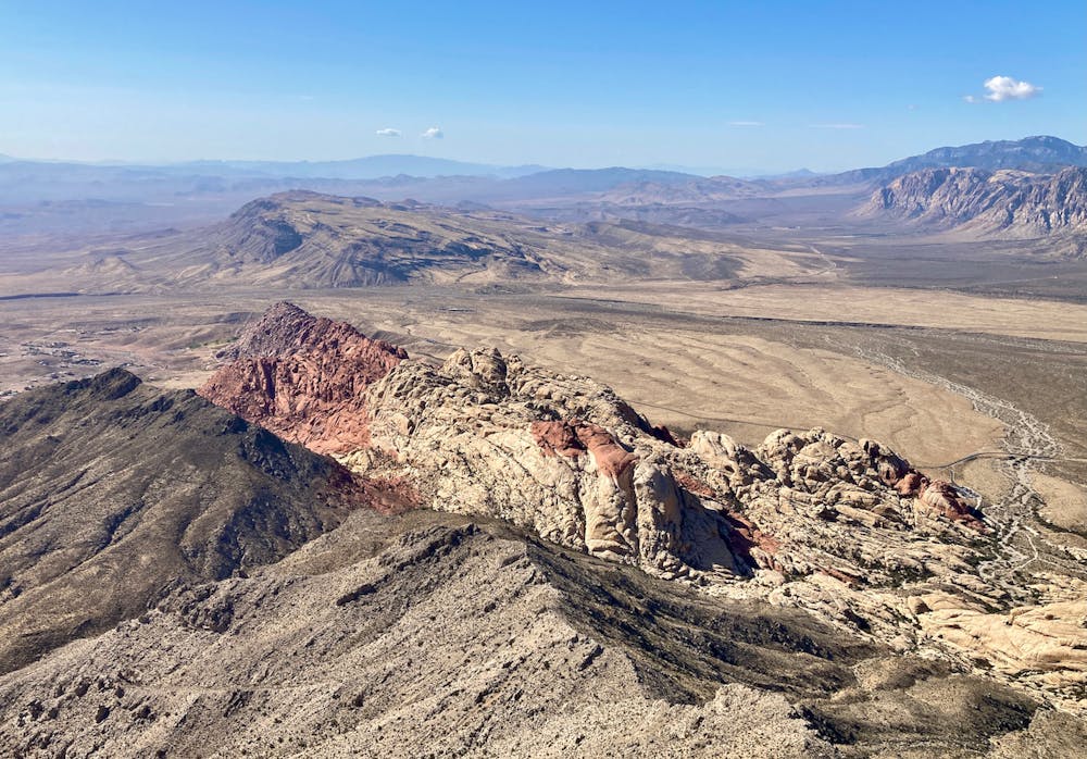
This upthrust rock formation stands prominently by itself, providing an unbelievable 360-degree view from the summit!
Hiking Extreme

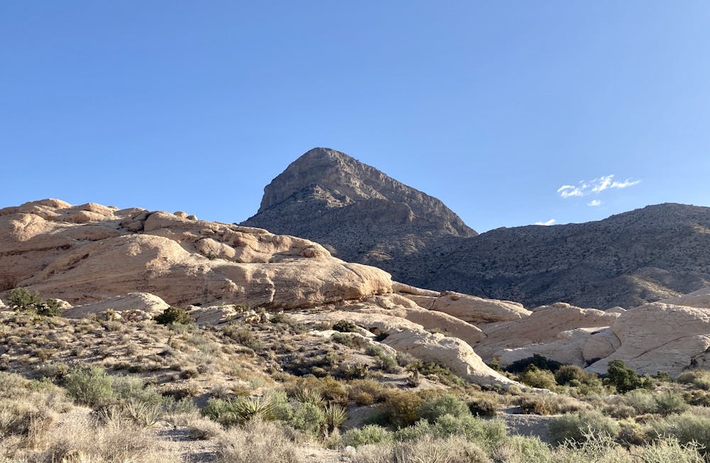
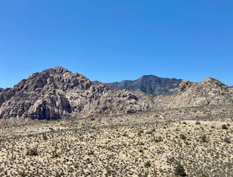
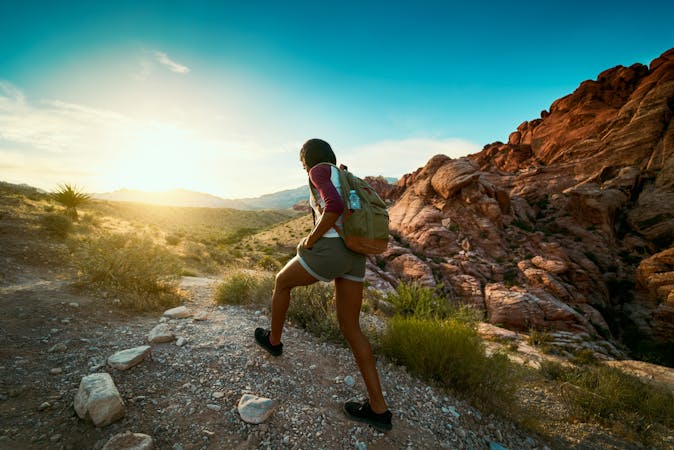
Turtlehead Peak isn't the highest or grandest mountain in the Red Rock Canyon Conservation Area, but this upthrust rock formation stands prominently by itself, providing an unbelievable 360-degree view from the summit!
The hike begins from the ever-popular trailhead shared with the Calico Tanks trail. This is easily the most popular trailhead in the conservation area, and to score a parking spot on the weekend, you'll have to arrive early in the morning, and it's best if you get there at or before sunrise. Even during the week, parking spots are competitive.
Further complicating matters, the conservation area recently instituted an hour-by-hour reservation system for getting into the park. To get your reservation, go to the Recreation.gov app and search for "Red Rock Canyon National Conservation Area Scenic Drive Timed Entry." Without a national parks pass, the entry fee is $15 at the time of this writing. With an America the Beautiful pass, it's only $2.
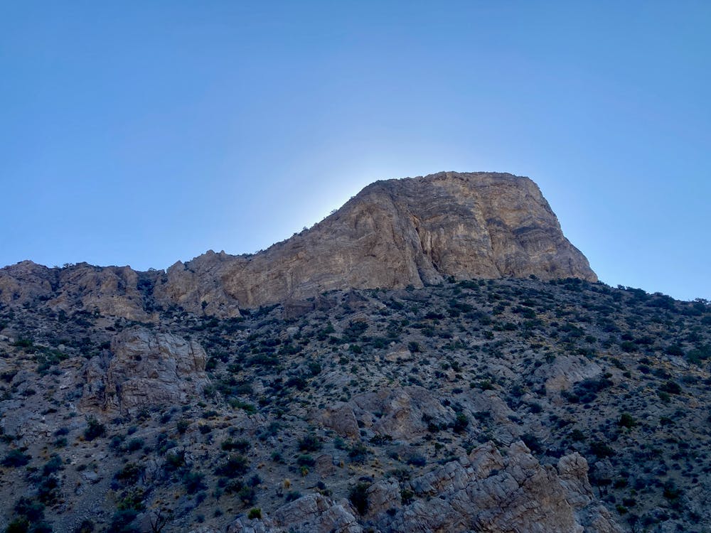
Once at the trailhead, the climb to the summit will cover about 2.6 miles and gain about 2,000 vertical feet. As you slowly hike up a wash toward the prominent Turtlehead Peak soaring high above, you might wonder when you're going to gain all of that elevation. The answer is that it all happens in a hurry, with a steep scramble up a valley to reach the saddle below the summit.
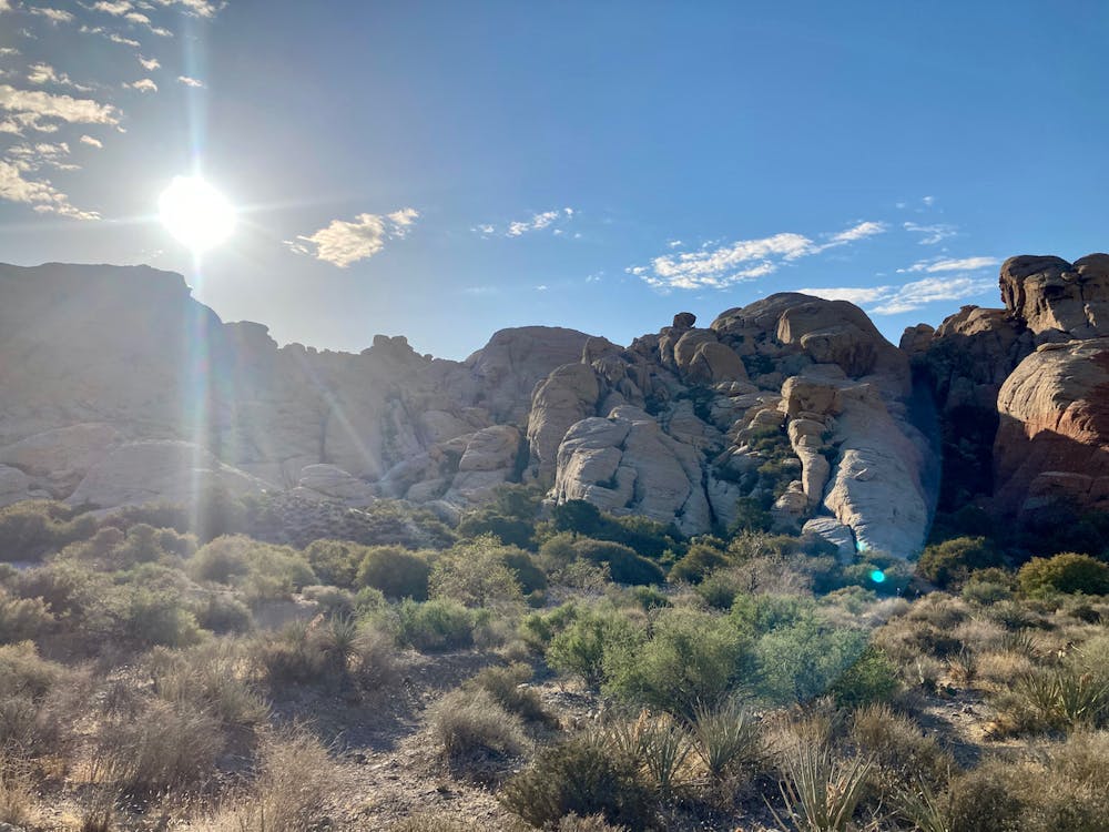
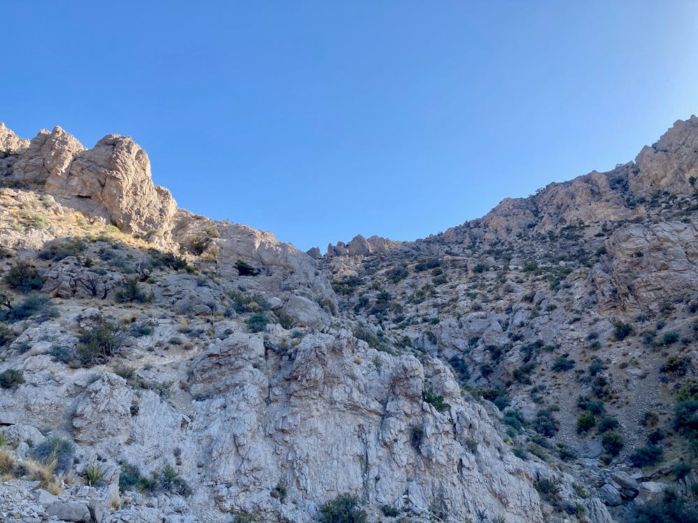
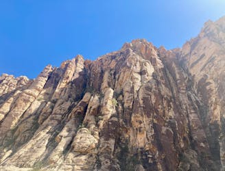
This rocky scramble is the crux of the climb, and thus I'll dedicate some significant space here to it. First, note that the actual navigation in this section is quite tricky. There is a myriad of threading and branching trails heading toward the ridge. Quite often you'll think that you're on the right trail, only to realize that you've somehow branched off. While all of the routes should get you there, some are more difficult than others.
Note that all of these routes will require the use of hands to scale steep, difficult rock sections, some of which are moderately exposed. The only question is: how much scrambling are you in for?
The route shown in the map here follows what appears to be a newly-defined standard route to the summit. At the time of this writing, it appears that some cairns and signs have been freshly installed to aid in navigation. Unfortunately, it is still quite easy to get off track. Complicating the navigation is a variety of old paint markings on the rock, many of which don't follow the new designated route. You'll notice white, red, and green spray paint markings.
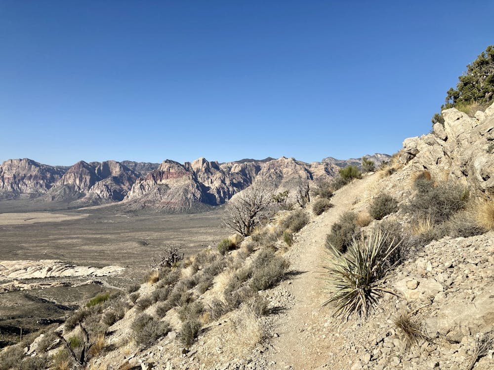
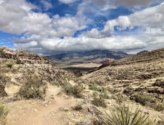
Ultimately, your goals are: 1) Follow the valley and hillside to climber's left to gain the saddle below the summit. 2) Once at the saddle, follow the most defined trail to gain the ultimate summit.
From the saddle, the most defined trail swings far to the east (what is then climber's left) while switchbacking up to the ultimate summit. It might be possible to make a more direct beeline via a lesser-traveled route, but again, do your best to stay the main trail.
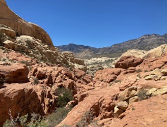
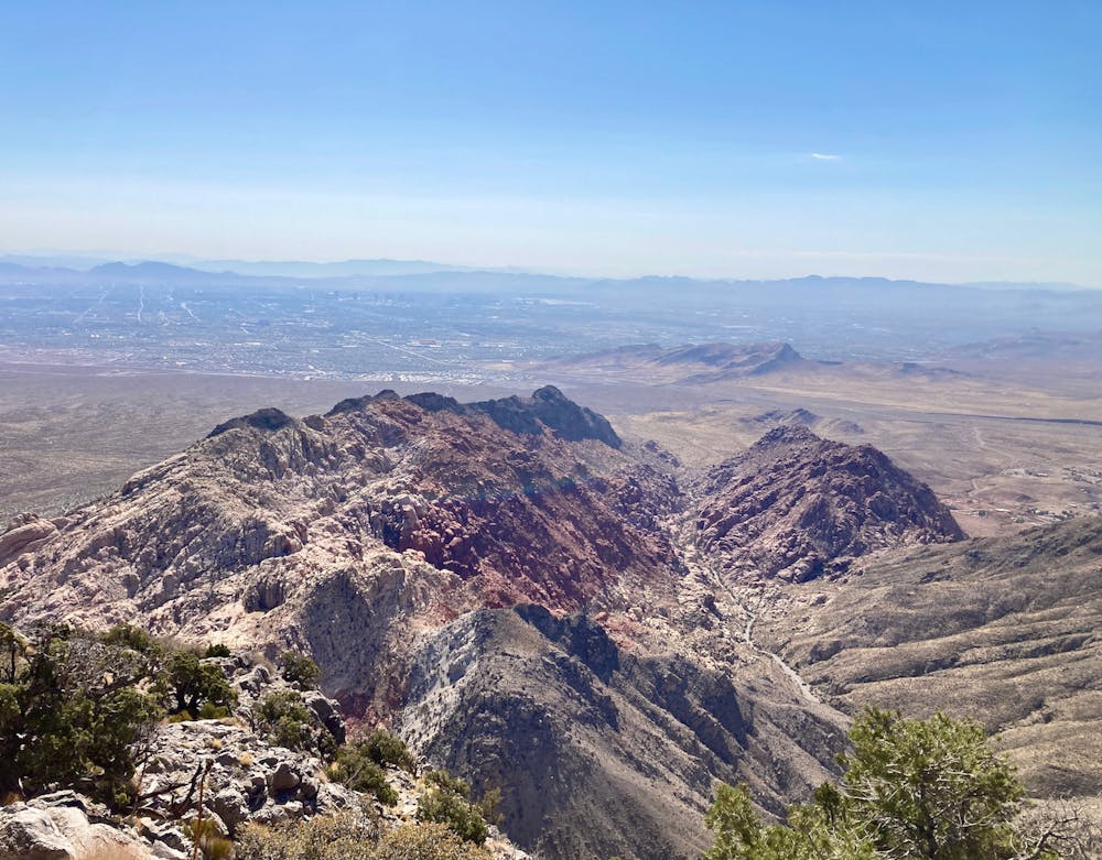
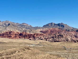
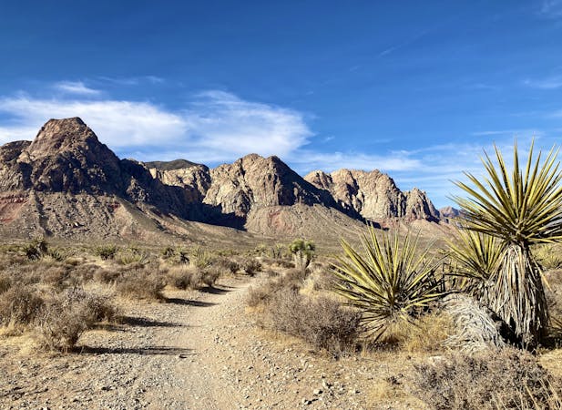
Once you've finally gained the summit, take some time to enjoy those expansive 360-degree views! From the top, you'll enjoy incredible views of the mountain range to the west with the red rock cliffs for which the area is named. Below you, the Calico Hills provide an incredible geologic display of sandstone. And beyond the Calico Hills, you can even see as far away as the Strip (and beyond), thanks to your lofty vantage point!
After you've had your fill on the summit, return the way you came. This is much easier said than done, as the hike down traverses loose, sliding dirt and rocks, the same steep rock scrambles, and as the navigation is often more difficult in the downhill direction. Do your best to follow the cairns, signs, and spray paint, to avoid getting cliffed out in the more difficult terrain.
Extreme
Scrambling up mountains and along technical trails with moderate fall exposure. Handholds are necessary to navigate the trail in its entirety, although they are not necessary at all times. Some obstacles can be very large and difficult to navigate, and the grades can often be near-vertical. The challenge of the trail and the steepness of the grade results in very strenuous hiking. Hikes of this difficulty blur the lines between "hiking" and "climbing".

Some trail sections have exposed ledges or steep ascents/descents where falling could cause serious injury.

Away from help but easily accessed.
1 m away
A popular and stunning, yet somewhat technical, hike in Red Rocks.
Severe Hiking
2.5 km away
Visually-stunning hike along the base of Calico Hills.
Moderate Hiking
2.7 km away
A remote loop circumnavigating a beautiful peak.
Moderate Hiking
3.3 km away
Hike up a rough trail into a stunning canyon.
Difficult Hiking
4.8 km away
A beautiful hike near Red Rocks that doesn't require a reservation.
Difficult Hiking

5 routes · Hiking
8 routes · Hiking
5 routes · Hiking

10 routes · Hiking