188 m away
Spooner Lake Loop
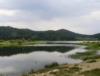
Easy hike around picturesque Spooner Lake, among summer wildflowers or fall foliage.
Easy Hiking
- Distance
- 4.4 km
- Ascent
- 78 m
- Descent
- 79 m
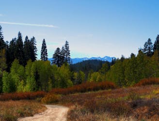
This relatively short section traverses the west side of the Carson Range through lush conifer forest, stands of aspen, and flowery meadows.
Hiking Difficult

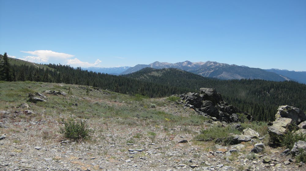
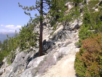
From Spooner Summit to Kingsbury, the Tahoe Rim Trail winds through dense forest on the west-facing slopes above Lake Tahoe. A 1-mile section called The Bench grants incredible, non-stop views over the lake. Other than that, most of the trail is concealed in the shade of lush firs and aspens, with occasional open meadows.
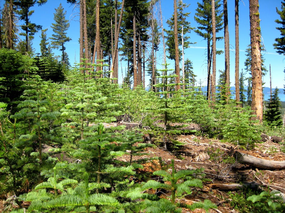
Begin by climbing steadily up from Highway 207 at Spooner Summit, passing in and out of shade and sun, through stands of conifer and fields of flowers. When you come to groves of aspen trees, look closely for old carvings in the trunks. Shepherds who moved here from Spain in the 1800s lived in isolation among these mountains with their sheep, and would sometimes draw on the trees to abate their boredom. Observe these traces of history, but please do not add marks of your own to the trees.
On the flank of South Camp Peak, the gradient levels out and the trail crosses a huge volcanic talus slope. This is The Bench, with its wonderful vantage over Lake Tahoe. The trail trends downward from here and enters more dark and quiet woods, through which it meanders for several miles.
Signs of civilization reappear near the neighborhoods of Kingsbury. The route intersects a few other trails near town, then passes close to some houses before reaching Highway 207. Continue across the road and head uphill once again, crossing a small creek and wet meadows over the course of a few miles, then crossing two ski runs of Heavenly Mountain Resort. This marks the end of the section, and a half-mile connector trail down the ski slopes leads to a trailhead on Quaking Aspen Lane.
Difficult
Hiking trails where obstacles such as rocks or roots are prevalent. Some obstacles can require care to step over or around. At times, the trail can be worn and eroded. The grade of the trail is generally quite steep, and can often lead to strenuous hiking.

The path is on completely flat land and potential injury is limited to falling over.

Away from help but easily accessed.
188 m away
Easy hike around picturesque Spooner Lake, among summer wildflowers or fall foliage.
Easy Hiking
2.4 km away
Colorful forest hike to Marlette Lake, a historic reservoir with historic cabins near its shore and on the particularly picturesque Chimney Point.
Moderate Hiking
7.6 km away
Uphill hike through forest to a large alpine reservoir perched in the mountains above Lake Tahoe, with access to the historic Flume Trail.
Difficult Hiking

8 routes · Hiking

14 routes · Hiking