5.5 km away
Marlette Lake Trail
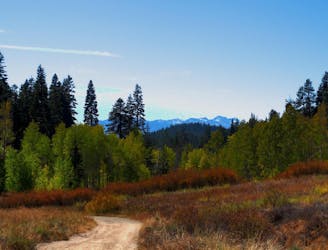
Colorful forest hike to Marlette Lake, a historic reservoir with historic cabins near its shore and on the particularly picturesque Chimney Point.
Moderate Hiking
- Distance
- 13 km
- Ascent
- 480 m
- Descent
- 480 m
Uphill hike through forest to a large alpine reservoir perched in the mountains above Lake Tahoe, with access to the historic Flume Trail.
Hiking Difficult

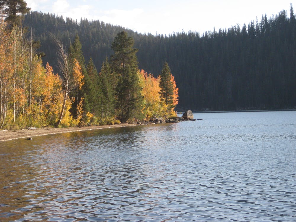
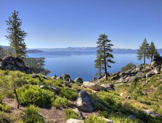
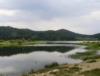
Not to be confused with the nearby swim spot on Lake Tahoe called Chimney Beach, the Chimney Beach Trail leads away from the lake, up into the mountains to a large alpine reservoir called Marlette Lake. The lake is located along the scenic and historic Flume Trail, and was in fact created for the purpose of supplying water to the logging flume in the late 1800s. Signs around the lake tell more about its history, and you can even find a chimney—all that’s left of an old cabin—on a prominent spit of land called Chimney Point on the lake.
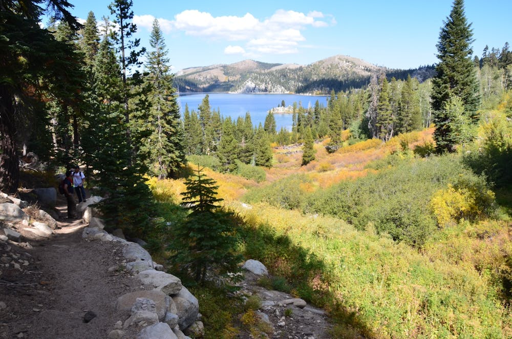
Multiple trails and dirt roads converge around Marlette Lake. The Chimney Beach Trail accesses its southwest shore, but you can also connect with other trails and viewpoints on the shoreline or higher in the mountains.
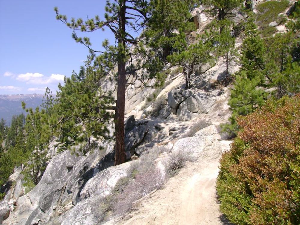
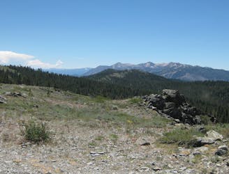
From Chimney Beach Trailhead along NV-28, the trail heads steeply upward through pine woodland that gives way to fir, aspen, and a forest floor of ferns as you get higher in elevation. The trail eventually reaches the top of a sunny ridge where a fantastic view awaits—down to Lake Tahoe on one side and Marlette Lake on the other. From there, take a short downhill to meet with the Marlette Lake Trail and follow it to the water.
Find Chimney Point on the southeast shore, which is a short detour from the route mapped here. To get to the dam and the junction with Flume Trail, follow the wide path along the lake’s southwest shore (mapped). You can catch another glimpse of Lake Tahoe from atop the small earthen dam, but walk a little ways north on the Flume Trail and you’ll find a better view.
An unsigned, somewhat overgrown connector trail links Chimney Beach Trail with Flume Trail at the dam on Marlette Lake. If hiking the loop clockwise, find this trail about 2 miles from the start of the hike. If going counterclockwise (as mapped), look for it just after starting on Flume Trail from the dam.
Difficult
Hiking trails where obstacles such as rocks or roots are prevalent. Some obstacles can require care to step over or around. At times, the trail can be worn and eroded. The grade of the trail is generally quite steep, and can often lead to strenuous hiking.

The path is on completely flat land and potential injury is limited to falling over.

Away from help but easily accessed.
5.5 km away
Colorful forest hike to Marlette Lake, a historic reservoir with historic cabins near its shore and on the particularly picturesque Chimney Point.
Moderate Hiking
7.2 km away
Rewarding uphill hike from Incline Village, Nevada with big views over Lake Tahoe and access to other great trails.
Moderate Hiking
7.5 km away
Easy hike around picturesque Spooner Lake, among summer wildflowers or fall foliage.
Easy Hiking
7.6 km away
This relatively short section traverses the west side of the Carson Range through lush conifer forest, stands of aspen, and flowery meadows.
Difficult Hiking

8 routes · Hiking

14 routes · Hiking