3.8 km away
Pink Beds Loop
A beautiful, relatively flat run through the historic Pink Beds Valley.
Easy Trail Running
- Distance
- 8.1 km
- Ascent
- 115 m
- Descent
- 115 m
A challenging and incredibly-steep approach to Shining Rock.
Trail Running Severe

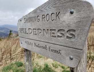
This route is an all-seasons trail run into Shining Rock Wilderness, accessible via US-276. A small parking area can accommodate a handful of cars, and an adjacent pull-off serves as overflow. Snow is likely in the winter months, but the route is still passable with appropriate gear. Trekking poles are highly recommended no matter the time of year.
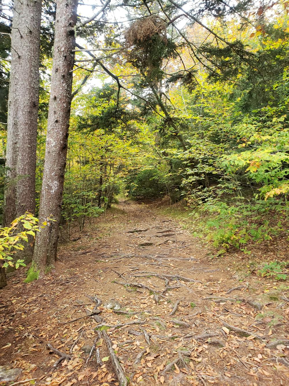
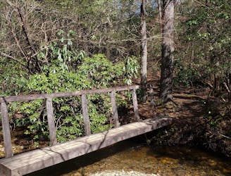
Beginning at the Big East Fork Trailhead, follow the trail as it parallels the creek. This is a popular camping area with numerous tent sites and hammock opportunities. As the trail spirals away from the creek, it will soon reach an unmarked intersection with Old Butt Knob Trail. A hard right, and you'll begin to climb.
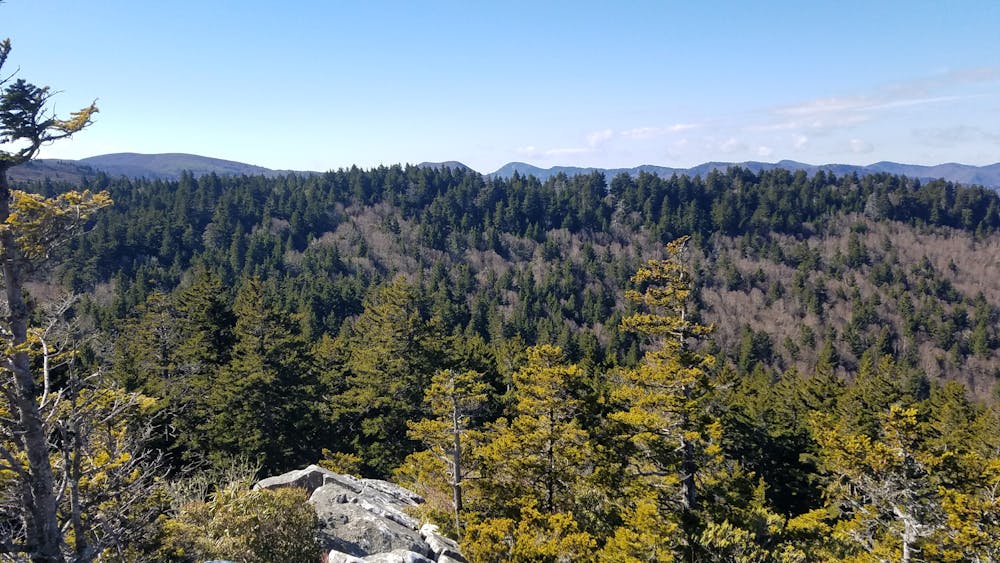
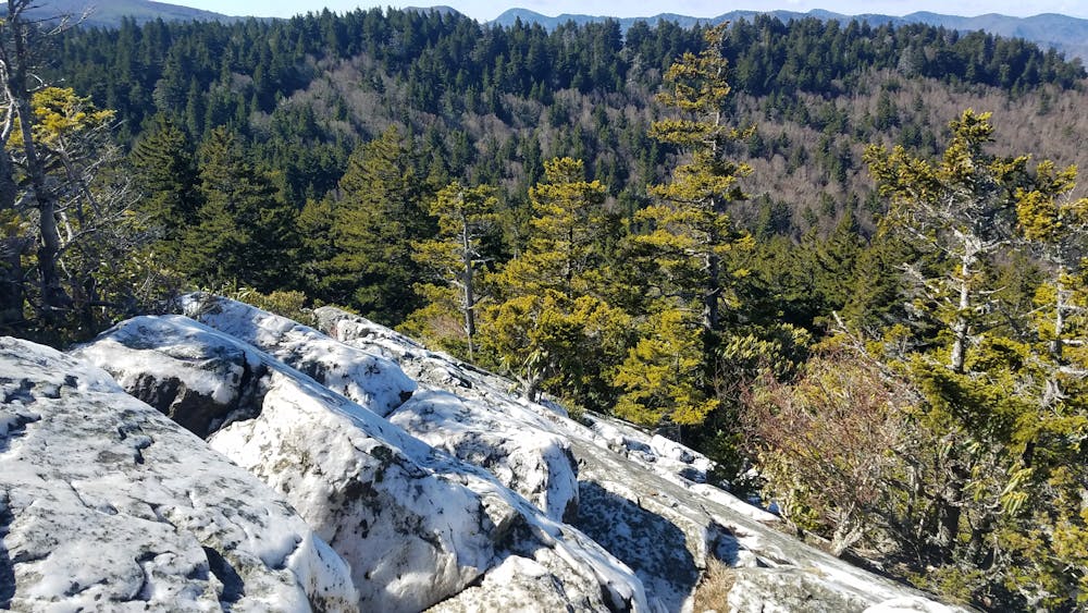
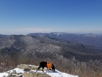
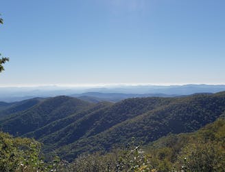
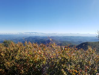
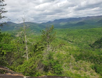
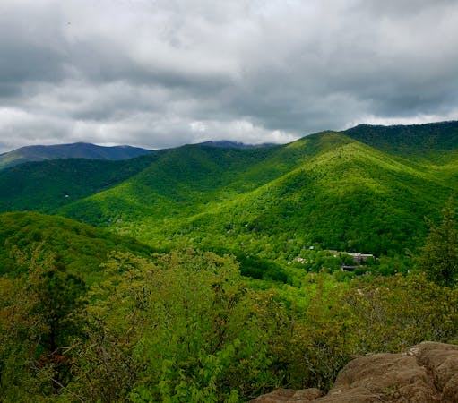
The next two miles will test your limits as you ascend to Old Butt Knob at 5,500'. This steep climb is sure to challenge even the strongest of trail runners. You'll find a couple of switchbacks along your way as you follow the steep ridge to the summit. A couple of craggy outcroppings give way to panoramic views of the surrounding wilderness.
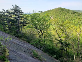
After Old Butt Knob, the trail levels as it continues towards Shining Rock Mountain. A series of tight switchbacks then lead the way to the midway point and destination for this loop, Shining Rock. According to Wikipedia, "Shining Rock is named for the large white quartzite rock outcropping near its summit." A handful of side trails lead to different vantage points along the formation.
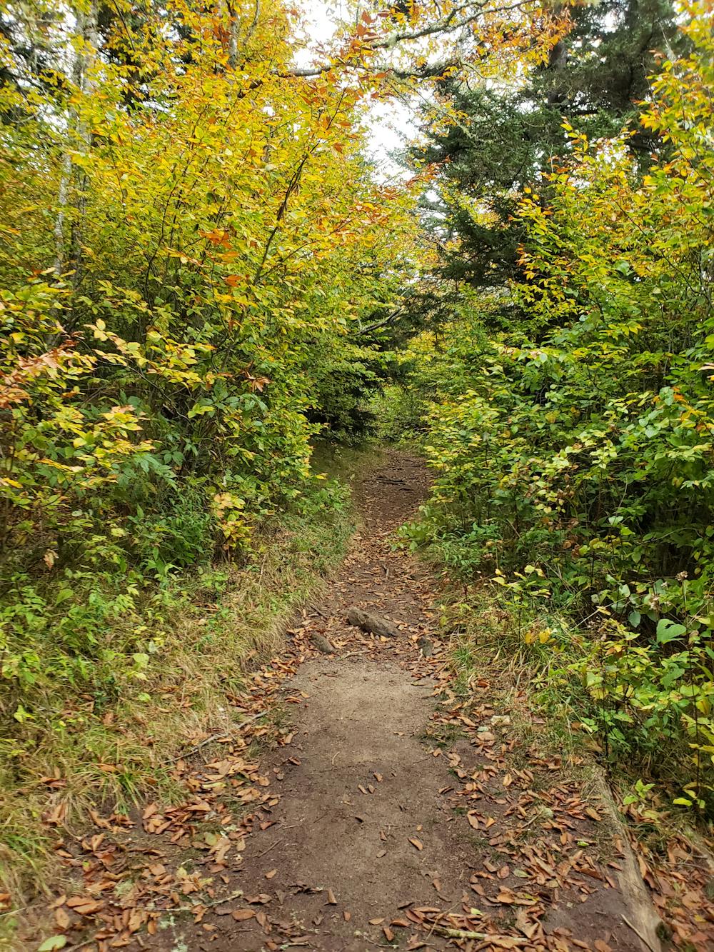
Along this stretch, note that trail markings are minimal and/or non-existent. Being designated as a Federal Wilderness Area, "trails are neither signed nor blazed, and are maintained at a low level that results in their treads being difficult or impossible to see at times," according to the US Forest Service.
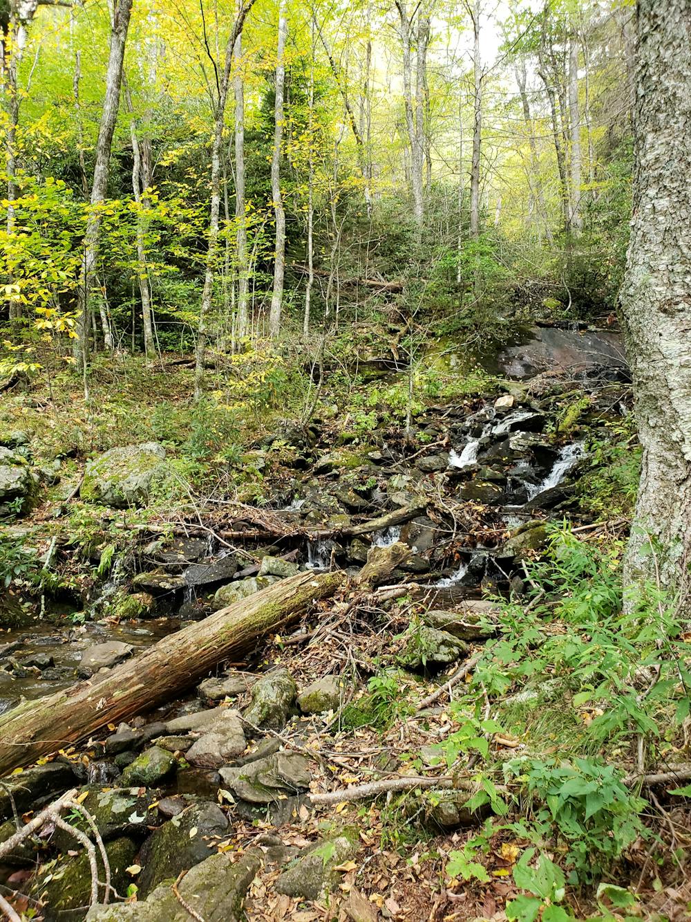
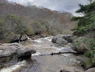
Continuing on the loop, you'll reach the 31-mile Art Loeb Trail, where you'll take a left to follow it for a short stretch. Shortly after, you'll find a marker denoting the turn for Shining Creek Path. Take the left and begin the descent. Along the way, you'll pass several springs that ultimately merge to form Shining Creek.
The way down Shining Creek Path is steady and often chosen for shorter out-and-back runs to its multiple cascading waterfalls.
Once you reach the intersection with Old Butt Knob Trail, keep right and follow the path along the river back to the trailhead.
Sources: https://www.fs.usda.gov/recarea/nfsnc/recarea/?recid=48260 https://en.wikipedia.org/wiki/ShiningRock
Severe

The trail contains some obstacles such as outcroppings and rock which could cause injury.

In the high mountains or remote conditions, all individuals must be completely autonomous in every situation.
3.8 km away
A beautiful, relatively flat run through the historic Pink Beds Valley.
Easy Trail Running
5.5 km away
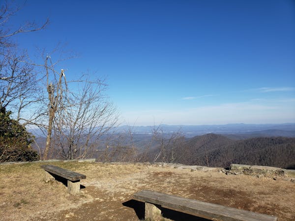
A short jog to a historic fire tower with breathtaking panoramic views.
Easy Trail Running
5.8 km away
A classic trail run in a high mountain valley with two waterfalls.
Moderate Trail Running
7.3 km away
An incredible trail run across bald summits and exposed overlooks.
Difficult Trail Running
7.4 km away
A iconic and scenic trail running route best known for its traverse through Shining Rock Wilderness.
Difficult Trail Running
8.6 km away
A short, yet challenging run with spectacular views from the summit of Mount Pisgah.
Difficult Trail Running
8.6 km away
A highly-acclaimed trail run starting at the top of Mount Pisgah, and ending at Mount Mitchell, the highest point east of the Rockies.
Difficult Trail Running
9.1 km away
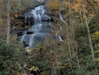
A staple trail running loop with a 150' cascading waterfall.
Moderate Trail Running
9.4 km away
A classic trail run from the fish hatchery with phenomenal views from John Rock.
Moderate Trail Running
9.4 km away
An incredibly challenging trail run requiring the use of fixed ropes to ascend Cedar Rock Mountain.
Extreme Trail Running
12 routes · Trail Running
6 routes · Trail Running

17 routes · Hiking · Trail Running

10 routes · Trail Running