696 m away
Pioneer Ridge Corner

A short, fun tree run that brings you right back to the resort
Severe Freeride Skiing
- Distance
- 250 m
- Ascent
- 0 m
- Descent
- 133 m
A steep, rocky, tree-d run into Snake Bowl.
Freeride Skiing Difficult

If the Avalanche conditions are safe and you want to get the full experience of the Snake Bowl run, take it to the next level by hiking to Preston Peak and skiing from the top. Be advised, there are a lot of tight trees in this area, as well as rocks when the snowpack is low. You should only head out here if there is a healthy, thick snowpack. This area is also out of bounds, so make sure to carry avalanche gear and be safe traveling on the ridge.
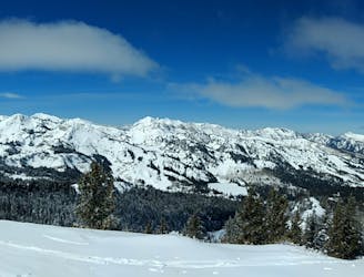
After unloading from Snake Creek Chairlift, head right out of the gate towards the Snake Bowl traverse. There is usually a short cat track heading up towards your left here. This is where you want to take off your skis and start hiking. Follow the Cat track up to the ridge line, and follow the ridge line from there. Continue hiking up this ridge line until you reach the top of Preston Peak. From here there is a great view of Snake Creek to the East, and the entire Central Wasatch to the West.
When skiing down, be very mindful of any rocks that may be beneath the snow. This area is notorious for giving core shots to unexacting skiers. There is steep, sustained pitch through the trees for several hundred feet, until you reach the Snake Bowl run bellow. This is one of the steeper, and more challenging runs in the Brighton area. After skiing it and the bowl below, you will end up on the Thunderroad, where you can head back to Snake Creek or Crest lifts.
Difficult
Serious gradient of 30-38 degrees where a real risk of slipping exists.

Away from help but easily accessed.
696 m away
A short, fun tree run that brings you right back to the resort
Severe Freeride Skiing
789 m away

A steep, tree-d run off Pioneer Ridgeline
Difficult Freeride Skiing
1.3 km away

A long steep chute off the Pioneer Ridge
Severe Freeride Skiing
1.3 km away
A classic longer line for skiers willing to make the walk
Difficult Freeride Skiing
1.3 km away

A partly open, partly tree-d run just outside the resort boundary
Difficult Freeride Skiing
1.3 km away

A steep run through trees with several different chute options.
Difficult Freeride Skiing
1.5 km away

Steep, rocky run, through tight trees that finishes in tight little chutes
Severe Freeride Skiing
1.8 km away

A fun run through open aspen glades
Difficult Freeride Skiing
2.2 km away

An exciting area with a variety of cliff and chute options
Difficult Freeride Skiing
2.4 km away

Cliff area just past the ski area boundary on Milly Bowl
Severe Freeride Skiing