127 m away
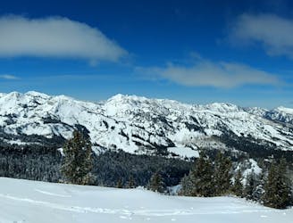
Pioneer Ridge Trees

A steep, tree-d run off Pioneer Ridgeline
Difficult Freeride Skiing
- Distance
- 448 m
- Ascent
- 0 m
- Descent
- 180 m
A short, fun tree run that brings you right back to the resort
Freeride Skiing Severe

The Pioneer Ridgeline is a classic Brighton Backcountry destination, with great tree skiing and steep terrain. This area is outside of the resort boundary, and no avalanche work is performed here. Make sure to carry a beacon, probe, shovel, know how to use them, and have a partner your trust. The Pioneer ridge corner is a shorter version of the full Pioneer ridge tee run. It takes about half the time to hike up (maybe 10 minutes) and brings you on a more direct route back into the resort. Although this run only takes you out of the resort, it is backcountry, so be aware of avalanche danger.
After unloading off the Crest Chair, head over to the backcountry gate on your right. Take off your skis here. It is long enough to merit putting your skis on your backpack. This is also a good place to check your beacon and discus your plans with your group. After heading out the gate, boot pack up the ridge towards the peak. If the boot pack is set, this hike will take 10 minutes. If there is no boot pack and you have to break trail, it can take longer.
Follow the ridge line until you reach the point where it starts to trend to the left. You will begin to see small alley ways in the trees to your right which feed back to the resort. The farther up you hike, the longer the run will be. As the trail and/or ridge begins to trend left toward the peak, drop into the trees. The trees here are decently spaced - enough to make easy turns on your way down. Take a line down through the trees and head right at the bottom. The run is fairly steep at the top, and gets more mellow towards the bottom. There are a few areas of isolated rocks here, but for the most part it's easy going.
As you get towards the bottom of the line, after 100-200 feet, the trees will open up and you will see the resort boundary where you can enter back in to your right. This will put you right above Wren Hollow on the Crest lift.
Severe
Steep skiing at 38-45 degrees. This requires very good technique and the risk of falling has serious consequences.

Close to help in case of emergency.
127 m away
A steep, tree-d run off Pioneer Ridgeline
Difficult Freeride Skiing
598 m away

A long steep chute off the Pioneer Ridge
Severe Freeride Skiing
696 m away

A steep, rocky, tree-d run into Snake Bowl.
Difficult Freeride Skiing
1.6 km away

An exciting area with a variety of cliff and chute options
Difficult Freeride Skiing
1.7 km away
A classic longer line for skiers willing to make the walk
Difficult Freeride Skiing
1.8 km away

A partly open, partly tree-d run just outside the resort boundary
Difficult Freeride Skiing
1.8 km away

A steep run through trees with several different chute options.
Difficult Freeride Skiing
1.8 km away

Cliff area just past the ski area boundary on Milly Bowl
Severe Freeride Skiing
1.8 km away

A steep, rocky chute running down the middle of Mount Millicent. For experts only.
Severe Freeride Skiing
1.8 km away

A steep, semi tree-d run on the west side of Mount Millicent
Severe Freeride Skiing