Squaw Canyon to Lost Canyon Loop
Day hike or backpacking trip into well-watered canyons, with some rock scrambling required to enter and exit them.
Severe Hiking
- Distance
- 13 km
- Ascent
- 288 m
- Descent
- 288 m
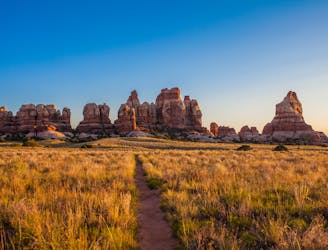
Two surprisingly lush canyons among multicolored walls, with exciting scrambles over a slickrock pass to connect them.
Hiking Severe

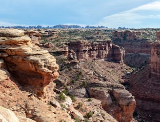
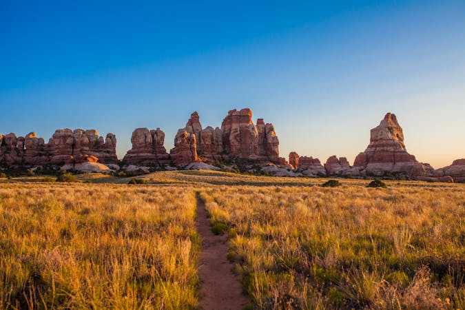
The loop hike through Big Spring Canyon and Squaw Canyon makes a fun exploration of both the intricacies and immensity of this landscape, with forest paths through hidden oases and slickrock scrambles to distant panoramas. It’s mostly easy walking, but some parts require careful footing and use of hands to negotiate rock ledges and ramps.
The loop is good in either direction, but most people start with Big Spring Canyon. This trail hops over a sandstone ridge to cross a juniper-studded meadow, then enters a canyon that gets progressively narrower, taller, and more forested as it goes. The small creek flows for much of the year, and the trail crosses it several times. Eventually, the trail climbs into a side canyon that’s nearly all bare rock, and begins to gain elevation more quickly. Views get even better of red-and-white layered rock walls all around.
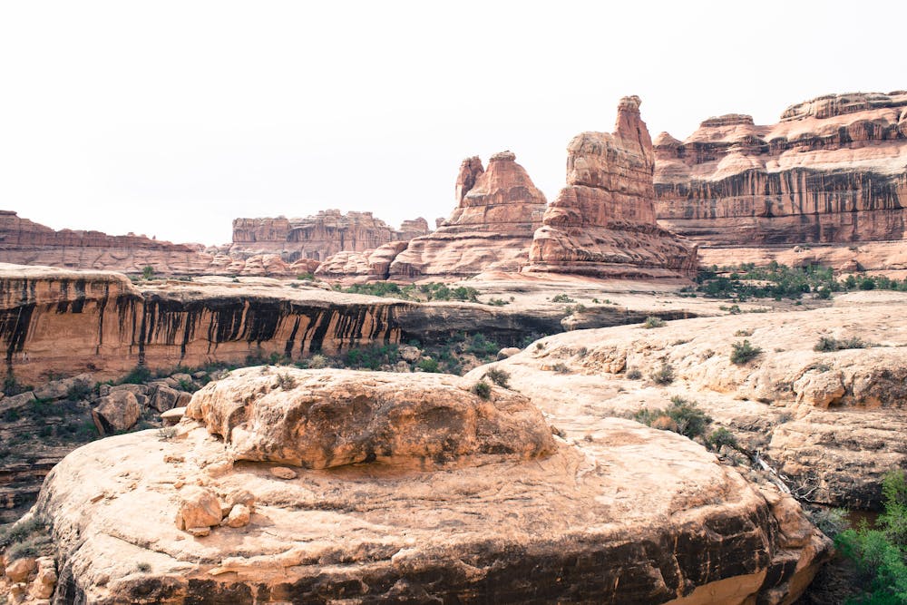
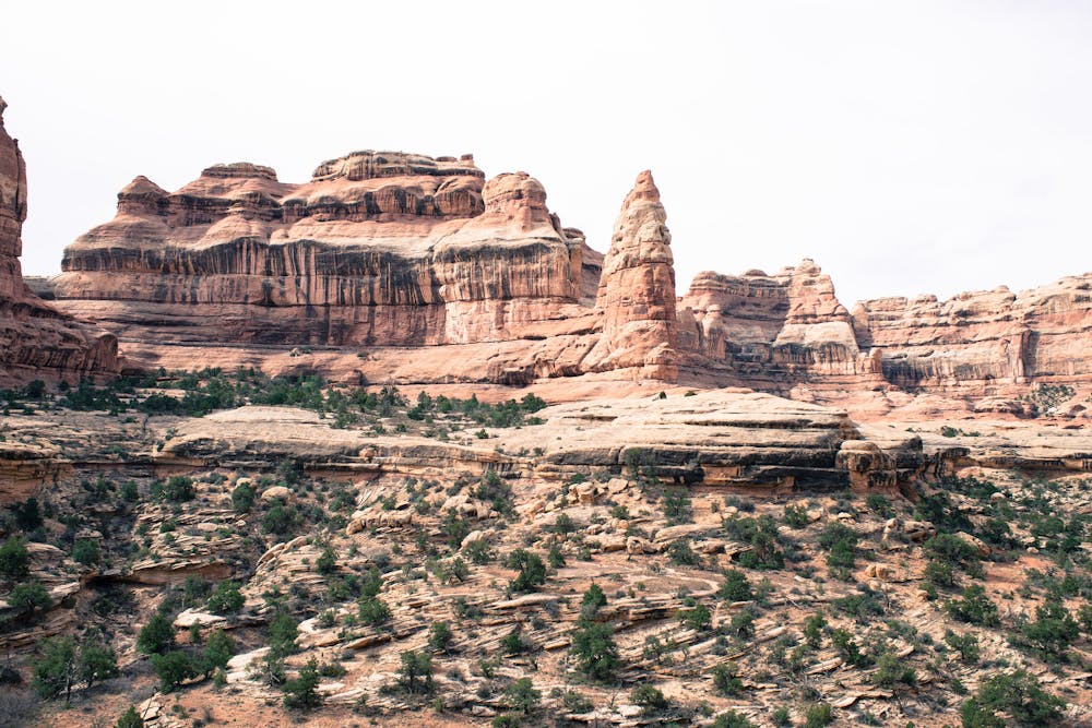
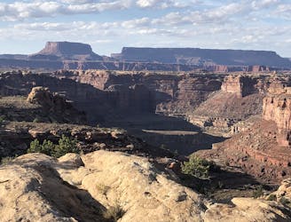
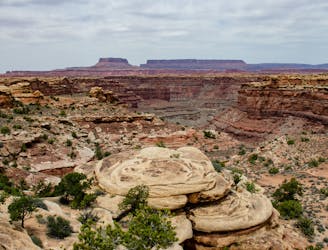
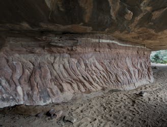
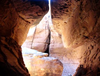
This canyon gets steeper, and eventually, a series of rounded ledges require some scrambling to get above them. If the rock is wet because of recent rain or snow, this section becomes dangerous, and even when dry, may give trouble to those afraid of heights. Route finding is a bit tricky in the tiers of slickrock, so look for cairns to guide the way. Scrambling sections continue off and on, with flatter parts in between, until topping out on an airy saddle. From there, you’ll have views over two canyons––Big Spring Canyon, which you just ascended, and Squaw Canyon, which you must next descend.
Getting into Squaw Canyon requires more careful route finding, as a series of rock slopes and ledges make a somewhat convoluted route to bypass vertical drops. Moving carefully and steadily will ensure safe passage to the canyon bottom. Don’t forget to look up every now and then to enjoy views of distant cliffs and rock towers, plus nearer formations that crown the canyon walls.
In the bottom, Squaw Canyon is another verdant drainage with trickling water. The trail meanders from side to side, crossing the creek several times, around a few bends between the undulating walls. Eventually, the path trends away from the creek, crossing sagebrush flats and rising over two slickrock ridges (these are casual, no scrambling required) on the return to the trailhead.
This loop is most commonly done as a day hike, but there are backcountry campsites in both Big Spring Canyon and Squaw Canyon, available by permit, in case you want to break it into two days or combine with a longer route.
Sources: https://www.nps.gov/cany/planyourvisit/hiking.htm https://www.grandcanyontrust.org/hikes/big-spring-canyon-trail https://liveandlethike.com/2015/04/12/big-spring-canyon-squaw-canyon-loop-trail-canyonlands-national-park-ut/
Severe
Hiking challenging trails where simple scrambling, with the occasional use of the hands, is a distinct possibility. The trails are often filled with all manner of obstacles both small and large, and the hills are very steep. Obstacles and challenges are often unexpected and can be unpredictable.

Some trail sections have exposed ledges or steep ascents/descents where falling could cause serious injury.

Away from help but easily accessed.
Day hike or backpacking trip into well-watered canyons, with some rock scrambling required to enter and exit them.
Severe Hiking
2.1 km away
One of the most popular hiking destinations in the Needles District of Canyonlands National Park.
Severe Hiking
2.1 km away
Day hike or backpacking trip through a playland of rocks, to what is arguably the most scenic spot in all of the Needles District.
Difficult Hiking
3.8 km away
A family-friendly loop with epic views and a chance and spotting unique wildlife.
Easy Hiking
4 km away
Wonderfully varied route from the trails of Canyonlands National Park to the crossing of the Colorado River, through deep canyons and over high plateaus.
Severe Hiking
4 km away
A hike for geology enthusiasts and desert lovers, crossing canyons and faultlines en route to a cliff-top view of the Green and Colorado Rivers.
Difficult Hiking
4.8 km away
Concise loop that’s perfect for young families, combining interesting history and fun rock scrambling.
Moderate Hiking
5.8 km away
Walk and scramble through a deep crevice in the rocks surrounding Chesler Park.
Difficult Hiking

14 routes · Hiking

25 routes · Alpine Climbing · Hiking

10 routes · Hiking
8 routes · Hiking

10 routes · Hiking
5 routes · Hiking

63 routes · Alpine Climbing · Hiking