3 m away
Confluence Overlook
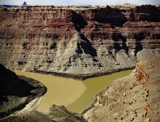
A hike for geology enthusiasts and desert lovers, crossing canyons and faultlines en route to a cliff-top view of the Green and Colorado Rivers.
Difficult Hiking
- Distance
- 16 km
- Ascent
- 470 m
- Descent
- 470 m
Wonderfully varied route from the trails of Canyonlands National Park to the crossing of the Colorado River, through deep canyons and over high plateaus.
Hiking Severe

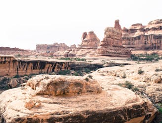
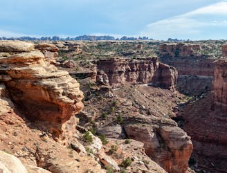
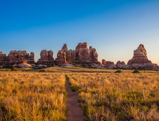
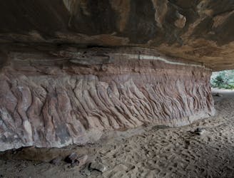
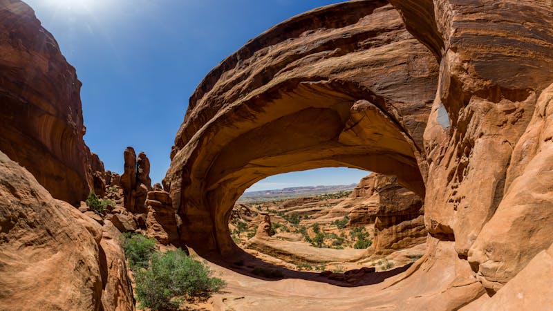
Section 3 contains some of the best and most varied scenery of the Canyonlands region. It includes the grassy glens and toothy rock spires of The Grabens, scattered stone citadels in the surrounding hills, wide-open Beef Basin on a breezy plateau, and the depths of Dark Canyon with emerald pools plus flowing waterfalls. Though some parts are on maintained trails or roads, this section contains a lot of tricky navigation through cliff bands and around dryfalls.
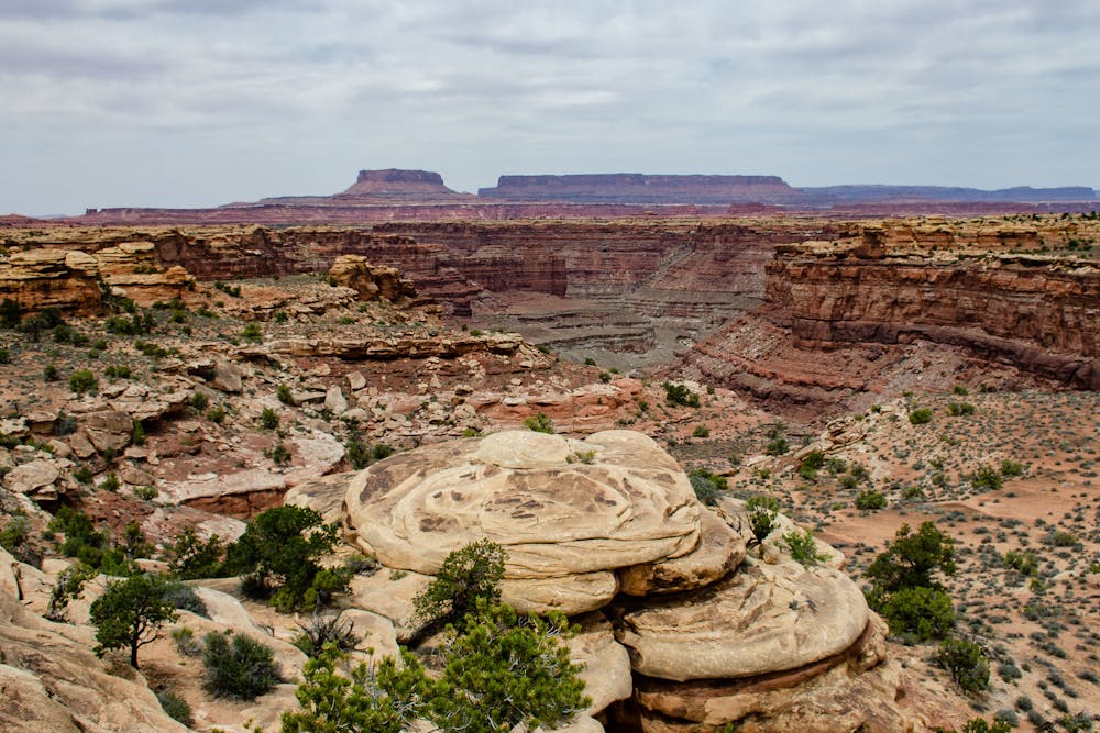
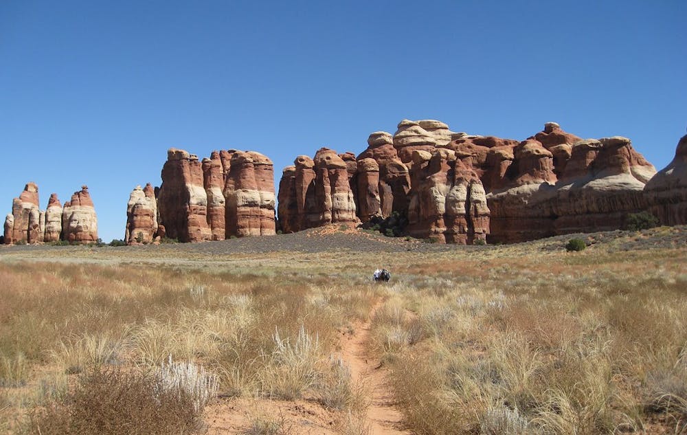
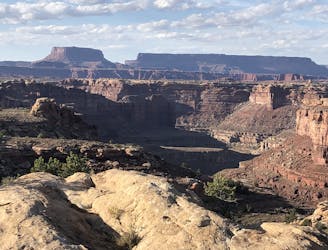
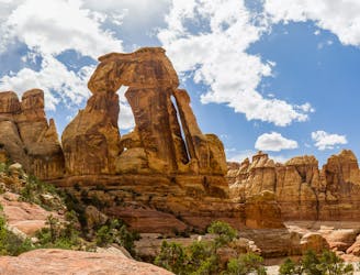
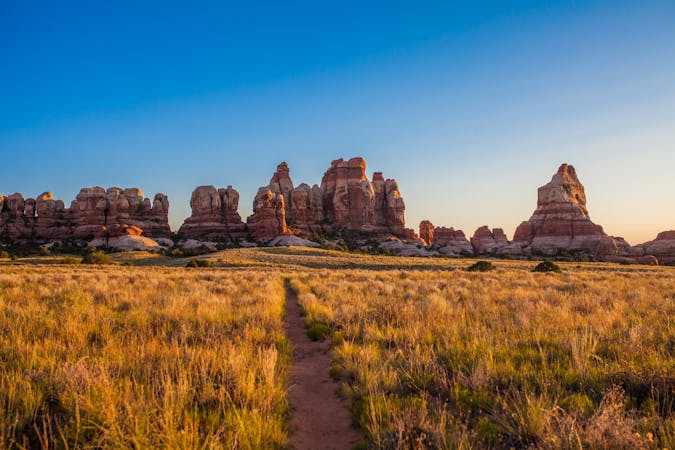
Big Spring Trailhead is the first place you’ll follow a maintained national park trail. This is the Overlook Trail, which cuts in and out of steep-sided canyons among many mushroom-capped rock towers. Soon it enters the oddly parallel, narrow valleys that streak this region called The Grabens. Leaving the park trail, the route links a few of these valleys via bouldery passes in between and dry washes within. It follows Butler Wash into a more open valley of clustered stone towers and rolling sage meadows.
This leads gradually up in elevation and into a canyon twisting through prehistoric hills. Follow a branch higher until it comes to a head in the sandy cliffs of a high ridgeline. Some slickrock and gully scrambling may be required to exit and get over the ridge. On the other side lies Beef Basin, a broad park dotted with juniper and rimmed by still-higher sandstone cliffs, with the Abajo Mountains closer than ever on the horizon. Going cross-country and along a few dirt roads leads to a traverse along the cliffs of Gypsum Canyon, then to the sage and sand-covered floor of Fable Valley. Unless there’s been recent snow, water is usually hard to come by in this high country except in the form of cattle tanks.
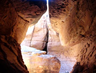
If you’ve found route-finding to be difficult so far, you are in for a real challenge in Youngs Canyon. It has many small drops to scramble down, and a few big dryfalls that require lengthy workarounds. The good news is that water is usually plentiful in pools, or even flowing, within this deep canyon. A small waterfall marks the confluence of Youngs with the even deeper Dark Canyon, which almost always has flowing water.
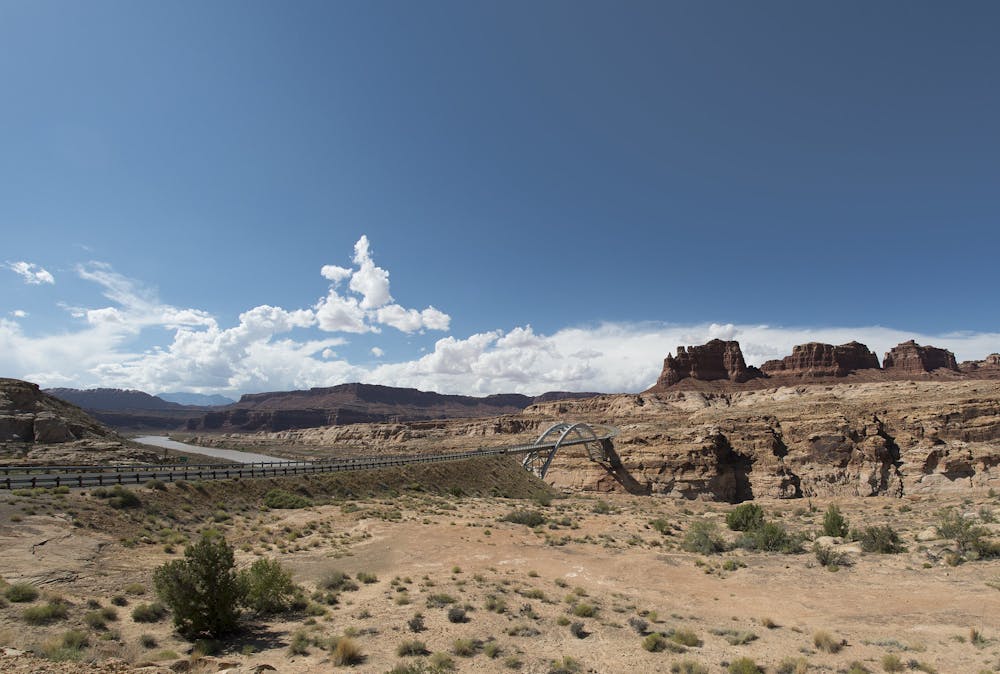
Continue down Dark, with considerably easier route-finding, to the Sundance Trail which takes grueling switchbacks to the rim. From there, one brief in-and-out scramble through a slickrock-rimmed canyon leads to dirt roads that continue the rest of the way to Hite. Hite Outpost is a possible resupply point with a convenience store, campground, and lodging, reached by a short detour just before crossing the Colorado River. This section ends with the spectacularly tall highway bridge over the river.
Sources: http://www.hayduketrail.org/TheRoute.html http://www.hayduketrail.org/Updates.html http://www.acrossutah.com/wordpress/youngs-canyon/ http://www.acrossutah.com/wordpress/dark-canyon/ https://caltopo.com/m/5J0S
Severe
Hiking challenging trails where simple scrambling, with the occasional use of the hands, is a distinct possibility. The trails are often filled with all manner of obstacles both small and large, and the hills are very steep. Obstacles and challenges are often unexpected and can be unpredictable.

Some trail sections have exposed ledges or steep ascents/descents where falling could cause serious injury.

In the high mountains or remote conditions, all individuals must be completely autonomous in every situation.
3 m away
A hike for geology enthusiasts and desert lovers, crossing canyons and faultlines en route to a cliff-top view of the Green and Colorado Rivers.
Difficult Hiking
265 m away
A family-friendly loop with epic views and a chance and spotting unique wildlife.
Easy Hiking
4 km away
Two surprisingly lush canyons among multicolored walls, with exciting scrambles over a slickrock pass to connect them.
Severe Hiking
4 km away
Day hike or backpacking trip into well-watered canyons, with some rock scrambling required to enter and exit them.
Severe Hiking
4.2 km away
Day hike or backpacking trip through a playland of rocks, to what is arguably the most scenic spot in all of the Needles District.
Difficult Hiking
4.2 km away
One of the most popular hiking destinations in the Needles District of Canyonlands National Park.
Severe Hiking
6.2 km away
Concise loop that’s perfect for young families, combining interesting history and fun rock scrambling.
Moderate Hiking
8.5 km away
Walk and scramble through a deep crevice in the rocks surrounding Chesler Park.
Difficult Hiking

14 routes · Hiking

25 routes · Alpine Climbing · Hiking

10 routes · Hiking
8 routes · Hiking

10 routes · Hiking
5 routes · Hiking

63 routes · Alpine Climbing · Hiking