3.9 km away
Alta Summer Road

The typical uphill access at Alta, used for inbounds and backcountry terrain.
Easy Resort Ski Touring
- Distance
- 5.4 km
- Ascent
- 548 m
- Descent
- 28 m
Inbounds uphill route at Brighton Resort, with option to exit through a backcountry gate.
Resort Ski Touring Moderate
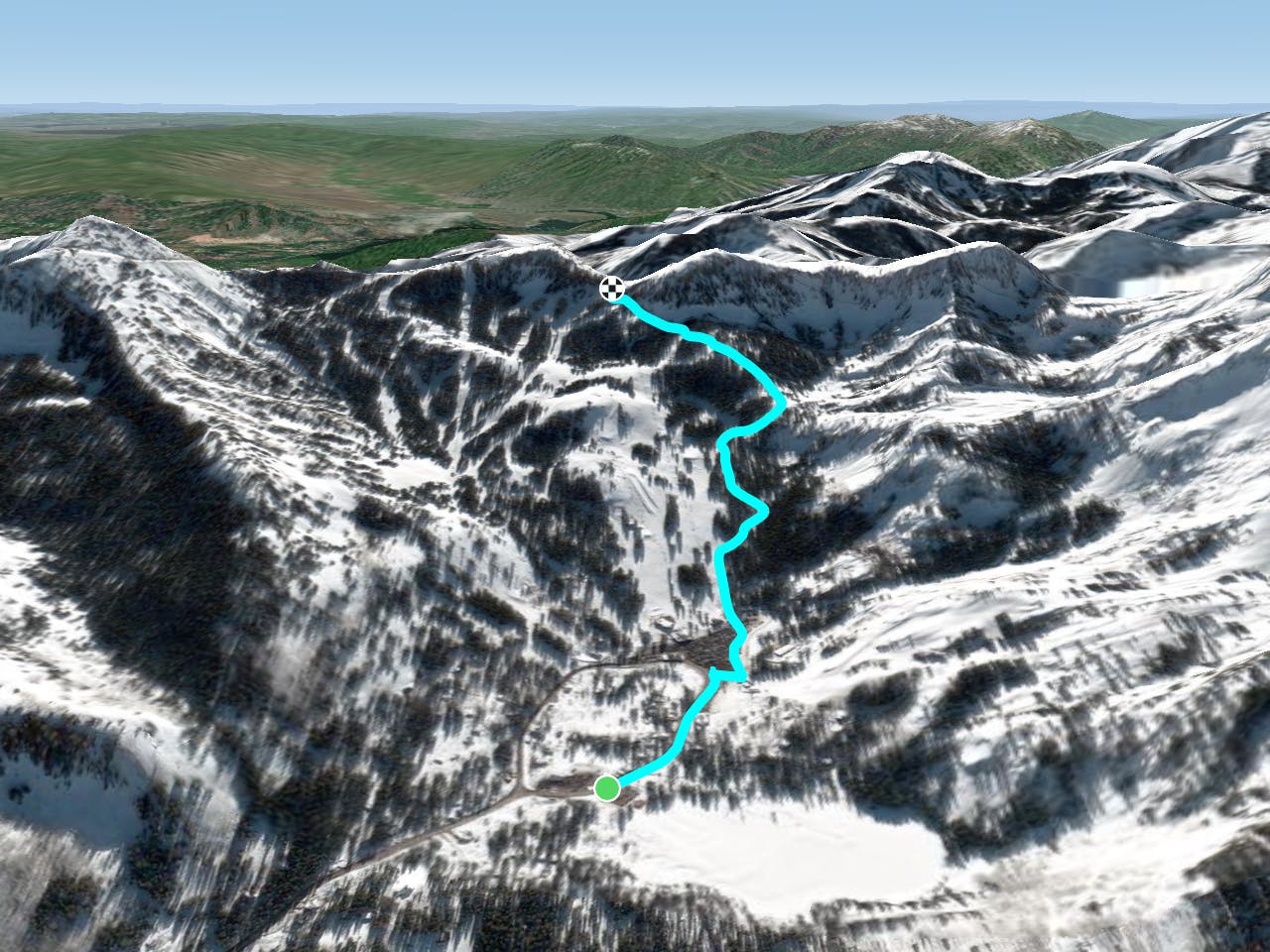
This is the main uphill route at Brighton resort, and it's typically open during operating hours. This allows all-day access to inbounds runs as well as backcountry terrain. Skin up this route to ski from the Crest Express lift, or to exit the resort through the backcountry gate. Pioneer Peak, Sunset Peak, and Catherine Pass are some popular backcountry zones you can reach from there.
The uphill route uses M&M trail to Lost Maid trail, then Wren Hollow and Pacific Highway to the top. According to the resort's website, parking for uphill access is allowed only at the Brighton Store, which is where the route mapped here begins. Note also that all uphill travel is subject to closure by ski patrol based on daily conditions. At the base area, a red/yellow/green light indicates status for the day. You can also check the resort's conditions page for status and more information on the uphill policy.
Moderate

Close to help in case of emergency.
3.9 km away
The typical uphill access at Alta, used for inbounds and backcountry terrain.
Easy Resort Ski Touring
4.9 km away
Early or late season uphill access at Alta, taking Collins Gulch toward Mount Baldy.
Moderate Resort Ski Touring
8.4 km away
The single designated route for skinning at Park City Resort.
Easy Resort Ski Touring

18 routes · Resort Ski Touring · Ski Touring
9 routes · Resort Ski Touring · Ski Touring