2.8 km away
Dresden Face

The Dresden is one of the longest and most continually steep faces in the Wasatch.
Severe Ski Touring
- Distance
- 658 m
- Ascent
- 0 m
- Descent
- 493 m
One of the greatest lines in the Wasatch, the NE Couloir off of Lone Peak is long and steep with beautiful rock lined walls in a remote setting.
Ski Touring Extreme
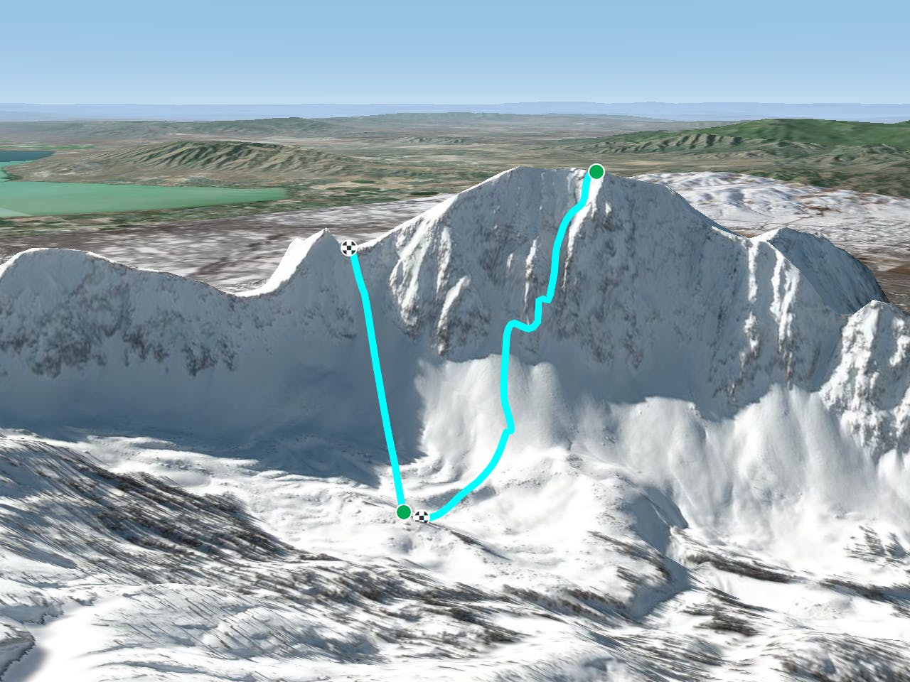
The quickest and "easiest" access if from the town of Alpine. Use your google maps to get yourself to Aspen Drive and park here. Follow the road then the trail until you hit snow and skin up through the open meadows until you hit the wide open slopes that lead to the summit. Follow the ridge to the S summit, then traverse over to the N Summit.
The summit of Lone Peak is a spectacular place to be in the winter. The entire Salt Lake Valley is at your feet. You can't quite ski right off the summit, but damn near it. The run starts steep, near 50 degrees and softens to 45 and parks it there for nearly 1,500 feet. The run is straightforward and straight down until it can cliff out in lean years which seem to be the norm lately. In fact, it hasn't filled in enough to ski cleanly in many years. However, once you get to the cliff you can traverse skiers right to avoid the cliff and get onto the apron.
Extreme
Extreme skiing terrain above 45 degrees. These routes are reserved for experienced experts.

In case of a fall, death is highly likely.

In the high mountains or remote conditions, all individuals must be completely autonomous in every situation.
2.8 km away
The Dresden is one of the longest and most continually steep faces in the Wasatch.
Severe Ski Touring
4.2 km away

Probably the longest, most consistent rock-lined chute in the Wasatch if you're into that sort of thing.
Severe Ski Touring
8.1 km away

Scotty's is a classic north facing roadside attraction in upper Little Cottonwood Canyon.
Difficult Ski Touring
8.5 km away

Stairs Gulch is 4,000 feet long, serious with a combination of a steep, technical chute and a flat, more mellow finish.
Difficult Ski Touring

18 routes · Resort Ski Touring · Ski Touring