2.9 km away
Old Growth / Benson & Hedges

Old Growth chute is a mini classic that provides great rock wall lined ambience and easy access.
Difficult Ski Touring
- Distance
- 580 m
- Ascent
- 0 m
- Descent
- 364 m
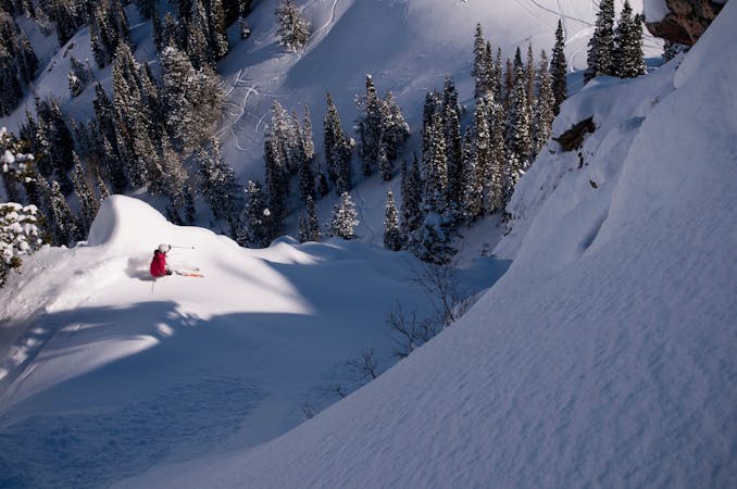
The Lightning Bolt is the boldest and most intriguing line off the infamous Cardiac Ridge.
Ski Touring Extreme

The best way to access the Lightning Bolt is to park at the Our Lady of the Snow church 7.5 miles up Little Cottonwood Canyon. Climb up Pole Line Pass and traverse over, then climb to the Black Knob. From here you can get a great view of the line. Descend and traverse then climb up towards the pass between Mount Superior and Cardiac Ridge and come around from the back side. Climb up to the tallest point on the ridge, and this is where the Lightning Bolt begins.
The upper section is very steep, over 50 degrees and rolls over so you can't see all the way down until you're out on it. This tends to be very rocky since it's steep and the snow in the Wasatch doesn't stick well to rock over 50 degrees. It's a short few turns and then the line dog legs to the left. This section can be very rocky as well and the exposure here is bad with a huge cliff below. Once you've made it through here the apron feels flat, but it's a nice finish to the steep and rocky line behind you.
Extreme
Extreme skiing terrain above 45 degrees. These routes are reserved for experienced experts.

In case of a fall, death is highly likely.

In the high mountains or remote conditions, all individuals must be completely autonomous in every situation.
2.9 km away
Old Growth chute is a mini classic that provides great rock wall lined ambience and easy access.
Difficult Ski Touring
3 km away

Virginia Slims is the fun dogleg chute next to the more popular Old Growth chute in the lower reaches of Cardiff Fork.
Difficult Ski Touring
3.3 km away

A big fun run off of Kessler Peak with some great chute and trees skiing involved.
Difficult Ski Touring
3.7 km away

This is the huge avalanche path that's visible from the road on the N slope of Kessler Peak.
Difficult Ski Touring
3.7 km away

Scotty's is a classic north facing roadside attraction in upper Little Cottonwood Canyon.
Difficult Ski Touring
5.2 km away

Stairs Gulch is 4,000 feet long, serious with a combination of a steep, technical chute and a flat, more mellow finish.
Difficult Ski Touring
6.5 km away

Probably the longest, most consistent rock-lined chute in the Wasatch if you're into that sort of thing.
Severe Ski Touring
7.1 km away

Access from Brighton to backcountry zones like Patsy Marley and Wolverine Cirque.
Moderate Ski Touring
7.9 km away

The Dresden is one of the longest and most continually steep faces in the Wasatch.
Severe Ski Touring
9.4 km away

Major Tom is a steep and sporty couloir in a remote corner of the Wasatch that can have a few rappels to navigate!
Extreme Ski Touring

18 routes · Resort Ski Touring · Ski Touring
9 routes · Resort Ski Touring · Ski Touring