935 m away
Butt Crack

A favorite backcountry zone among locals.
Moderate Freeride Skiing
- Distance
- 651 m
- Ascent
- 1 m
- Descent
- 221 m
The easiest woods trail
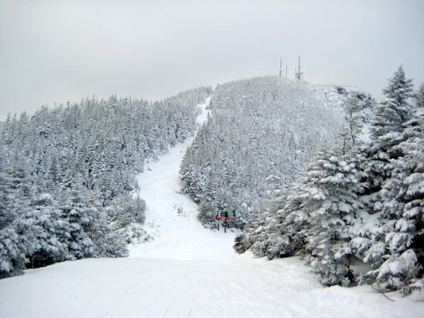
Freeride Skiing Easy

This is a popular freeride skiing route which is generally considered to be easy. It's not remote, it features low exposure (e1) and is typically done between December and March. From a low point of 531 m to the maximum altitude of 545 m, the route covers 132 m, 0 vertical metres of ascent and 14 vertical metres of descent. It's graded 1.1 and Labande grade 1.
Sometimes this "trail" has too much powder it also has a pipe, watch out for the pipe. My friend almost broke his leg on the pipe.
Easy
Wide gentle slopes at around 20 degrees or less.

Exposure is limited to that of the slope itself. Getting hurt is still likely if the slope is steep and/or the snow is hard.
Close to help in case of emergency.
935 m away
A favorite backcountry zone among locals.
Moderate Freeride Skiing
1.1 km away

A short little stash off Cross Cut #2
Moderate Freeride Skiing
1.8 km away

While it may not have any ledges, it does have plenty of room for turns.
Moderate Freeride Skiing
1.8 km away

A low angle trail used to cross from Spruce Peak to Sterling Peak and to access the Back Bowls.
Easy Freeride Skiing
1.9 km away

A popular patch of woods that are always fun to ski.
Moderate Freeride Skiing
1.9 km away

Long, steep glade runs, involving cliffs and chutes.
Severe Freeride Skiing
2 km away

A fun little chute between National and Liftline.
Moderate Freeride Skiing
2.1 km away

One of the most popular hardwood glades in The Notch
Moderate Freeride Skiing
2.2 km away

A frozen riverbed that’s almost as wide as a ski trail.
Moderate Freeride Skiing
2.2 km away

A massive backcountry glade with a number of drop ins
Difficult Freeride Skiing
12 routes · Freeride Skiing