166 m away
Pipeline

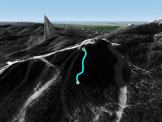
The most relentless inbounds line at Stowe
Severe Freeride Skiing
- Distance
- 218 m
- Ascent
- 0 m
- Descent
- 136 m
really good glades for intermediate skiers to warm up for backcountry
Freeride Skiing Difficult

This is a popular freeride skiing route which is generally considered to be difficult. It's remote, it features low exposure (e1) and is typically done between January and March. From a low point of 943 m to the maximum altitude of 1.1 km, the route covers 330 m, 0 vertical metres of ascent and 118 vertical metres of descent.
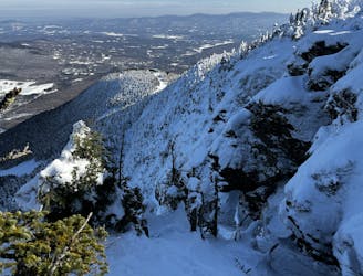
VEER LEFT. Really great, but you have to stay left to avoid the gully out of bounds. Somewhat tight. Pops you out on toll road
Difficult
Serious gradient of 30-38 degrees where a real risk of slipping exists.

Exposure is limited to that of the slope itself. Getting hurt is still likely if the slope is steep and/or the snow is hard.

Away from help but easily accessed.
166 m away
The most relentless inbounds line at Stowe
Severe Freeride Skiing
172 m away
Very similar to Pipeline, with a different access point. Perfect for skiers looking for something tight and steep.
Difficult Freeride Skiing
192 m away

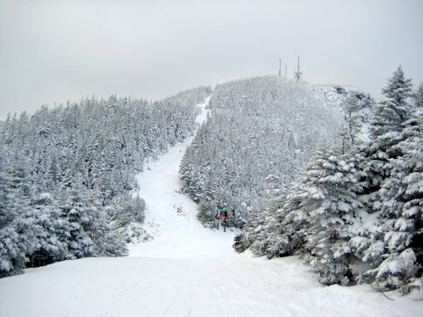
One of the oldest ski trails in the USA and a great run for advanced skiers.
Moderate Freeride Skiing
340 m away

Popular woods between Upper National/Liftline and Starr
Difficult Freeride Skiing
381 m away

A Stowe Classic, Goat Glades is the popular glade to skiers left of Goat.
Moderate Freeride Skiing
407 m away

Steep chutes with trees and cliffs, accessed by a sidestepping traverse.
Difficult Freeride Skiing
435 m away

An expert glade with an interesting history.
Moderate Freeride Skiing
639 m away

The remnants of a classic New England ski trail.
Moderate Freeride Skiing
640 m away
A an exposed, hanging chute that is quite technical.
Severe Freeride Skiing
648 m away

A fun little chute between National and Liftline.
Moderate Freeride Skiing
12 routes · Freeride Skiing