106 m away
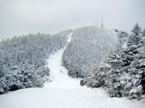
The Bruce Trail

One of the oldest ski trails in the USA and a great run for advanced skiers.
Moderate Freeride Skiing
- Distance
- 5.6 km
- Ascent
- 14 m
- Descent
- 781 m
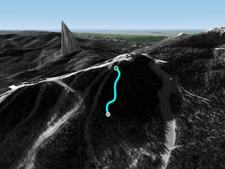
A tight and steep alternative rout.
Freeride Skiing Difficult

This is a popular freeride skiing route which is generally considered to be difficult. It's not remote, it features low exposure (e1) and is typically done between December and March. From a low point of 1 km to the maximum altitude of 1.1 km, the route covers 132 m, 0 vertical metres of ascent and 49 vertical metres of descent. It's graded 4.3 and Labande grade 5.
It's borderline severe. Being, of course, very steep and tight, a skier might have a hard time navigating. Plus, two easy-to-miss jumps might cause an out-of-control person discomfort or injury.
Difficult
Serious gradient of 30-38 degrees where a real risk of slipping exists.

Exposure is limited to that of the slope itself. Getting hurt is still likely if the slope is steep and/or the snow is hard.
Close to help in case of emergency.
106 m away
One of the oldest ski trails in the USA and a great run for advanced skiers.
Moderate Freeride Skiing
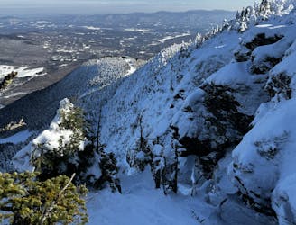
136 m away

Steep chutes with trees and cliffs, accessed by a sidestepping traverse.
Difficult Freeride Skiing
157 m away

The most relentless inbounds line at Stowe
Severe Freeride Skiing
240 m away
Very similar to Pipeline, with a different access point. Perfect for skiers looking for something tight and steep.
Difficult Freeride Skiing
241 m away

A Stowe Classic, Goat Glades is the popular glade to skiers left of Goat.
Moderate Freeride Skiing
407 m away
A an exposed, hanging chute that is quite technical.
Severe Freeride Skiing
409 m away

The remnants of a classic New England ski trail.
Moderate Freeride Skiing
418 m away

A fun little freeride zone in the shadow of The Nose.
Difficult Freeride Skiing
537 m away

An expert glade with an interesting history.
Moderate Freeride Skiing
548 m away

Popular woods between Upper National/Liftline and Starr
Difficult Freeride Skiing
12 routes · Freeride Skiing