19 m away
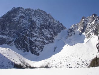
Sherpa Glacier Couloir
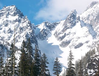
A stunning North facing bowl far away from the crowds
Difficult Ski Touring
- Distance
- 21 km
- Ascent
- 1.7 km
- Descent
- 1.7 km
Just a taste of the beauty of Cannon Mountain
Ski Touring Difficult

Cannon Mountain is one of those places which is stacked with lines on all aspects. Just looking at the maps you can dream up numerous great ski lines and this was one of those trips. Our hopes were to ride one of the stunning North facing chutes thinking it would be powder conditions only to find avalanche scoured ice. When going to climb this route it is important that the avalanche forecast is low as it is a dangerous face.
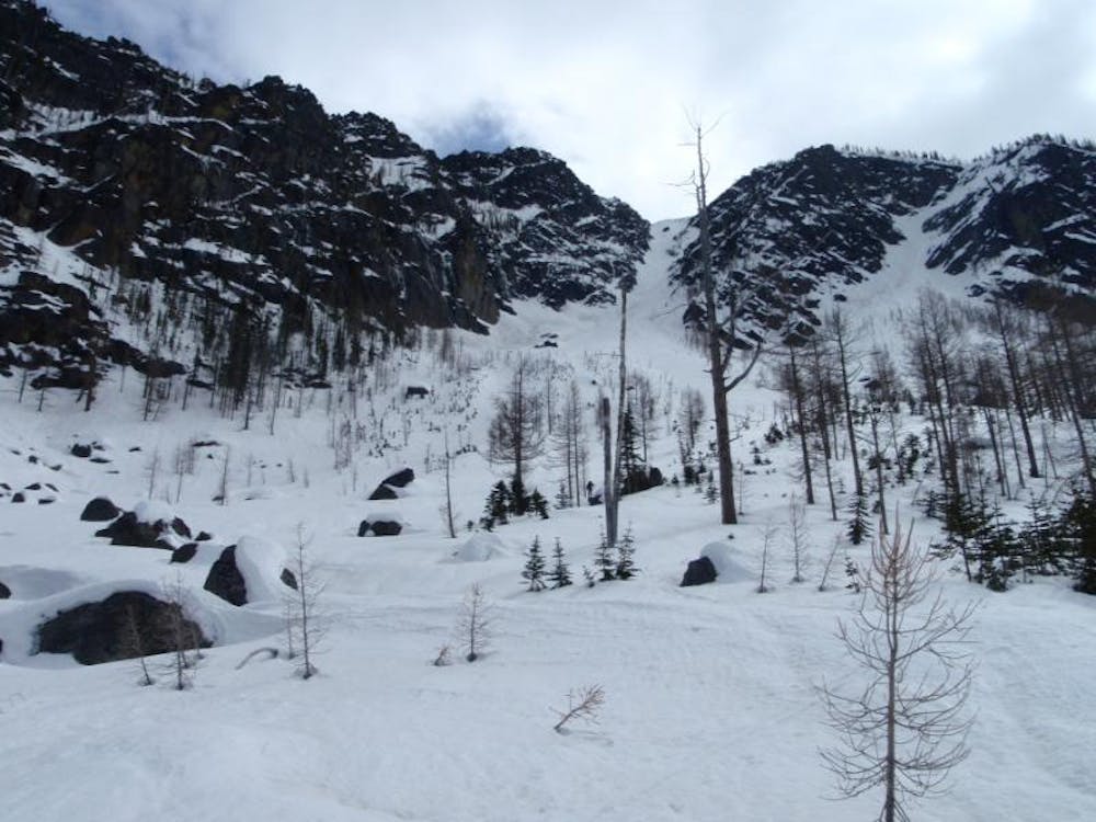
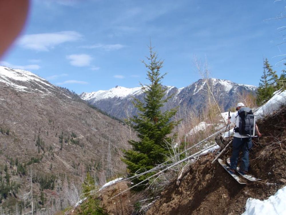
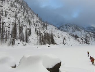
Starting at the Stuart Lake Trailhead (another approach down bottom) if you look close enough you will find an abandoned road on the Northern Slopes heading East. While it is a nasty route to follow it is possible but expect to be thrashing through slide alders with numerous wash outs along the way. Keep following the road until it does a switchback and from there you are directly below the north face of a sub summit of Cannon Mountain. From here on out ditch the road and start skinning directly up the gully before reaching the base of the couloir. From there you can head lookers right and climb up the tree covered ridge all the way to the top of the sub summit. Yet if the snow is soft and stable then you can just directly climb up the chute itself.
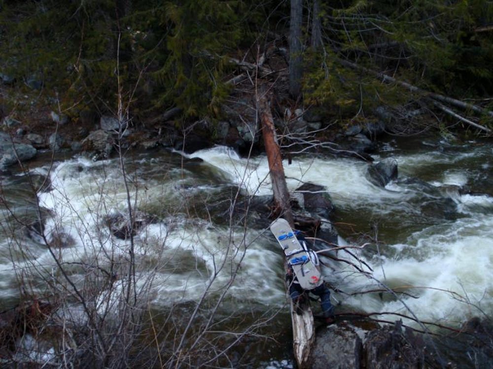
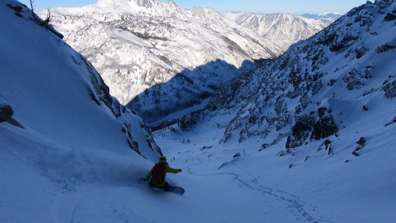
When we were there the snow was terrible so we opted out of riding the main chute and decided to ride back down through the trees in hope of finding good snow. Sticking up on the ridge we made our way all the way down to the valley where we had to find a fallen log to safely cross over Icicle Creek and walk back up to the car.
There is another more direct approach via Bridge Creek Campground as long as it is easy to cross the creek.
To see my trip in the area and more photos check out this link https://www.whereiskylemiller.com/stevens-pass/cannon-mountain/
Difficult
Serious gradient of 30-38 degrees where a real risk of slipping exists.

As well as the slope itself, there are some obstacles (such as rock outcrops) which could aggravate injury.

Little chance of being seen or helped in case of an accident.
19 m away
A stunning North facing bowl far away from the crowds
Difficult Ski Touring
222 m away
The epicentre of Backcountry skiing on the Eastern Side of the Cascades
Difficult Ski Touring
4.1 km away
A stunning North Facing Ridge with numerous options for ski descents
Difficult Ski Touring
5 routes · Ski Touring