4 km away
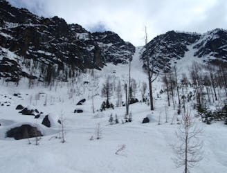
Sherpa Glacier Couloir
A stunning North facing bowl far away from the crowds
Difficult Ski Touring
- Distance
- 21 km
- Ascent
- 1.7 km
- Descent
- 1.7 km
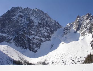
A stunning North Facing Ridge with numerous options for ski descents
Ski Touring Difficult

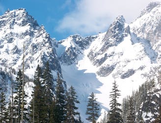
The Eightmile Lake area holds a stunning north facing ridge with numerous options for ski descents. Even though it is in a popular area this zone rarely sees any traffic. With places like Dragontail Peak seeing many groups a day this area may see a handful of people all season even though the approach is similar and the lines are perfect fall line. The trick with this zone is that you need to get out there before the lake melts out if you show up later in the season expect a much more challenging approach. Like so many routes in the area don’t do this trip if the avalanche danger is high as you will be climbing an avalanche path. It is remote enough that you must be self sufficient so make sure to play it smart and if your gut is telling you to turn around make sure to listen to it.
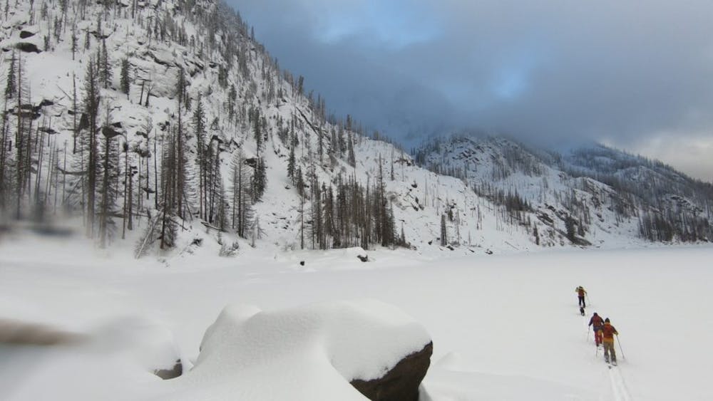
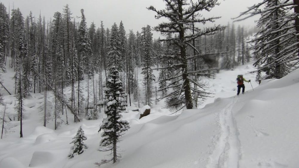

Starting at Icicle Creek Campground start making the long journey East up Mountaineers Creek road. After a bend in the valley keep continuing on the road until you reach Eigmile creek valley on the right which is just before Mountaineers Creek Parking lot. With a deep snowpack head up just lookers right of the creek while during the summer there is a trail but don’t expect to be able to spot it. Soon enough you will reach the southern shores of Eightmile Lake which makes for a great camping spot and base of operations.
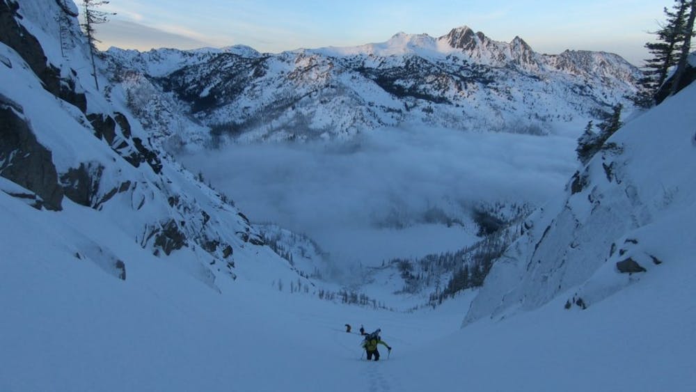
Making your way halfway across the lake head south to the first main gully which is visible from the lake. Starting at just below 4,700 feet start climbing the north facing slope but be careful as this is a huge slide path so it is best to limit exposure and minimilize skinning above your partners. For the most part you can skin the route until the last 200 hundred feet where bootpacking is the best option. Once on top take in the view of Dragontail peak to your Southwest before riding fall line back to the lake.
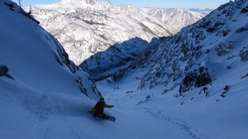
Once you’ve had a good break it is time to do the next gully to the west. This line is a bit steeper and more challenging for climbing but well worth the effort. Starting at the West end of the lake start climbing through the trees before heading into the open gut of the line. Like the previous route you will probably have to bootpack the last 400 feet but the view of Mount Stuart alone makes it worth it. Once you’re ready just descend once again fall line into the valley and prepare for the long exit back to the car.
Now just retrace your skin tack back to the road and if you are a snowboarder you can only ride down the final section of the road. Yeah it is a brutal approach and exit but in my opinion the lines make it worth it.
To see my trip in the area and more photos check out this link https://www.whereiskylemiller.com/stevens-pass/eightmile-lake/
Difficult
Serious gradient of 30-38 degrees where a real risk of slipping exists.

As well as the slope itself, there are some obstacles (such as rock outcrops) which could aggravate injury.

Little chance of being seen or helped in case of an accident.
4 km away
A stunning North facing bowl far away from the crowds
Difficult Ski Touring
4.1 km away
Just a taste of the beauty of Cannon Mountain
Difficult Ski Touring
4.3 km away
The epicentre of Backcountry skiing on the Eastern Side of the Cascades
Difficult Ski Touring
5 routes · Ski Touring