19 m away
Cannon Mountain
Just a taste of the beauty of Cannon Mountain
Difficult Ski Touring
- Distance
- 11 km
- Ascent
- 1.6 km
- Descent
- 1.6 km
A stunning North facing bowl far away from the crowds
Ski Touring Difficult

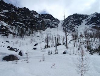
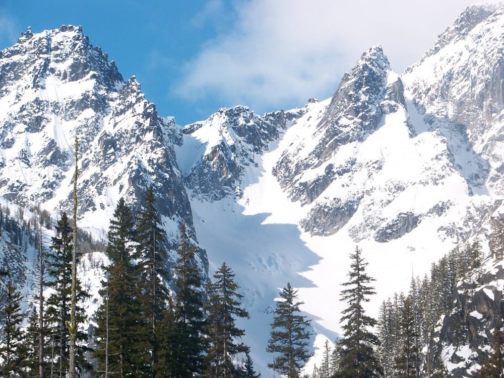
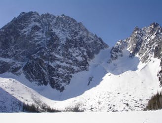
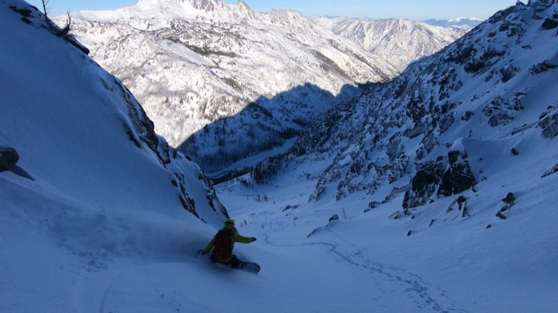
The Sherpa Glacier Couloir is one of those lines that is just beyond reach from your standard ski touring crowd. Most groups heading into the area are focused on the Colchuck Lake area but with a bit more effort that just means you have the place to yourself. This tour is all about timing as you want to get in just after the Mountaineers Creek road is open but still want to have snow while heading up the valley. Terrain wise this is a beautiful 3,000 foot line with the top 800 feet being a semi tight couloir before opening up to a massive bowl below. Being that the approach is surrounded by big mountains it is not complicated to get to, the hard part is the ascent.
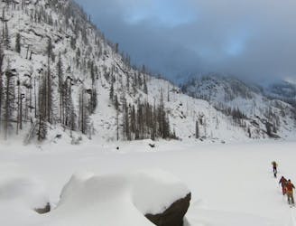
Leaving the Mountaineers Creek trailhead make your way South on the Stuart Lake trail. Before long the valley will start heading Southwest and will pass by the Colchuck Lake trail but make sure not to go on it. Soon enough the Valley will split into a Y with the trail still going west but you need to start heading South. From my memory crossing Mountaineers creek was quite easy and once on the Southern branch stay on the lookers right side. Follow the valley floor up the main creek and before long it will wrap west into a small basin divided by the Northeast ridge of Sherpa Peak.
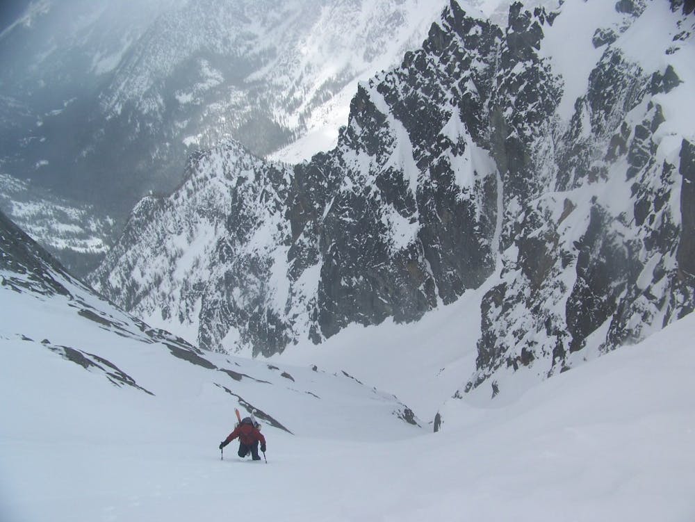
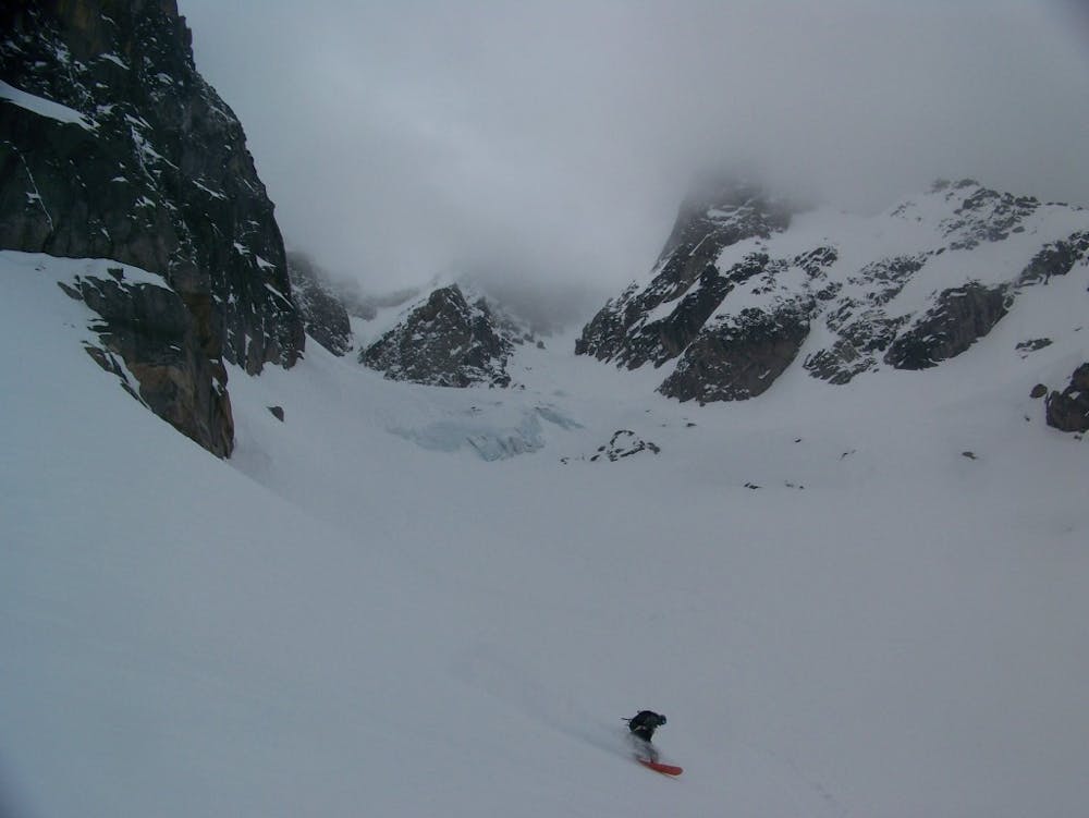
If you followed the route correctly you should be at the base of the Sherpa Glacier with your ascent route directly south of you. Start off skinning as you gain elevation all the way to the base of the couloir. Soon enough you will have to switch over to cramponing until gaining the ridge and being on top of your line. If you want to add some extra vert you can climb to the false summit of Mount Stuart.
The descent is perfect fall line all the way into the valley before following your skin track back to the car. The moment you are back in the basin you will have to skin as it is flat terrain but at least things should go relatively fast as you had set in the trail earlier. We did this route in Early May as a day trip but it would be a little bit less hectic if done as an overnight trip.
To see my trip in the area and more photos check out this link https://www.whereiskylemiller.com/stevens-pass/sherpa-glacier-mount-stuart/
Difficult
Serious gradient of 30-38 degrees where a real risk of slipping exists.

As well as the slope itself, there are some obstacles (such as rock outcrops) which could aggravate injury.

Little chance of being seen or helped in case of an accident.
19 m away
Just a taste of the beauty of Cannon Mountain
Difficult Ski Touring
241 m away
The epicentre of Backcountry skiing on the Eastern Side of the Cascades
Difficult Ski Touring
4 km away
A stunning North Facing Ridge with numerous options for ski descents
Difficult Ski Touring
5 routes · Ski Touring