222 m away
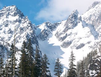
Cannon Mountain
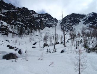
Just a taste of the beauty of Cannon Mountain
Difficult Ski Touring
- Distance
- 11 km
- Ascent
- 1.6 km
- Descent
- 1.6 km
The epicentre of Backcountry skiing on the Eastern Side of the Cascades
Ski Touring Difficult

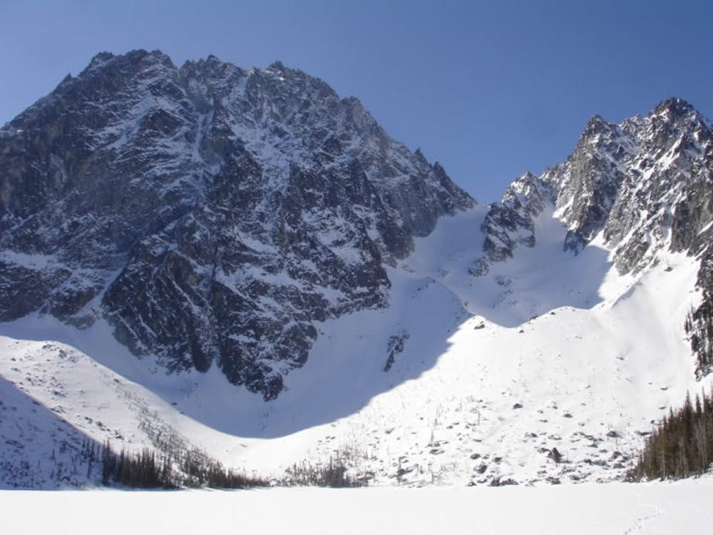
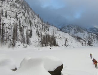
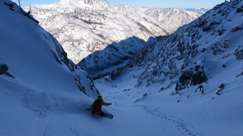
From what I’ve heard recently the Colchuck Lake area is possibly the most popular area on the Eastern Side of the Cascades. It is easy to see why with stunning scenery and a huge North facing Basin. Looking directly South across the lake Dragontail peak rises 3,000 feet being a massive rock wall with two nice cols on both the Eastern and Western sides. For most people looking at the summit you would never think that making it to the summit is possible but never judge a book by its cover. What you can’t see it that there is a nice and semi mellow chute on its Southwest side that makes it all the way to the summit ridge. Below is how to make this happen and enjoy yet another stunning view within the Cascades.
By late Spring the Mountaineers Creek road should be drivable all the way to the Stuart Lake trailhead. Leaving here follow the trail heading lookers right of Mountaineers creek as the valley goes from Southwest to West. Before long you will spot the Colchuck Lake trail on the lookers left side and make sure to stay on it. Fortunately there is a bridge crossing over the creek and from there stay on the trail as it gains elevation all the way to Colchuck Lake.
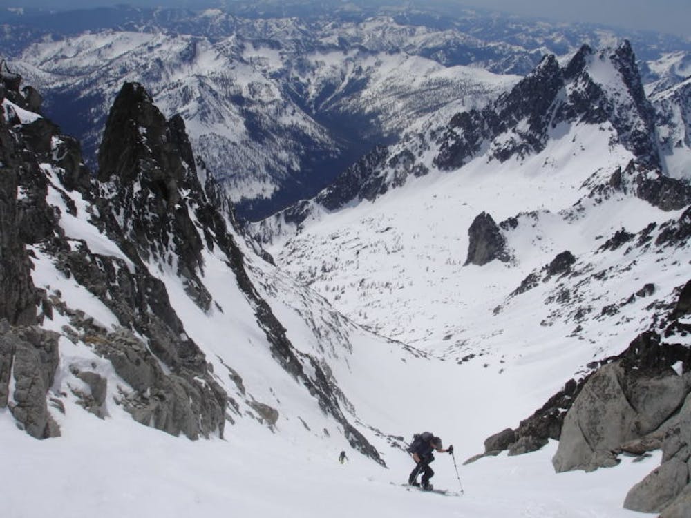
Always cross Colchuck Lake with caution and if you have any fear of the ice holding just follow the Western shoreline. Before long you need to start climbing up the basin just Northwest of Dragontail Peak where the remnants of the Colchuck Glacier remains. Before long there will be a rock wall the divides the slopes and you need to go lookers left to access the col. Once there drop a few feet and start traversing East to get to the base of the Dragontails Southwestern chute. If conditions are firm put on your crampons and climb the final 800 feet to the summit ridge. From here you can easily make it to the top but by no means is it necessary.
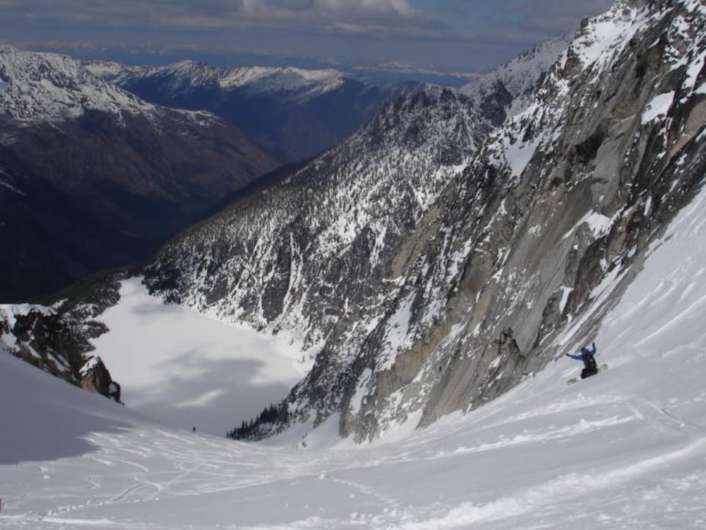
Standing on top it is time to start your descent by riding back down what you had climbed. Riding the Southwest chute you can just traverse back over to the col or ride to the semi flatter slopes before climbing back over the col. Standing on top of the north facing bowl it is a nice and mellow ramp heading all the way back down to Colchuck Lake where you need to skin across via the shore if you want to do it safely. Standing on top of the Colchuck Lake Trail you have two options A You can just follow the trail or B in which you can go through the trees hoping for the best. I would recommend just going with option A as I’ve done B and vowed never to do it again. Once in the valley start skinning again and cross the river via the bridge and soon enough you will be back at the parking lot.
To see my trip in the area and more photos check out this link https://www.whereiskylemiller.com/stevens-pass/dragontail-peak/
Difficult
Serious gradient of 30-38 degrees where a real risk of slipping exists.

As well as the slope itself, there are some obstacles (such as rock outcrops) which could aggravate injury.

Little chance of being seen or helped in case of an accident.
222 m away
Just a taste of the beauty of Cannon Mountain
Difficult Ski Touring
241 m away
A stunning North facing bowl far away from the crowds
Difficult Ski Touring
4.3 km away
A stunning North Facing Ridge with numerous options for ski descents
Difficult Ski Touring
5 routes · Ski Touring