1.8 km away
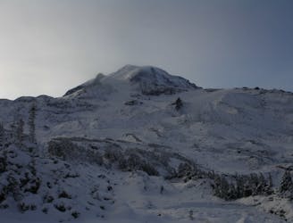
Mount Pleasant and Fay Peak
A midwinter basecamp trip into the Mowich Lake Zone during the
Difficult Ski Touring
- Distance
- 25 km
- Ascent
- 1.4 km
- Descent
- 1.4 km
Making the most out of a low snow year getting into the Northwest side of Mount Rainier
Ski Touring Difficult

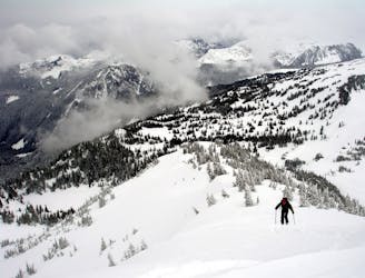
Yes you read this correctly this was the time we made it out to the Flett Glacier Headwall mid winter but this tour can also be done the moment the Mowich Lake Road opens. For us it was a low snow year starting at the Mowich lake gate making our way up the road until arriving at the Outflow of Mowich lake before skinning up the Knapsack Pass Trail into the alpine section. From there we climbed up and over Knapsack Pass and rode down to Mist Park. Heading south towards Pleasant Peak make sure to give a bit of space between you and the steep Eastern Slopes of Fay Peak. Once on the bottom of Pleasant Peak make a mellow traverse Southeast to the ridge before climbing up to the summit of Peasant where we camped for the night after taking a quick lap of the Northeast bowl.
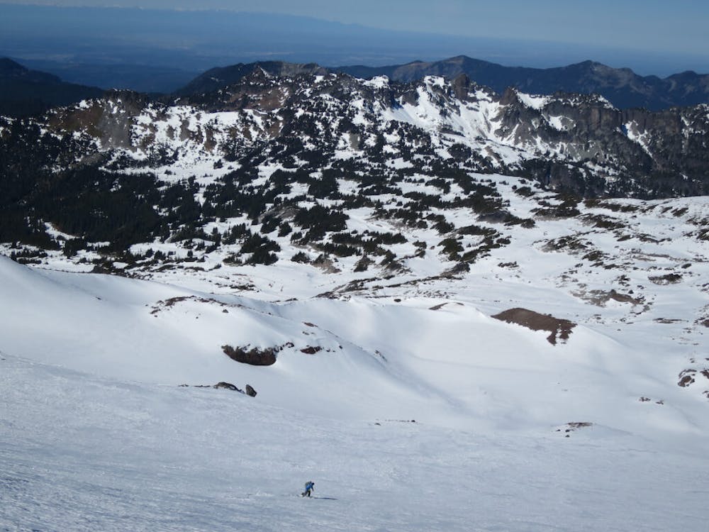
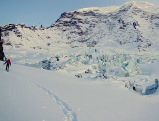
Once it is time to head towards the Flett Glacier Headwall drop into Spray Park making a slow traverse skiers left to keep elevation before arriving at the flats. Putting on the skins start heading South following the lower basin for a ways than start gaining elevation towards Echo Peak. Soon enough you will be at the base of the Flett Glacier where you should climb the mellow slopes until it arrives on a small ridge separating the Flett and Russel Glaciers. Start heading southwest wrapping around to the southern slopes of Observation rock then make your way up mellow slopes to the summit.
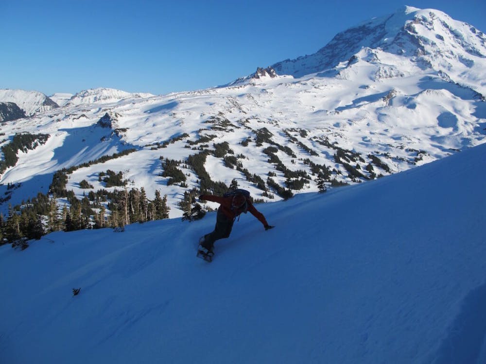
Standing on top of Observation rock you will have a great view of the Puget Sound Basin all the way to the Olympic Mountains. Directly underneath you will be the Flett Glacier Headwall. When we were there we this section was wind scoured so we decided to drop a little bit northwest before dropping into the main gully. While riding down make sure to slowly head skiers right if you want to exit via Knapsack Pass. Once in the flats make your way up to the ridge just East of Pleasant Peak before descending into Mist Park and making your way up and over Knapsack Pass.
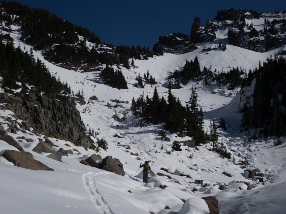
The trick with descending west from Knapsack Pass is to keep your speed while in the basin. Once just above Mowich Lake head skiers left of the main gully which will take you through semi dense trees al the way to the Lake. If you feel confident with the ice situation skin near the shores but if not make sure just to stay on the shoreline wrapping around to the Mowich Lake Road. From here just follow the road up to the col and you can ride directly down past the first switchback before gaining said road again. From here it is pretty flat so just follow the road all the way back down to where the car is parked.
To see my trip in the area and more photos check out this link https://www.whereiskylemiller.com/mt-rainier/mount-pleasant/
Difficult
Serious gradient of 30-38 degrees where a real risk of slipping exists.

As well as the slope itself, there are some obstacles (such as rock outcrops) which could aggravate injury.

Little chance of being seen or helped in case of an accident.
1.8 km away
A midwinter basecamp trip into the Mowich Lake Zone during the
Difficult Ski Touring
3.3 km away
Another option for early season powder conditions
Easy Ski Touring
6.7 km away
A mid-winter traverse on the North Side of Mount Rainier
Difficult Ski Touring
6.7 km away
Crossing the northern portion of Mount Rainier National Park
Difficult Ski Touring

11 routes · Ski Touring