45 m away
Riding Curtis Ridge and the 3rd Burrough
Crossing the northern portion of Mount Rainier National Park
Difficult Ski Touring
- Distance
- 43 km
- Ascent
- 3.3 km
- Descent
- 2.6 km
A mid-winter traverse on the North Side of Mount Rainier
Ski Touring Difficult

The Osceola Traverse was one of if if not my favourite traverses within the Cascade Mountains of Washington. Although you won’t be in the North Cascades the views of Mount Rainier alone more than make up for it. This route traverses from the Carbon River Trailhead all the way to the White River Campground. Being a snowboarder I wanted to make the most of my home mountain and instead of sidehilling the whole time so I came up with a route that offered big descents but with that big climbs as well. This is an incredibly dangerous traverse mid winter because of both Isolation and massive avalanche potential. The reason we felt comfortable with it was that there was a massive rain event followed by a small storm starting as rain and transitioning to snow so the snow had bonded well before the sun came out for 3 days. While I would only recommend this route in powder if you had these same exact conditions it would be quite a bit easier in corn snow during the Spring but that adds way more crevasse dangers. Now sit back and grab a cup of coffee because this description is going to be long.
Starting at the Carbon River make your way up the Boundary Trail before it switches to the Florence Peak trail gaining elevation up the ridge. Once on the high point descend the southern slopes until in the upper basin before heading west over to Alki Crest making your way all the way up to Howard Peak. From there descend down the ridge and start going up the semi mellow slopes south towards Tolmie Ridge. We did a quick side trip over to the lookout but it is not necessary as you want to ski through the southern trees down to Eunice Lake.
Once on Eunice lake head southeast towards where the summer trail is and start riding down some of the best open glades around before hitting the Mowich lake Road. The first section of the route is not necessary but a great way to start the trip if the snowpack allows. Head up the Mowich Lake road going up and over the pass before heading down to the outflow of said lake where we decided to camp for the first night. From here on out since you will be in the alpine most of the time it is vital that you have clear weather.
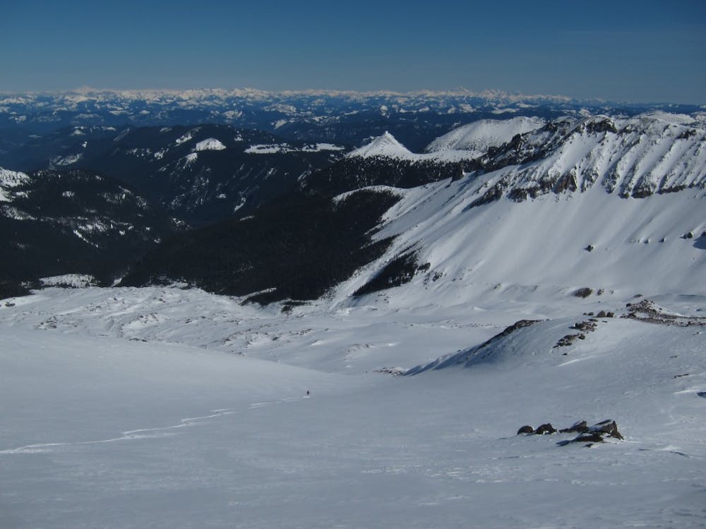
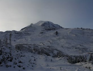
Make your way across Mowich Lake heading East towards Knapsack Pass where you should join the trail for the first section until arriving in the upper basin. Heading over Knapsack pass is straightforward before descending down to Mist Park and doing a low and flat traverse south making sure to give space between you and the east slopes of Fay Peak. With a low traverse make your way over Pleasant Peaks east ridge and descend down to Spray park. From here start slowly gaining elevation making your way towards the low col between Echo and Observation rocks. Now start heading southwest on the ridge before it wraps directly south and keep going until you are standing on top of the Russel Glacier.
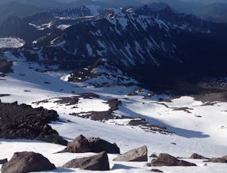
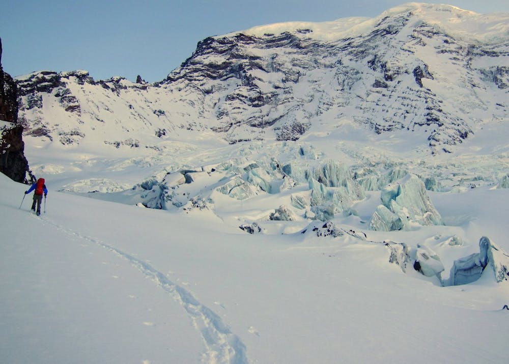
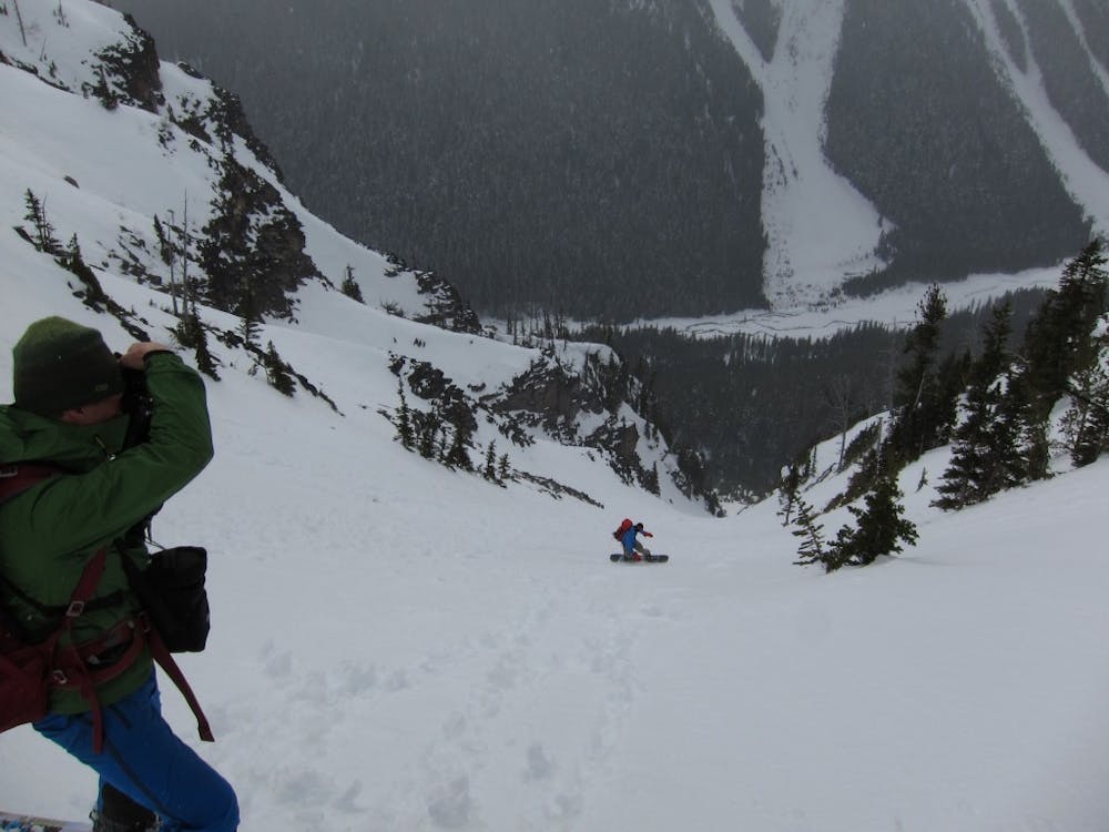
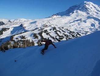
Looking to the Northeast you will have a massive open slope that goes all the way down to the Carbon Glacier but don’t let your guard down. You need to be careful as there are some steep faces and cliffs that you need to be cautious of. Drop in slowly making your way skiers right. If all went according to plan the lower slope is steep but totally ridable until arriving on the upper area of the Carbon Glacier. From here just make your way East doing what you can to not get swallowed by a crevasse. We were here in the heart of winter and felt okay with said danger but if during the spring it would be smart to rope up. Soon enough you will be on the Northwest ridge of Curtis Ridge where we descended a few hundred feet and set up camp for the night.
After waking up and taking in the sunrise make your way up the slopes until arriving at a flat sub summit of Curtis Ridge and prepare for your descent. Looking to the Northeast there is a beautiful ramp leading all the way down to the Winthrop Glacier. Ride down fall line until on the Western side of the glacier and once you have a chance it is time to make a hard right all the way to the eastern side making your way all the way down to the toe of the Glacier where you will join the Wonderland trail.
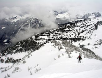
The next section can be confusing but start heading up just lookers right of Granite Creek attempting to follow the snow covered trail. Once the trail crosses the creek just keep climbing up the basin and once in the alpine make your way southeast towards the summit of the Second Burroughs Mountain. Standing up top drop into the north facing slope and once down on the flats it is time to transition again. Heading East make your way over to Frozen lake before climbing the north ridge of the First Burroughs all the way to its summit. Drop into the Eastern slopes and once in the flats start making your way East towards the Sunrise visitor center where we set up our final camp of the trip.
Waking up early in the morning we went out to Dege Peak where we rode the Northeast face before heading back to Sunrise and packed our gear up. The last descent of this traverse is one of those lines where you don’t want to make a mistake with. Head over to the middle of the parking lot and start heading south. Before long you will be at a point where the slopes roll over with a south facing chute that goes all the way into the valley. Being that it was midwinter we were sure that it had a thick snowpack but if it was spring I would just take the trail down instead. Dropping in the line was steep and open before hitting the lower trees where we connected with the Wonderland trail descending all the way to the White River where we had a snowmobile waiting for us to get back to Crystal Mountain Boulevard.
Now I hope you understand why this is such a great traverse on Mount Rainier.
To see my trip in the area and more photos check out this link https://www.whereiskylemiller.com/mt-rainier/osceola-traverse/
Difficult
Serious gradient of 30-38 degrees where a real risk of slipping exists.

As well as the slope itself, there are some obstacles (such as rock outcrops) which could aggravate injury.

Little chance of being seen or helped in case of an accident.
45 m away
Crossing the northern portion of Mount Rainier National Park
Difficult Ski Touring
6.7 km away
Making the most out of a low snow year getting into the Northwest side of Mount Rainier
Difficult Ski Touring
6.9 km away
A midwinter basecamp trip into the Mowich Lake Zone during the
Difficult Ski Touring
8 km away
Another option for early season powder conditions
Easy Ski Touring

11 routes · Ski Touring