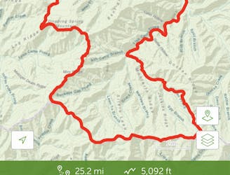
Appalachian Trail: Davenport Gap to Hot Springs
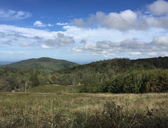
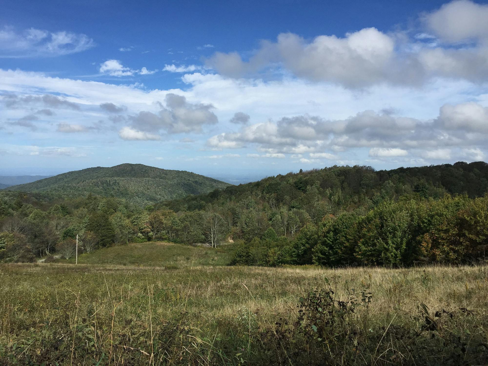
The trek to Max Patch Mountain, a bald, grassy summit with 360° views of the Blue Ridge Mountains.
Moderate Hiking
- Distance
- 54 km
- Ascent
- 2.8 km
- Descent
- 2.9 km
Go hiking in Tennessee with curated guides of the best hikes across the region. With over 38 3D trail maps in FATMAP, you can easily discover and navigate the best trails in Tennessee.
No matter what your next adventure has in store, you can find a guide on FATMAP to help you plan your next epic trip.
Get a top hiking trail recommendation in Tennessee from one of our 11 guidebooks, or get inspired by the 38 local adventures uploaded by the FATMAP community. Start exploring now!
The trek to Max Patch Mountain, a bald, grassy summit with 360° views of the Blue Ridge Mountains.
Moderate Hiking
The second half of the Great Smoky Mountains National Park.
Difficult Hiking

The approach to Clingmans Dome, the highest point in the Great Smoky Mountains National Park.
Difficult Hiking
A shorter AT segment best known for its summit of Big Bald.
Difficult Hiking

A tough but incredibly beautiful hike.
Severe Hiking

A mellow walk into Great Smokey Mountains National Park.
Easy Hiking

Loop traversing through lush creek valleys and across sandstone bluffs overlooking the gorge.
Easy Hiking

A 6 day hikje from Elkmont to Leconte via Clingman's Dome, Andrew's Bald, Smokemont, and Charlie's Bunion
Severe Hiking

A scenic hike into and out of the gorge with great views and camping
Moderate Hiking

A beautiful and well-maintained 5.2 mile trek through heavily wooded area in south Nashville which is used for hiking and trail running.
Moderate Hiking
Views from some of the Appalachian mtns highest peaks on this moderate/difficult loop.
Difficult Hiking
Little River Trail/Goshen Prong Trail/Appalacian Trail/ Miry Ridge Trail/Jakes CreekTrail
Difficult Hiking