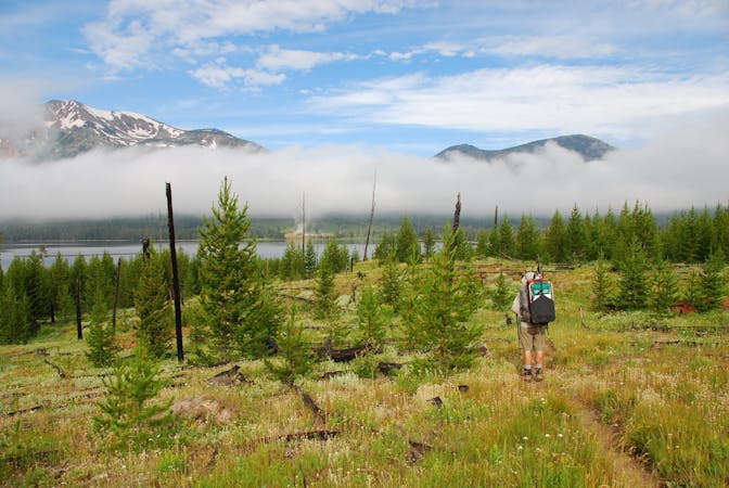
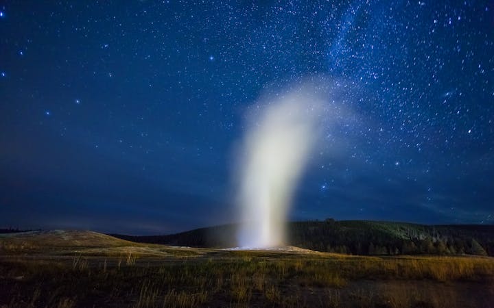
CDT: Lewis Lake (US-191) to Targhee Pass (US-20)
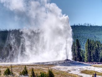
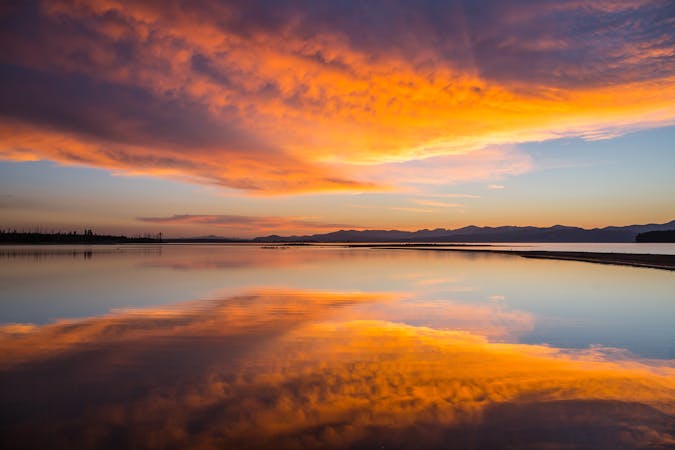
The CDT's passage through the southwest corner of Yellowstone National Park, including the stunning Old Faithful Geyser.
Difficult Hiking
- Distance
- 124 km
- Ascent
- 1.9 km
- Descent
- 2.1 km
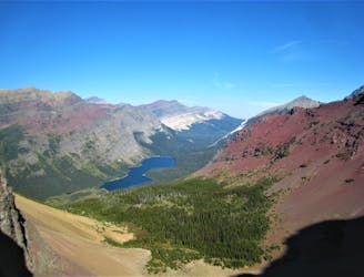
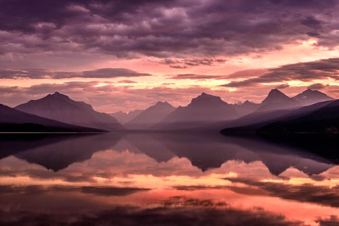
Explore Yellowstone and Glacier National Park and traverse some of the wildest and most expansive wilderness areas in the lower 48 on the CDT in Montana and Idaho.
Hiking Moderate, Difficult, Severe
Also in Alberta, Canada • Idaho, United States of America • Montana, United States of America
Rounding out a 3,100-mile journey, the Continental Divide Trail continues its way north of Wyoming into the rugged, wild, and most mountainous corners of Idaho and Montana. Rather than choosing one state over the other as the trail has done thus far, the CDT follows the ID/MT border along the Continental Divide, where the states officially earned their boundaries. Whether you’re out for a day hike or planning a thru-hike or section-hike, this guidebook breaks down the northernmost segment of the CDT, a trail that helps form North America’s Triple Crown of Hiking.
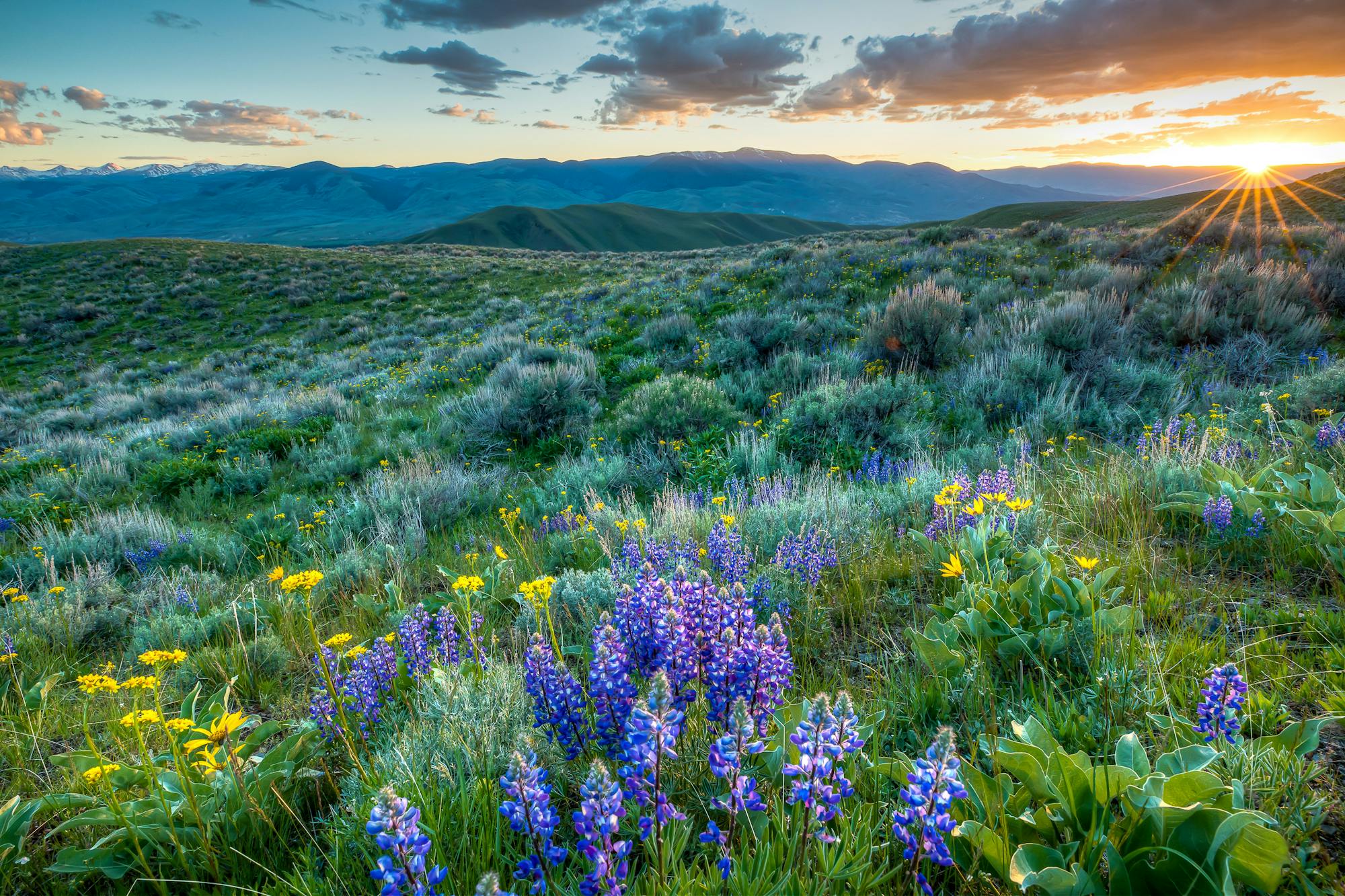
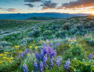
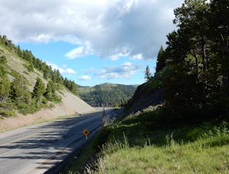
When it comes to hiking the CDT through Idaho and Montana, it’s worth noting how incredibly scenic – yet remote - much of the trail can be. In fact, there are numerous disagreements about the exact route the trail follows, especially as you get further north. Wildfires, weather, and land ownership all play their part. The trail also traverses some of North America’s most vast wilderness areas, such as the massive Bob Marshall Wilderness Complex, a multi-million-acre plot in the heart of Montana. In fact, the CDT Coalition even notes the megafauna such as grizzly bears and wolves that thrive throughout a region lined with 1,000-foot-high rock escarpments just off the trail. As such, bear-proof canisters and bear spray are a must for hikers.
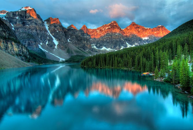
Highlights of the trail include Glacier National Park and numerous Gateway Communities along the way. Anaconda, Lincoln, Helena, and the greater Lemhi County all offer welcoming amenities to hikers and the chance to resupply. That said, thru-hikers making their way north to Canada must be mindful of timing, as winter weather can hit many of the mountaintops as early as September. By October and November, most portions of the trail will be covered in snow.
When it comes to completing the trail, you have several options to choose from. The traditional finish is to hike to the Border Monument and finish your life-changing trip off with a 4-mile hike into Canada. That, however, requires extra planning since a passport is needed for both hikers and the vehicle that plans to pick them up. As an alternative, the Chief Mountain Teriminus sits just within the US boundary and eliminates most of those worries. The route also follows lower elevations that tend to be free of snow when the Waterton Route is unpassable. Of course, a road walk is always an option as well, though it's less scenic and exciting than most would prefer.
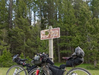
Of the other need-to-know items, dogs are allowed on most parts of the CDT, but they are prohibited within Glacier National Park. Water is usually abundant here, and waist-deep river crossings are not out of the question at times. Snow, wildfires, and other trail closures are all variables to be aware of if you’re hiking north, and massive changes in elevation can yield summer thunderstorms atop the highest peaks or snow, depending on the time of year. Even so, the Montana and Idaho sections of the CDT yield some of the best views and most remote terrain the trail has to offer, so don’t hesitate to plan a section hike or day hike along any of these segments.
Sources: CDT Coalition
The CDT's passage through the southwest corner of Yellowstone National Park, including the stunning Old Faithful Geyser.
Difficult Hiking
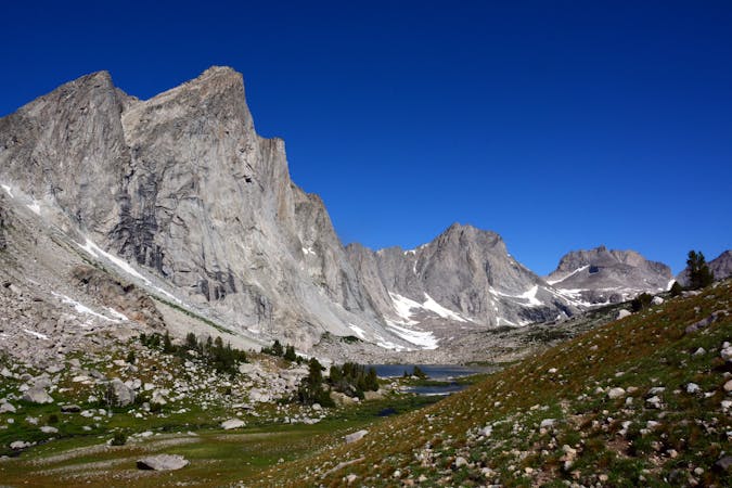
A rugged traverse through the remote Centennial Mountains, an ecologically significant area connecting Yellowstone to the greater Rocky Mountains.
Difficult Hiking
A scenic and rugged passage along the Red Conglomerate Peaks and through the Eighteen Mile WSA.
Difficult Hiking
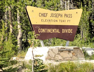
A scenic and demanding ridgeline traverse through the heart of Idaho's Beaverhead Mountains.
Difficult Hiking
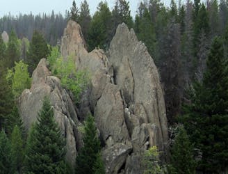
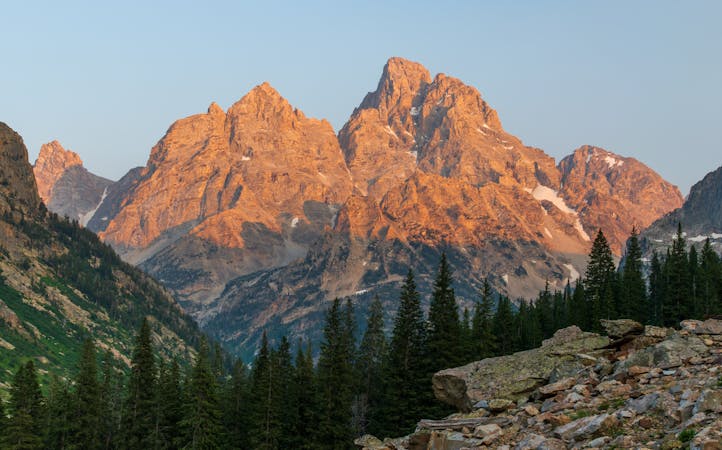
The trek through the Anaconda Pintler Wilderness Area, a jewel of the Northern Rockies.
Difficult Hiking
Explore the remote Mount Haggin WMA then enjoy convenient access to and from Butte, MT, on this section of the CDT.
Difficult Hiking
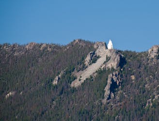
A 100-mile passage north through the heart of the Butte-Jefferson Ranger District, with an option to visit Our Lady of the Rockies statue overlooking Butte.
Difficult Hiking
A remote segment of the CDT known for its views from the Granite Mountain Lookout Tower.
Difficult Hiking
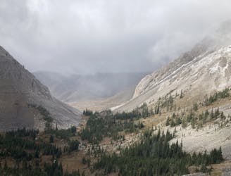
A scenic and especially remote traverse through wild Montana wilderness ending at the Benchmark Wilderness Ranch.
Severe Hiking
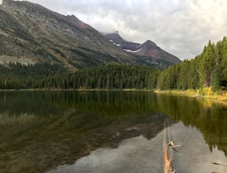
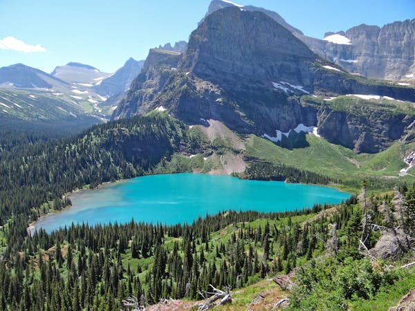
The gateway into Glacier National Park as you near the finale of the 3,100-mile CDT.
Difficult Hiking
An alternate way to complete the CDT when snow or logistics into Canada are problematic.
Moderate Hiking
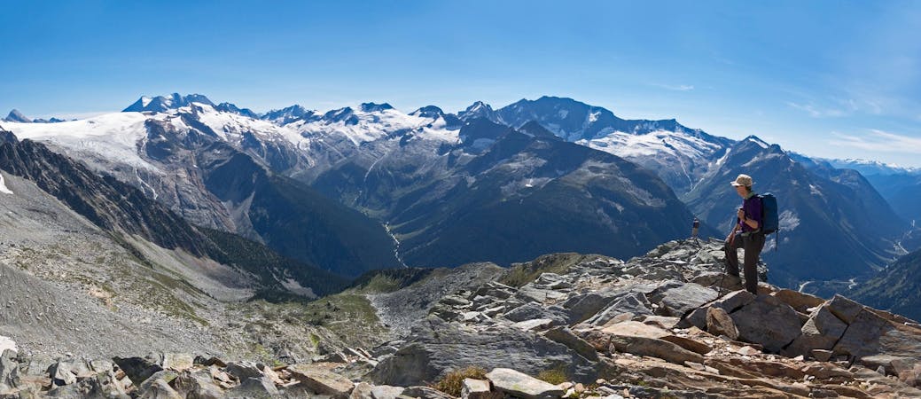
One of the most remote and wild areas of the CDT as you traverse the 3rd largest designated wilderness in the lower 48.
Severe Hiking
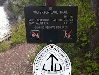
A classic finish to the CDT that ends at Waterton Park in Canada.
Moderate Hiking
7 routes · Hiking
5 routes · Hiking · Trail Running
11 routes · Hiking
5 routes · Hiking
5 routes · Hiking · Trail Running
5 routes · Hiking · Trail Running
8 routes · Hiking
6 routes · Hiking

25 routes · Alpine Climbing · Hiking
7 routes · Hiking