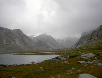
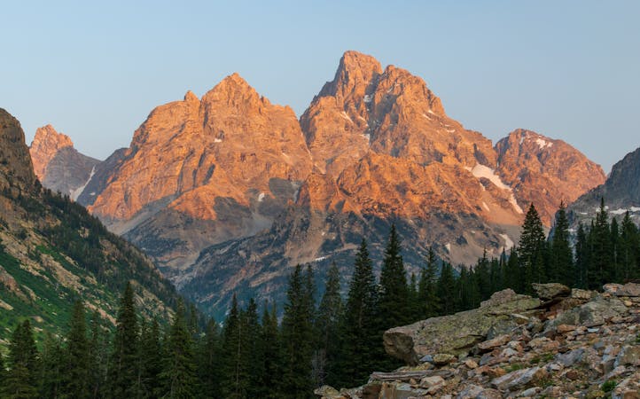
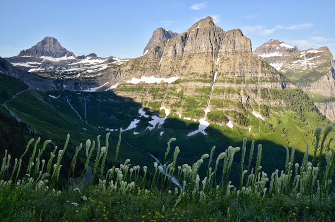
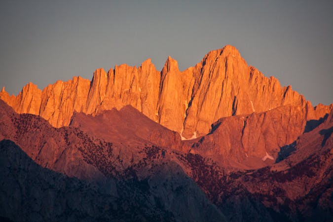
Cirque of the Towers
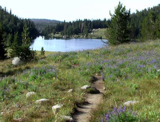
High alpine basin rimmed by huge granite spires in Wyoming's remote Wind River Range.
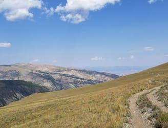
Difficult Hiking
- Distance
- 27 km
- Ascent
- 1 km
- Descent
- 1 km
Affectionately referred to as the “Winds”, these day hikes and backpacking routes explore what many consider to be the wildest and most rugged mountain range in the Lower 48: the Wind River Range.
Hiking Moderate, Difficult, Severe
Part of the greater Rocky Mountains, the Wind River Range (or simply, the “Winds”) are possibly “the most wild and remote range in the Lower 48,” according to UltimateDirection.com. Included in this region are epics such as the iconic Continental Divide Trail and the Wind River High Route, both world-renowned thru-hikes in the heart of the Winds. While the CDT is often revered as one of the top hikes in the west, this segment through the Winds "follows a relatively lackluster route on the west side of the crest," according to this post written by Andrew Skurka. The High Route is a much more adventurous and scenic route – much of which is off-trail.
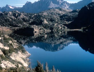
If you’re visiting Jackson Hole and are looking for a hike outside of the Tetons, both Pinedale and Dubois are roughly 90 minutes away. With a population hovering around 2,000 people, “Pinedale is an important hunting outfitting town and a gateway to the Wind River Mountains,” according to Wikipedia. While the town serves as a hub for longer routes such as the Wind River High Route, it’s also the closest town to the Seneca and Lost Lakes route, as well as the iconic Titcomb Basin hike. Both explore some of the Wind’s finest glacial lakes, many of which are known as premier fly fishing destinations. Lake inlets typically offer the best chance for a worthwhile catch, which could include Rainbow, Brook, and even Cutthroat Trout!
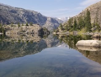
On the other side of the ridge, Dubois is an even smaller town with an estimated population of fewer than 1,000 people. Just a short drive from downtown, the Trail Lake Trailhead provides a gateway into the Fitzpatrick Wilderness and offers an abundance of day hikes, overnight trips, and epic trail runs. The two must-do routes are Lake Louise and the Glacier Trail Loop. Lake Louise is a short 4.5-mile hike perfect for the entire family, and according to theoutbound.com, averages 90-minutes to the lake and 45-minutes to return. In contrast, the Glacier Lake Loop is one of the most epic backcountry hikes on this side of the mountains and an excellent option for trail runners or a long day hike. It is worth noting, however, that the New Glacier Trail was created as an alternative to the Old Glacier Trail – which requires a challenging ford of the river. The loop is best counter-clockwise, but it’s wise to check the river levels beforehand so you know what to expect.
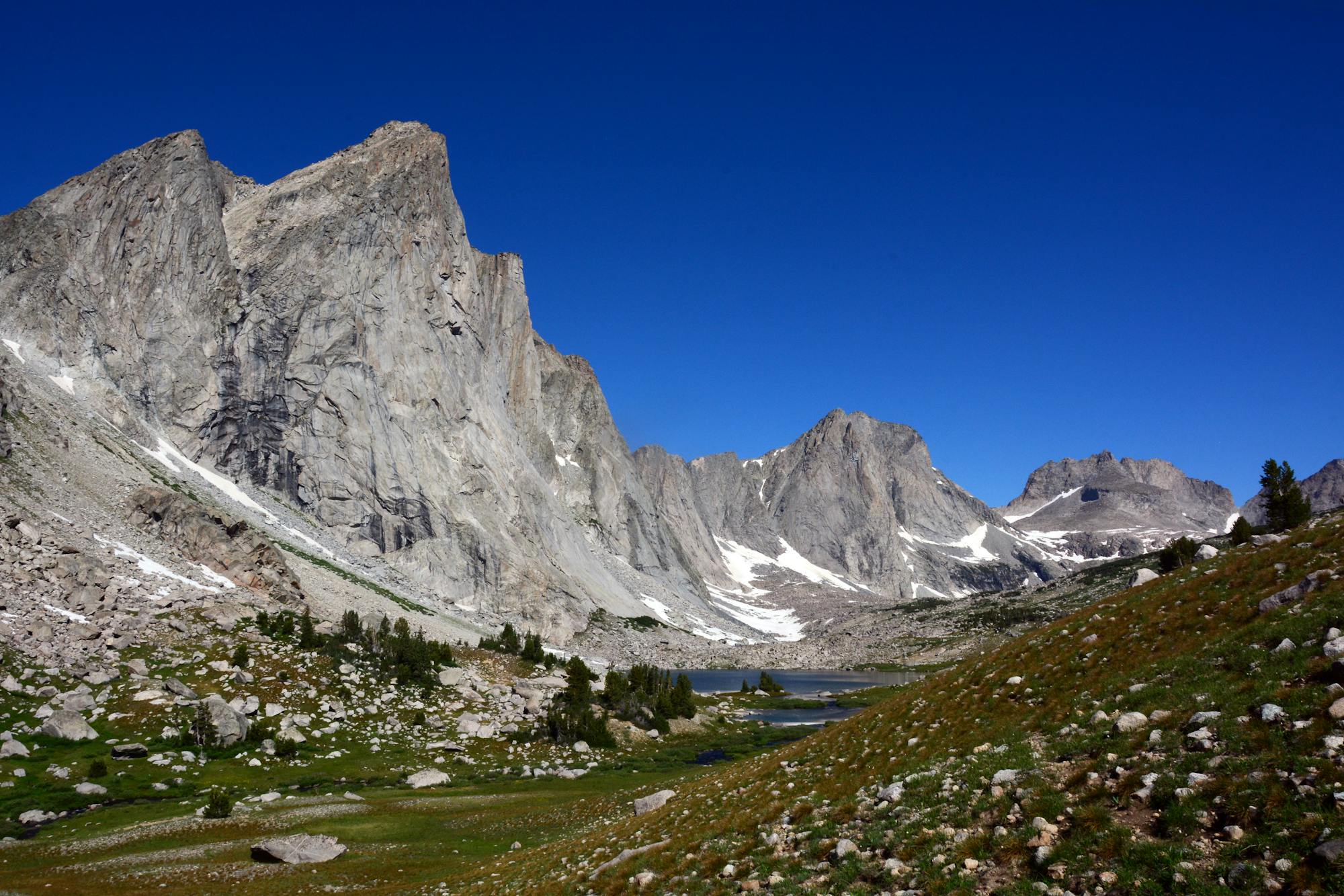
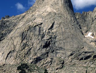
Rounding out the list, the Cirque of the Towers and Sweetwater Loop are two of the most coveted backpacking routes in the southern reaches of the range. Rimmed by massive granite spires and blanketed by beautiful summer wildflowers, Cirque of the Towers is one of the most renowned climbing areas in the West, with routes ranging from 5.1 to 5.11a. According to Wikipedia, "the cirque is an almost circular hole or valley carved by a glacier that retreated over 8,000 years ago." The author continues by noting how "the mountains are composed almost entirely of granite," and how "the Continental Divide spans the crest of the main peaks.”
Sources: https://en.wikipedia.org/wiki/WindRiverRange https://en.wikipedia.org/wiki/Dubois,Wyoming https://en.wikipedia.org/wiki/Pinedale,Wyoming http://blog.ultimatedirection.com/wind-river-high-route/ https://www.theoutbound.com/wyoming/hiking/hike-to-lake-louise-wind-river-range
High alpine basin rimmed by huge granite spires in Wyoming's remote Wind River Range.
Difficult Hiking
One of the most epic thru-hikes in the Lower 48.
Severe Hiking
An out-and-back hike to a stunning glacial lake.
Moderate Hiking
An epic backcountry hike, trail run, or overnight trip along the eastern edge of the Winds.
Difficult Hiking
An overnight hike or all-day trail run to stunning glacial lakes known for their excellent fishing—a great alternative to Titcomb Basin.
Difficult Hiking

One of the most coveted backpacking routes or all-day trail runs in the Wind River Range.
Difficult Hiking
A classic backcountry hike or trail run in the southeastern reaches of the Winds.
Difficult Hiking
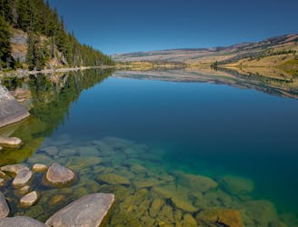
A short day hike from the Green River Lakes Campground.
Moderate Hiking
7 routes · Hiking
5 routes · Hiking · Trail Running
5 routes · Hiking
5 routes · Hiking · Trail Running
5 routes · Hiking · Trail Running

25 routes · Alpine Climbing · Hiking
5 routes · Alpine Climbing · Hiking
4 routes · Mountain Biking · Hiking · Trail Running
5 routes · Alpine Climbing · Hiking
10 routes · Alpine Climbing · Hiking