2 m away
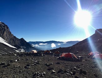
Aconcagua: Camp III to Base Camp Plaza de Mulas
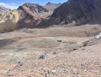
Hike down to Base Camp Plaza de Mulas.
Difficult Hiking
- Distance
- 6.8 km
- Ascent
- 0 m
- Descent
- 1.6 km
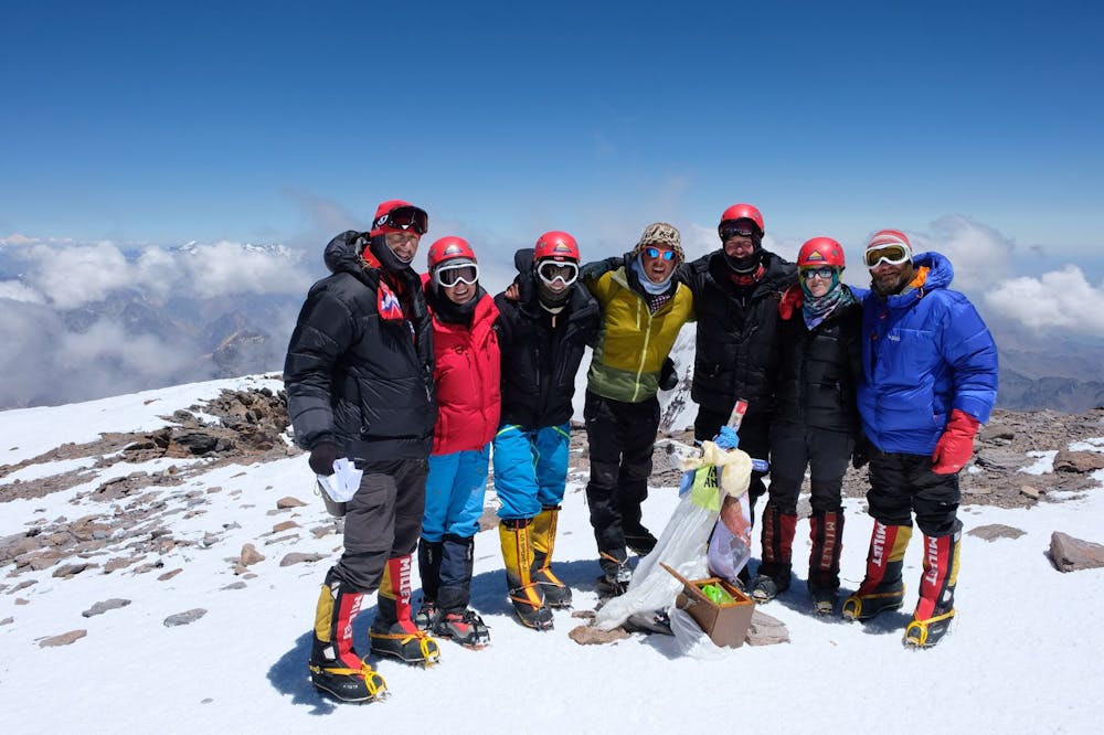
Summit the highest peak in South America!
Hiking Severe

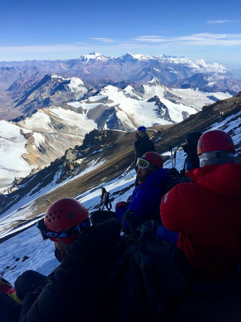
Starting in the dark hours of the middle of the night with your crampons and headlight on, you only have 1,000 climbing meters lef to reach the very top of South America!
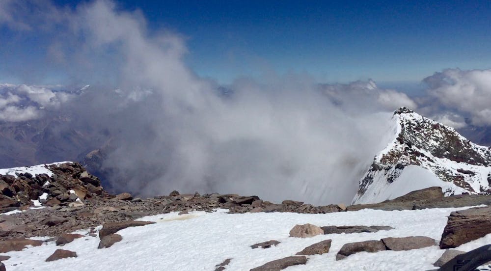
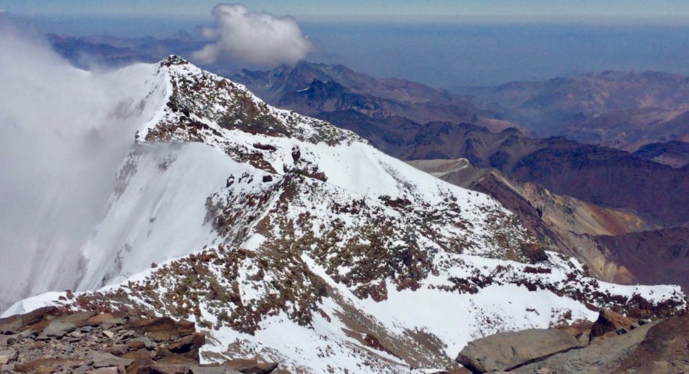
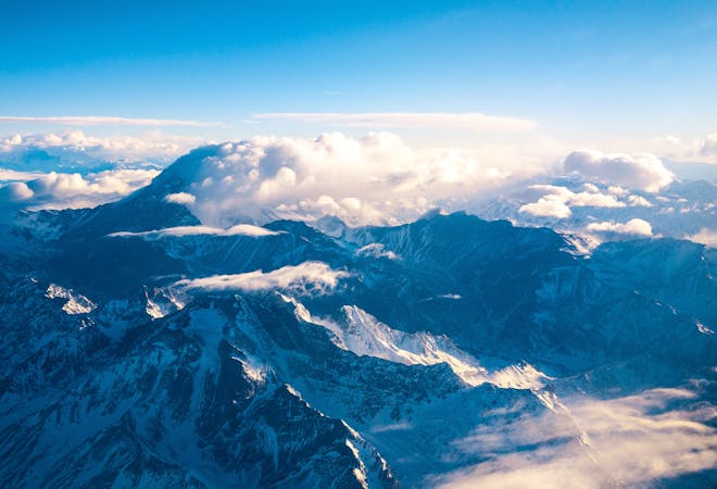
The trail at this stage is characterized by the fact that it leads you up to almost 7000 m.a.s.l. The path of the summit approach will most likely be filled with snow. However, due to the popularity, you will probably find yourself walking on a defined trail from previous groups. In addition, it is exposed and steep in many places. Therefore, crampons, a helmet, and hiking poles/ice axe are essential equipment for safety and stability reasons. At some points, the narrowness of the path doesn't allow more than one person to pass at a time.
The weather conditions are often the most crucial factor for a successful ascent and descent to and from the summit. You should especially take into consideration strong wind and thunderstorms before attempting to summit.
The way up is very different from the previous legs of the journey, as you start off in the middle of the night. Watching the sunrise gradually hitting the enormous mountain peaks now located beneath you is just breathtaking, and not something you get to experience on most hikes. Finally, reaching the summit and knowing that you made it to the rooftop of South America is another feeling one simply has to experience in order to understand!
Some specific tips and tricks: This is a long, cold, and challenging day. It is important to be both physically and mentally prepared. Resting and eating in the hours before the final approach and wearing warm clothes are absolutely necessary. There are a few suitable places where you can get some time to rest, but remember that you will be on a time schedule so you will have to keep on moving to reach the summit before turnaround time.
Drinking water and eating snacks will be important to ward off the altitude symptoms and for your energy levels. Being so high up in the cold, though, your water will more easily freeze, so it is critical to keep it insulated—for instance, by placing it inside your jacket. In addition, avoid too much extra weight and bring only the realistic amount of snacks you think you will need. Remember that getting to the top is only half the distance you'll need to hike!
Severe
Hiking challenging trails where simple scrambling, with the occasional use of the hands, is a distinct possibility. The trails are often filled with all manner of obstacles both small and large, and the hills are very steep. Obstacles and challenges are often unexpected and can be unpredictable.

Some trail sections have exposed ledges or steep ascents/descents where falling could cause serious injury.

In the high mountains or remote conditions, all individuals must be completely autonomous in every situation.
2 m away
Hike down to Base Camp Plaza de Mulas.
Difficult Hiking
1.7 km away
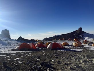
The last hike before the summit attempt!
Difficult Hiking
3.7 km away
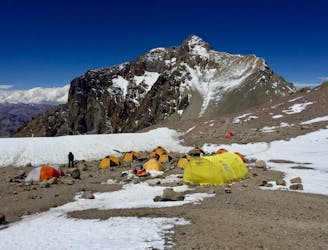
Continue higher up the flanks of Aconcagua, ending at Camp II at 5,500 m.a.s.l.
Difficult Hiking
3.9 km away
The last day of the Aconcagua expedition.
Moderate Hiking
7 km away
The first day the Aconcagua route gets above 5000 m.a.s.l.
Difficult Hiking
7 routes · Hiking

18 routes · Alpine Climbing · Hiking