20 m away
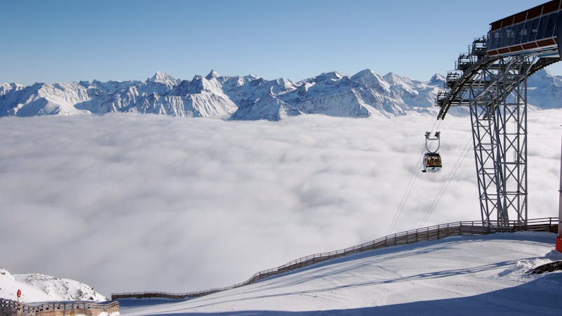
The classic Gaislachkogel off-piste

Classic off piste with many variations down from Gaislachkogl for good riders
Severe Freeride Skiing
- Distance
- 1.4 km
- Ascent
- 0 m
- Descent
- 607 m
Mellow big mountain off-piste for intermediates
Freeride Skiing Difficult

This one is one of the easier lines on Gaislachkogl. It's easy because the face is open, simple to follow and there is barely any chance of falling down cliffs. Start right on top of Gaislachkogl, then follow the fence on the right of you. After approximately 30 metres is the entry to the line. Don't leave the gondola and attempt to ride down immediately on the left side. There is a big curve to left, around a huge rock. You will see a yellow sign on the outside of the curve, which informs you about the danger behind the sign. This is also the start point for other lines facing towards the south. After the yellow sign, decide if you want to go down on the left side or the right side of the smaller wooden fence. Keep in mind, that for this line it is essential to cross the mountain to the far right. So drop in. Ride along the right side so you will be able to cross the mountain. In front of you there will some huge cliffs and on your right will be a chance to cross under them. On your left side you will see different spines. Cross the hillside until the last spine is on your left. You will now be facing now an open field with barely any rocks or anything in between; normally it is just a wide and long white field. Enjoy the snow and ride down. Take care of smaller rocks as there might be some hidden by the snow. The big mountain ridge on the right of you protects the snow beside to it from the sun. Keep that in mind when choosing your line. After the open face, you will end in the flatter bowl. Be wary of bigger rocks and make your way to the pistes. If you think you've lost the orientation, look up to the gondola and the cables will lead you down.
Difficult
Serious gradient of 30-38 degrees where a real risk of slipping exists.

As well as the slope itself, there are some obstacles (such as rock outcrops) which could aggravate injury.
Away from help but easily accessed.
20 m away
Classic off piste with many variations down from Gaislachkogl for good riders
Severe Freeride Skiing
44 m away

Marvellous big mountain off-piste for intermediate skiers, away from the chairs and the crowds.
Severe Freeride Skiing
214 m away

Non crowded big mountain off-piste for experienced skiers.
Severe Freeride Skiing
328 m away

A beautiful big mountain line from Gaislachkogel, well away from the slopes.
Difficult Freeride Skiing
343 m away

Advanced off piste from the infamous Gaislachkogl.
Severe Freeride Skiing
409 m away

Long big mountain off-piste. Because of the danger in the beginning of the line it is for experienced riders only.
Difficult Freeride Skiing
423 m away

A steep and narrow big mountain couloir on top of Gaislachkogl. For experts only!
Severe Freeride Skiing
485 m away

Big mountain off-piste on the infamous Gaislachkogl. Because of the danger in the beginning of the line this is reserved for experienced riders.
Difficult Freeride Skiing
1.2 km away

Classic off piste down to Rettenbachtal for advanced riders
Difficult Freeride Skiing
1.5 km away

Off piste under Gratlift
Moderate Freeride Skiing
16 routes · Freeride Skiing