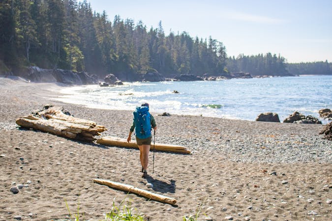
Rubble-Helm-Cheakamus Backpacking
The ultra classic Garabaldi Backpacking Route
Moderate Hiking
- Distance
- 25 km
- Ascent
- 1.4 km
- Descent
- 1.1 km
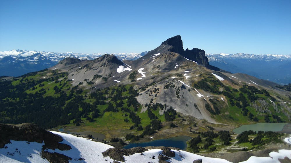
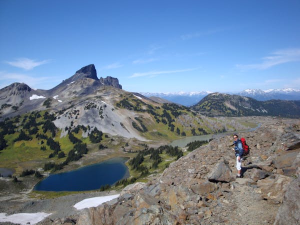
Climb to one of the most striking features in the Sea to Sky mountains
Hiking Extreme

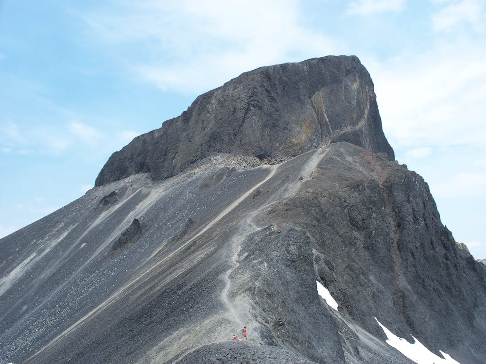
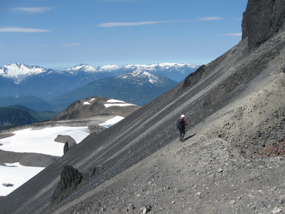
Due to its prominence and spectacular appearance, Black Tusk is one of the most popular scrambles in the Whistler/Vancouver area. The ascent is strenuous, but earns you terrific views over the glaciated Garibaldi mountains. Be warned that whilst initially on a trail, the last part of the route involves difficult scrambling, and a helmet is recommended.
Most hikers choose to end just before the true summit, which is separated by a steep notch and is a Class 5 mountaineering objective. The map shown here runs all the way to the top of the mountain, but be sure to only attempt the final pitch if you're adequately prepared.
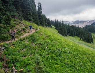
This route runs concurrently with the Garibaldi Lake Hike. The Black Tusk trail heads up through meadows. Creeks here provide the last water source. You then hit scree slopes and follow them to the ridge at 2150m. The views are great even from here, making it a good place for non-scramblers to stop.
Once you reach the chimney/ascent gulley it’s best to climb one at a time to avoid being hit by falling rocks. Keep right to find and follow a narrow gully which leads to a well-worn path finishing at the south summit. Be sure to return the same way!
Make sure you access the weather conditions throughout the day and be prepared to turn back if needed.
Sources: Scrambles in Southwest British Columbia by Matt Gunn; 4th Edition, 2017; Cairn Publishing
Extreme
Scrambling up mountains and along technical trails with moderate fall exposure. Handholds are necessary to navigate the trail in its entirety, although they are not necessary at all times. Some obstacles can be very large and difficult to navigate, and the grades can often be near-vertical. The challenge of the trail and the steepness of the grade results in very strenuous hiking. Hikes of this difficulty blur the lines between "hiking" and "climbing".

Some trail sections are extremely exposed where falling will almost certainly result in serious injury or death.

Little chance of being seen or helped in case of an accident.
The ultra classic Garabaldi Backpacking Route
Moderate Hiking
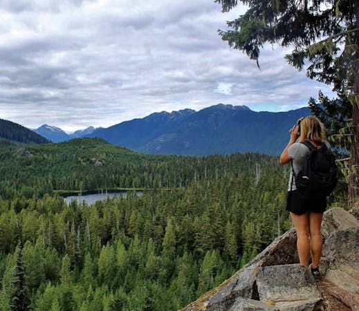
Continue on from Garabaldi Lake to one of the best vistas in the area
Severe Hiking
1 m away

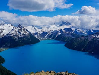
One of the most scenic destinations in British Columbia
Difficult Hiking
15 m away

Day hike visiting Black Tusk, Panorama Ridge & Garibaldi Lake
Difficult Hiking
8.9 km away
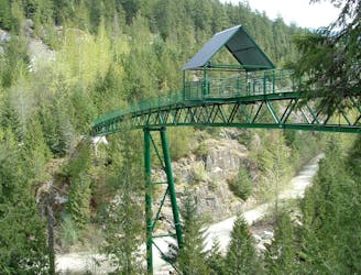
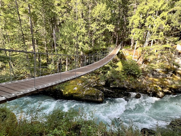
A longer spin on a classic Whistler hike that visits both Brandywine Falls and the Whistler Bungee Bridge.
Moderate Hiking
8.9 km away
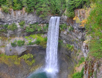
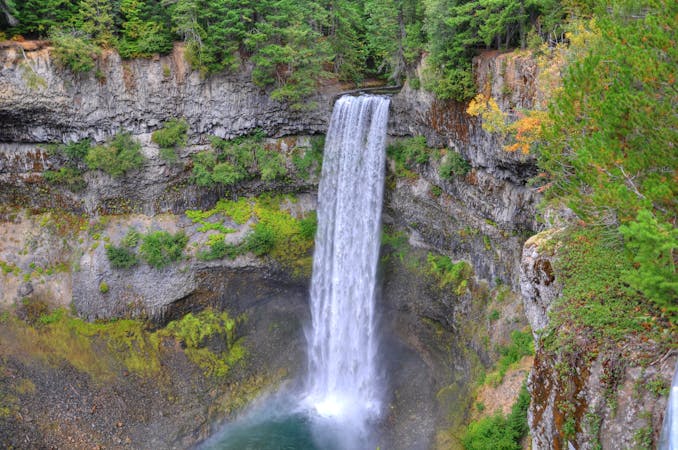
Short walk to a viewing platform over a picture-perfect, 70-meter waterfall.
Easy Hiking
10 routes · Hiking
3 routes · Hiking
6 routes · Hiking
5 routes · Hiking · Trail Running
18 routes · Hiking