Rubble-Helm-Cheakamus Backpacking
The ultra classic Garabaldi Backpacking Route
Moderate Hiking
- Distance
- 25 km
- Ascent
- 1.4 km
- Descent
- 1.1 km
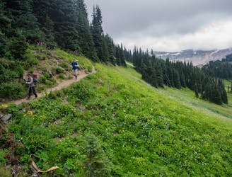
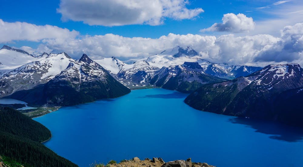
Continue on from Garabaldi Lake to one of the best vistas in the area
Hiking Severe

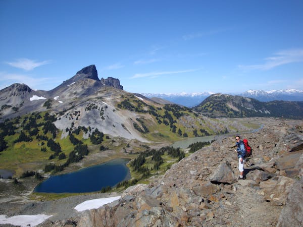
Panorama Ridge is a very popular extension of the Garabaldi Lake hike and, being less of a technical scramble than the Black Tusk, makes it a perfect objective for the intermediate hiker.
Choosing to hike to Garibaldi Lake on day 1, spending the night camped beside the lake, and then tackling Panorama Ridge the next day is a good idea. But for the ambitious, Panorama Ridge can be hiked in a single day.
Alternatively, you can choose to camp at the trail junction in Taylor Meadows.
From Taylor Meadows below Garibaldi Lake, the route meanders at a more gentle gradient up to the Black Tusk junction. Continue heading straight and after about 2km you will gain views of Mimulus Lake and Black Tusk Lake below.
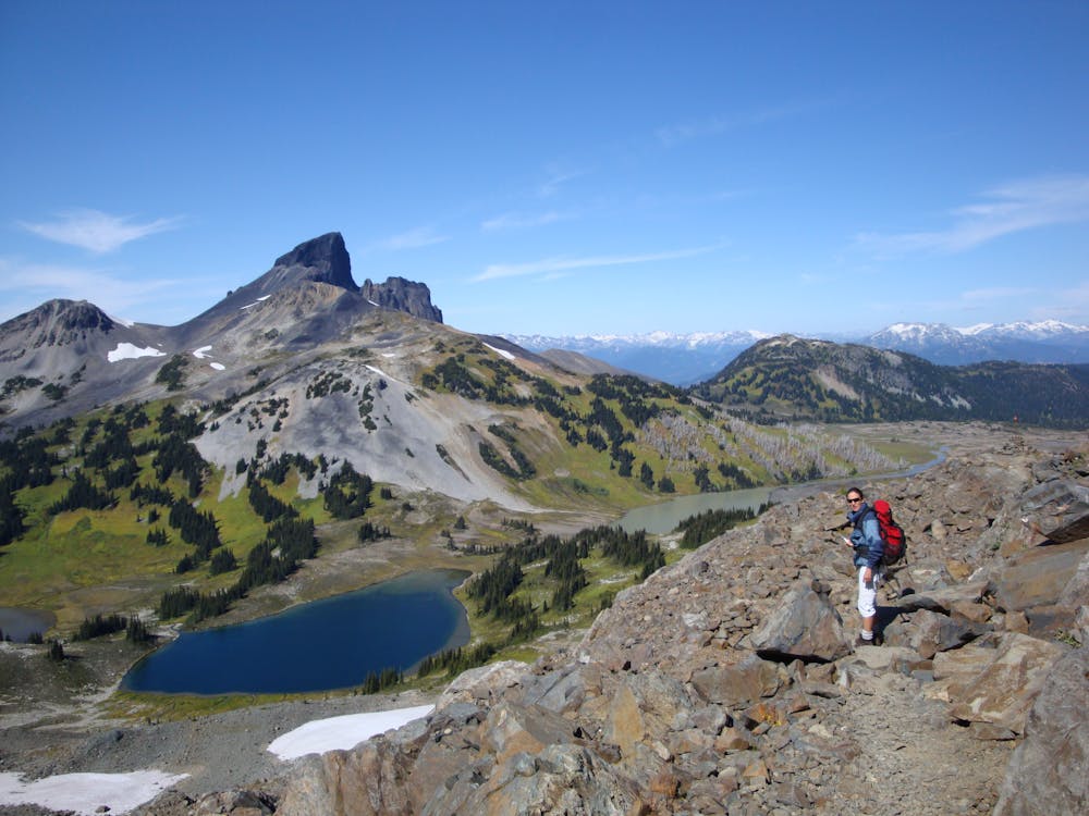
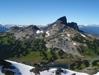
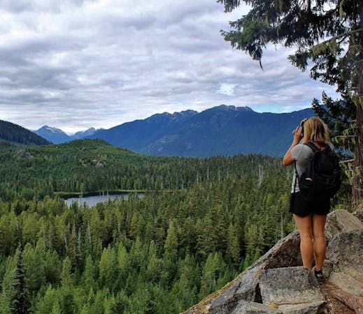
The trail becomes steeper and less obvious the further you go—look for rock cairns and boot marks to guide the way. Eventually the route levels out and you will see how the ridge got its name. Your view includes a number of volcanoes: Mt Price, Clinker Peak, Cinder Cone, Black Tusk and Mt Garibaldi, to name a few. Return the same way.
Severe
Hiking challenging trails where simple scrambling, with the occasional use of the hands, is a distinct possibility. The trails are often filled with all manner of obstacles both small and large, and the hills are very steep. Obstacles and challenges are often unexpected and can be unpredictable.

The trail contains some obstacles such as outcroppings and rock which could cause injury.

Little chance of being seen or helped in case of an accident.
The ultra classic Garabaldi Backpacking Route
Moderate Hiking
Climb to one of the most striking features in the Sea to Sky mountains
Extreme Hiking
1 m away
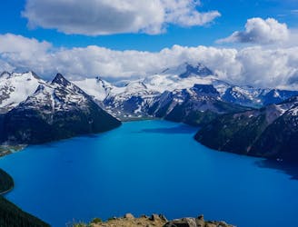
One of the most scenic destinations in British Columbia
Difficult Hiking
15 m away

Day hike visiting Black Tusk, Panorama Ridge & Garibaldi Lake
Difficult Hiking
8.9 km away
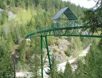
A longer spin on a classic Whistler hike that visits both Brandywine Falls and the Whistler Bungee Bridge.
Moderate Hiking
8.9 km away
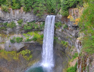
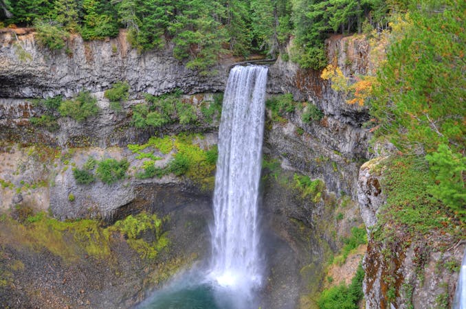
Short walk to a viewing platform over a picture-perfect, 70-meter waterfall.
Easy Hiking
10 routes · Hiking
3 routes · Hiking
6 routes · Hiking
5 routes · Hiking · Trail Running
18 routes · Hiking