1 m away
Rubble-Helm-Cheakamus Backpacking
The ultra classic Garabaldi Backpacking Route
Moderate Hiking
- Distance
- 25 km
- Ascent
- 1.4 km
- Descent
- 1.1 km
One of the most scenic destinations in British Columbia
Hiking Difficult

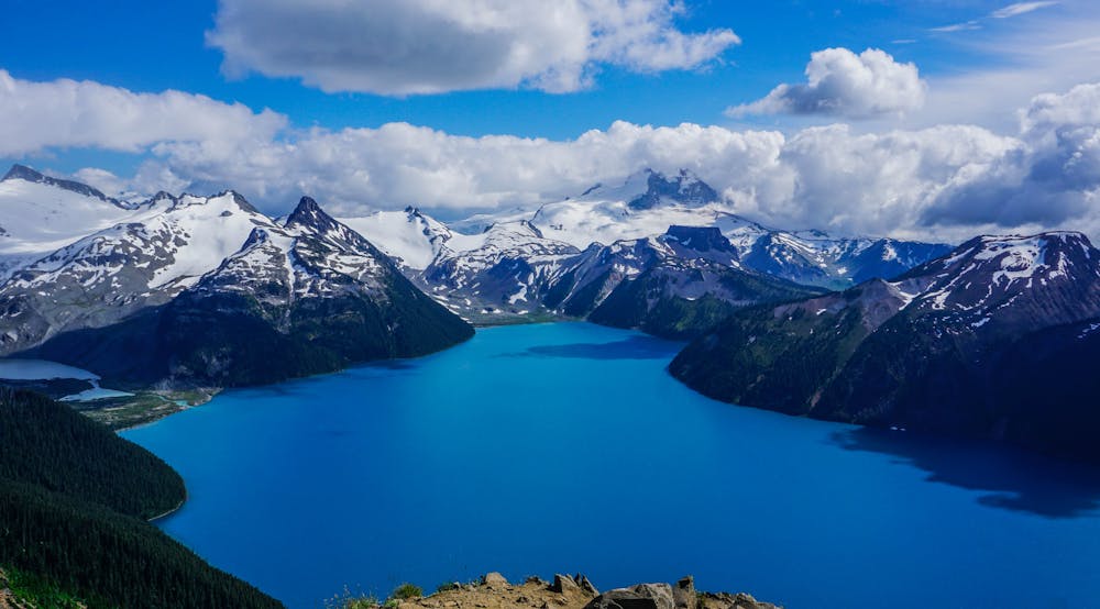
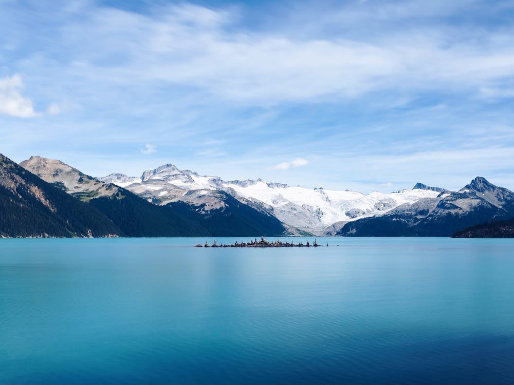
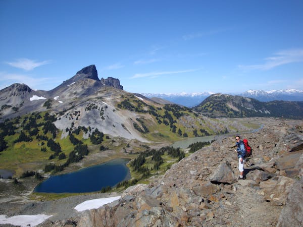
Garibaldi Lake was formed over 9,000 years ago during the last Ice Age, when a volcano named Clinker Peak erupted. Dacite lava formed a 450m tall ice-contact dam known as The Barrier, blocking the glaciated valley1. Meltwater pooled behind The Barrier, creating what is now Garibaldi Lake and one of the most loved destinations in the Lower Mainland. Inflow to the lake continues today from the nearby Sphinx and Sentinel glaciers, whilst water flows out through cracks in The Barrier.
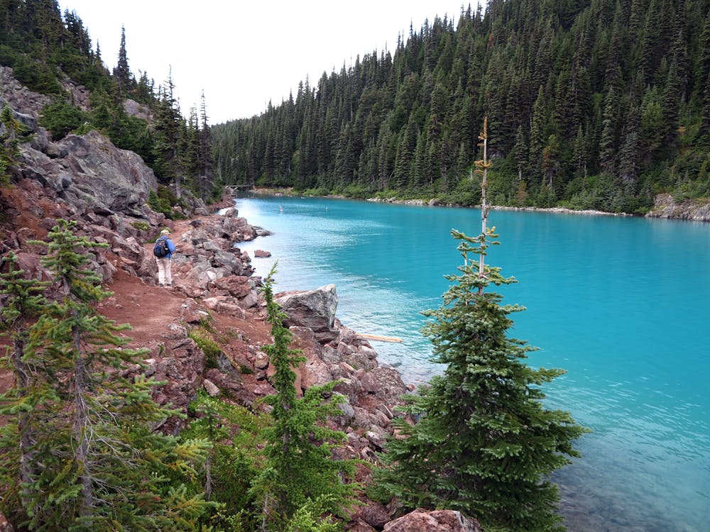
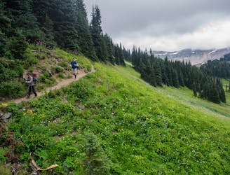
The trail is demanding, with 1000m of elevation gain, but is well-maintained, making it accessible to moderately experienced hikers. From the Rubble Creek trailhead, over 20 switchbacks take you up 770m to a major intersection. The right fork to Garibaldi Lake is described here, but taking the left fork would allow for a loop via Taylor Meadows.
After the turnoff, you'll be rewarded with a wide-open view of The Barrier. If it ever collapsed, water from the lake would release onto the town of Squamish with catastrophic effect2.
Once at the lake, follow the shore to the campground where there are 50 tent sites, 4 day-use shelters, and 4 pit toilets. Note that as of 2018, BC Parks requires reservations year-round for camping at both Garibaldi Lake and Taylor Meadows: http://www.env.gov.bc.ca/bcparks/explore/parkpgs/garibaldi/#Reservations.
Numerous options exist beyond here for those with the time and experience; Black Tusk and Panorama Ridge being the most well-known. Otherwise, once you have taken in the views and replenished your energy reserves, head back down the same way.
Sources: 1). 105 Hikes by Stephen Hui. Published 2018 by Greystone Books. 2). Garibaldi Lake a ticking time bomb? https://www.squamishchief.com/news/garibaldi-lake-a-ticking-time-bomb-1.1753732.
Difficult
Hiking trails where obstacles such as rocks or roots are prevalent. Some obstacles can require care to step over or around. At times, the trail can be worn and eroded. The grade of the trail is generally quite steep, and can often lead to strenuous hiking.

The path is on completely flat land and potential injury is limited to falling over.

Away from help but easily accessed.
1 m away
The ultra classic Garabaldi Backpacking Route
Moderate Hiking
1 m away
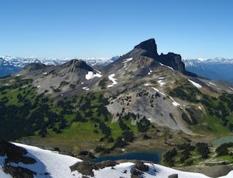
Climb to one of the most striking features in the Sea to Sky mountains
Extreme Hiking
1 m away
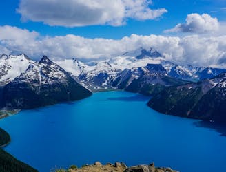
Continue on from Garabaldi Lake to one of the best vistas in the area
Severe Hiking
14 m away

Day hike visiting Black Tusk, Panorama Ridge & Garibaldi Lake
Difficult Hiking
8.9 km away
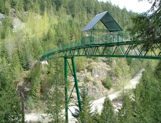
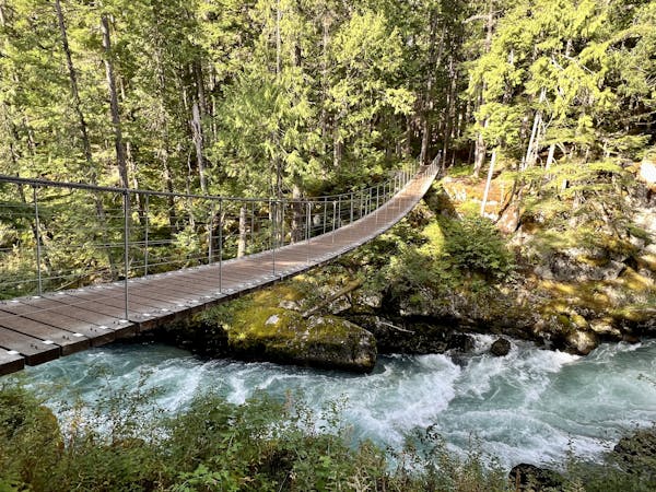
A longer spin on a classic Whistler hike that visits both Brandywine Falls and the Whistler Bungee Bridge.
Moderate Hiking
8.9 km away
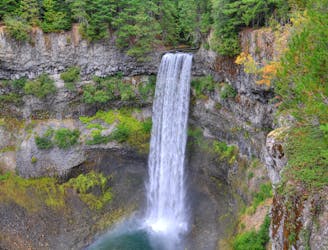
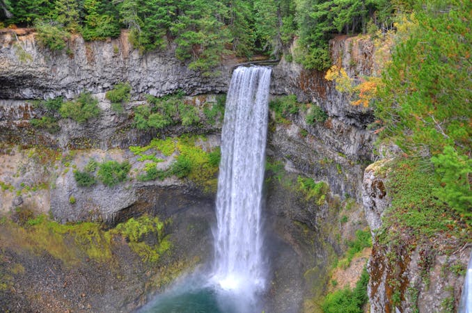
Short walk to a viewing platform over a picture-perfect, 70-meter waterfall.
Easy Hiking
10 routes · Hiking
3 routes · Hiking
6 routes · Hiking
5 routes · Hiking · Trail Running
18 routes · Hiking