2.2 km away
Out There Loop
A slab-filled masterpiece!
Severe Mountain Biking
- Distance
- 6.4 km
- Ascent
- 237 m
- Descent
- 237 m
A classic Whistler XC ride with a rewarding descent at the end.
Mountain Biking Severe

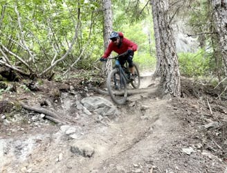
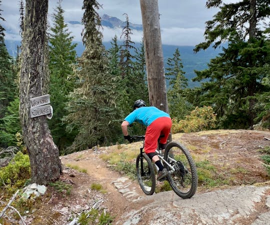
Kill Me Thrill Me is a true classic Whistler mountain bike ride. If you look up any list of classic trail rides near Whistler, this trail is definitely on it. While its popularity has been surpassed in recent years thanks to new trail development in the region, don’t overlook this gem of a mountain bike ride!
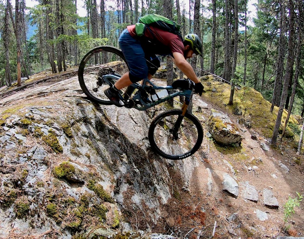
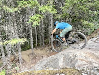
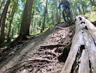
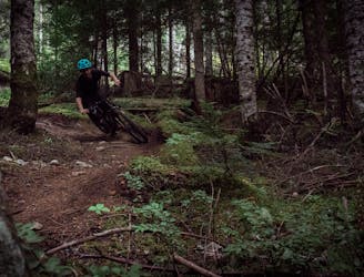
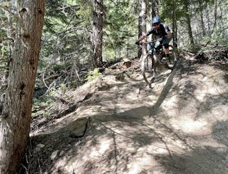
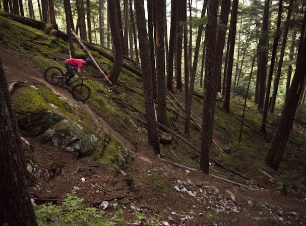
Kill Me Thrill Me is an up-and-down gnarly XC trail interspersed with some big features and technical descents. This up-and-down character is one of the reasons that other trails in the area have come to prominence. On most of the new trail rides in Whistler these days, a long climb is followed by an equally long descent. After a few days of pushing your bike up the top of ultra-long, ultra-steep climbs, the short hike-a-bikes on Kill Me Thrill Me may indeed come as a welcome relief.
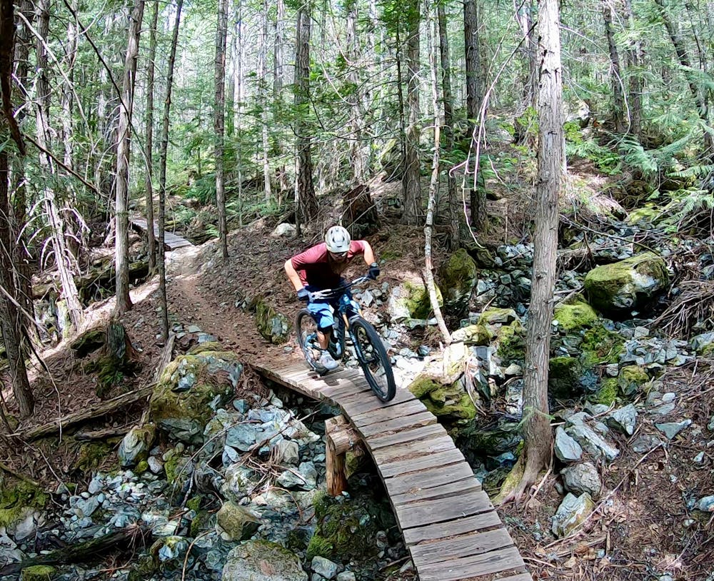
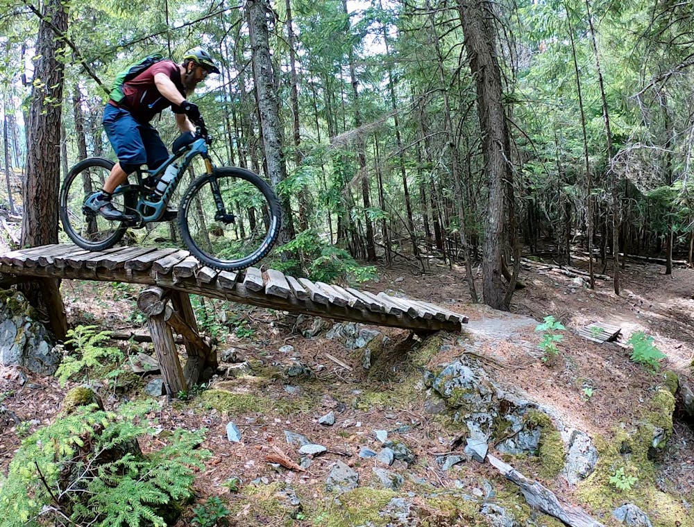
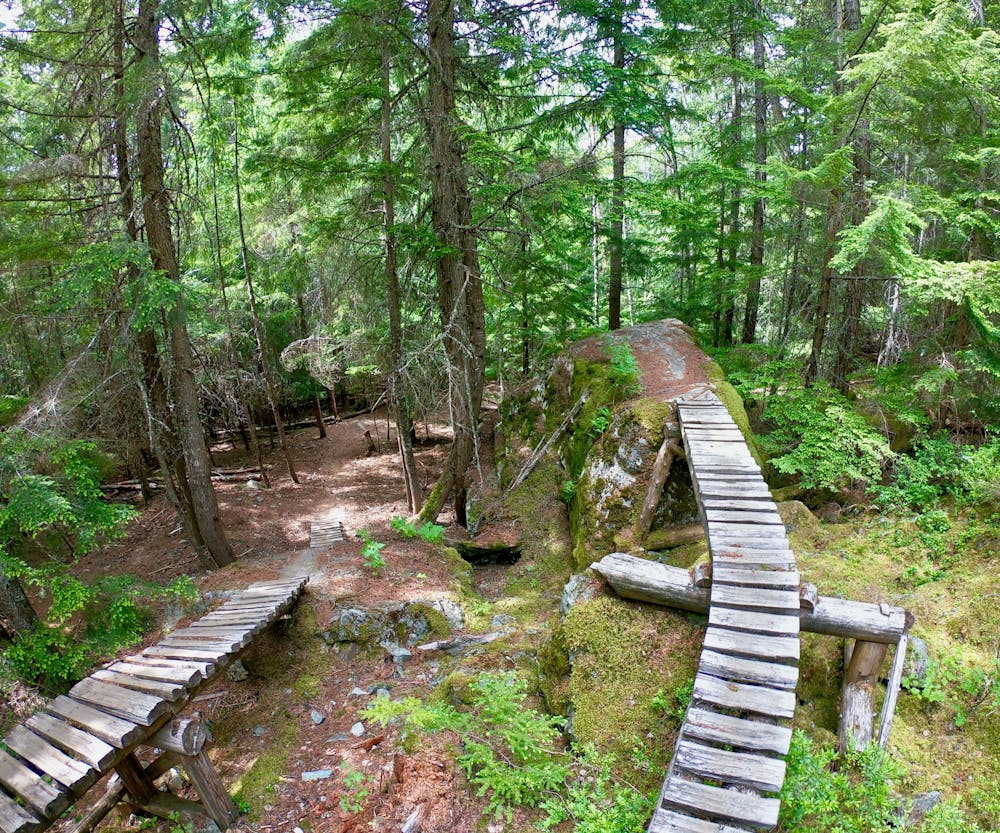
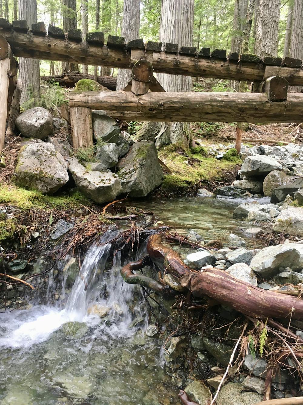
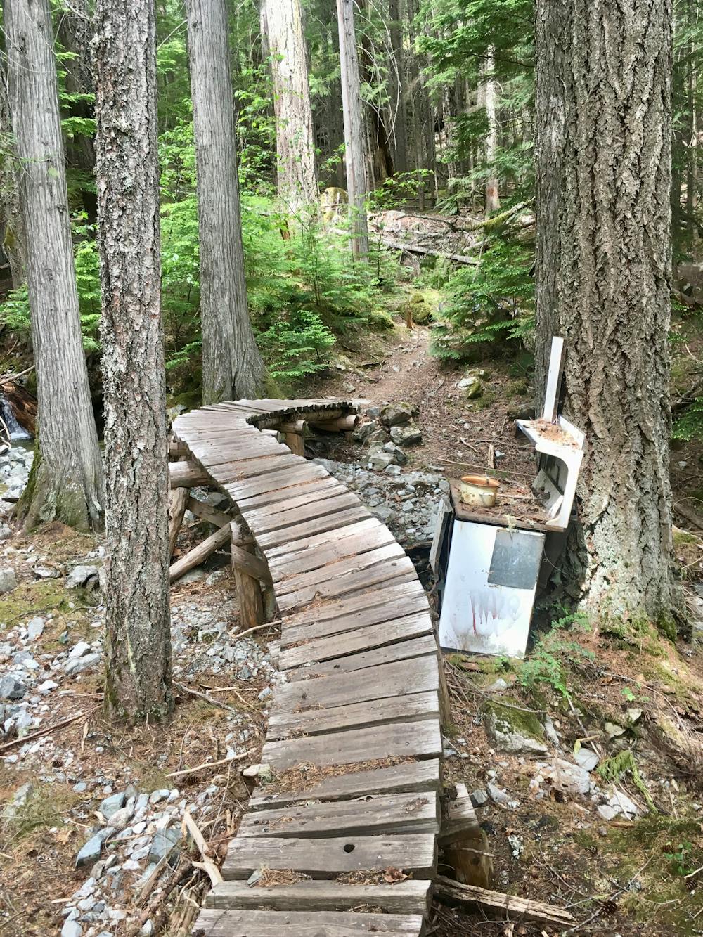
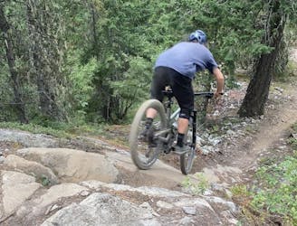
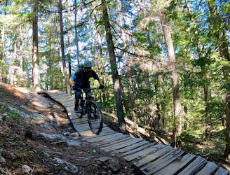
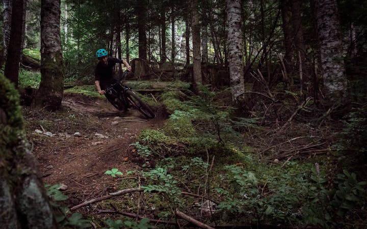
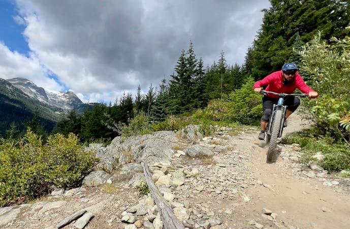
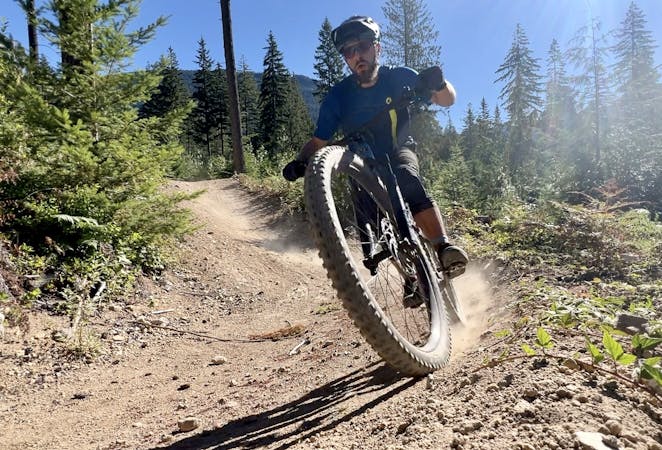
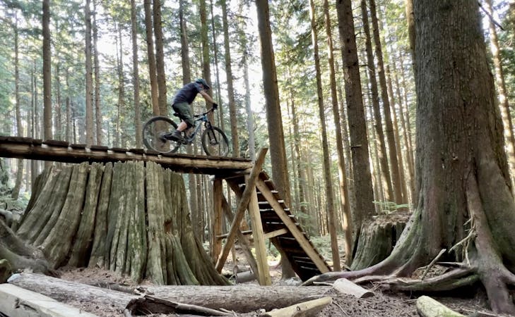
The trail roughly contours along the hillside above the highway, dipping in and out of deep valleys with rushing mountain streams. Entertaining bridges provide picturesque stream crossings, and excellent bench cut singletrack makes for a delightfully flowy ride quality. At times, the trail does point straight up the mountainside, but inevitably these steep climbs are followed with sweet, technical descents. A few of the most technical features offer double black rock roll and drop options, but these are usually coupled with a single black line that is more approachable.
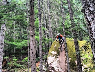
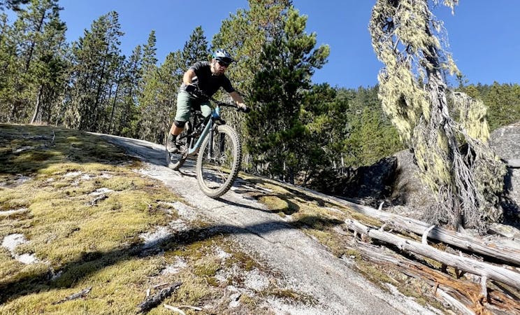
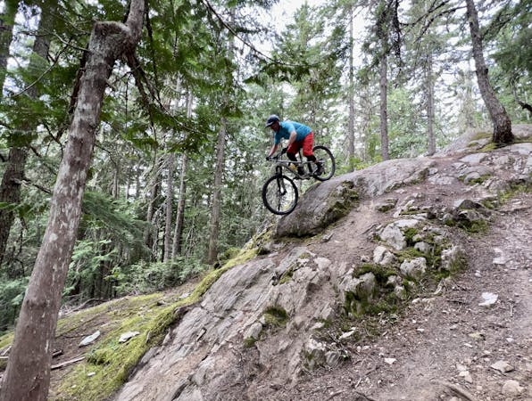
The final descent under the power lines is a raucous romp down a cascading series of rock slabs. Multiple lines weave down these slabs, providing a never-ending series of options and alt lines to choose from. Only now that you’re ripping down hundreds of feet of rad rock do you realize how much climbing you did!
Severe
Widely variable, narrow trail tread with steeper grades and unavoidable obstacles of 15in/38cm tall or less. Obstacles may include unavoidable bridges 24in/61cm wide or less, large rocks, gravel, difficult root sections, and more. Ideal for advanced-level riders.

Some trail sections have exposed ledges or steep ascents/descents where falling could cause serious injury.

Close to help in case of emergency.
2.2 km away
A slab-filled masterpiece!
Severe Mountain Biking
4.2 km away
The must-do XC epic in the Whistler valley
Severe Mountain Biking
4.4 km away
A classic rock-filled descent with stunning views up high.
Severe Mountain Biking
4.4 km away
Whistler's top rock slab ride!
Extreme Mountain Biking
4.7 km away
Whistler's worst kept secret trail is now on the map!
Difficult Mountain Biking
6.2 km away
The easiest singletrack trails in Whistler.
Difficult Mountain Biking
6.2 km away
Fantastic deep, dark singletrack and steep rock slabs make Micro Climate a local favorite.
Severe Mountain Biking
6.4 km away
A true Blackcomb Classic.
Severe Mountain Biking
6.4 km away

Classic Enduro stage on Blackcomb Mountain.
Difficult Mountain Biking
6.6 km away
Combine old school freeride features with a loose, ripping descent on this high-value loop.
Severe Mountain Biking
14 routes · Mountain Biking

16 routes · Mountain Biking

25 routes · Mountain Biking
5 routes · Mountain Biking
5 routes · Mountain Biking
7 routes · Mountain Biking
9 routes · Mountain Biking
10 routes · Mountain Biking
6 routes · Mountain Biking
14 routes · Mountain Biking
10 routes · Mountain Biking