2.2 km away
Kill Me Thrill Me
A classic Whistler XC ride with a rewarding descent at the end.
Severe Mountain Biking
- Distance
- 9.4 km
- Ascent
- 266 m
- Descent
- 267 m
A slab-filled masterpiece!
Mountain Biking Severe

What this loop might lack in mileage it makes up for in sheer high-quality ripping! Out There is a fantastic rock slab romp that will put a grin on the face of any advanced-level mountain biker.
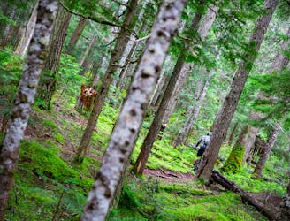
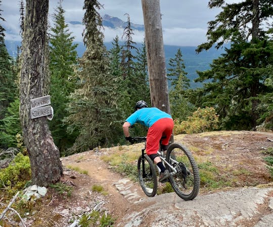
The ride, as mapped, begins near the Green River on Wedge Creek FS Road by climbing up the furthest reaches of the classic Comfortably Numb. If you're truly looking for a beat down, you could ride the entirety of the Comfortably Numb loop in such a way that you'd tack on and descend Out There on the far end of the loop. Or, if you're not looking for that much mileage, simply pedal up the far corner of Comfortably Numb to reach Out There, as mapped.
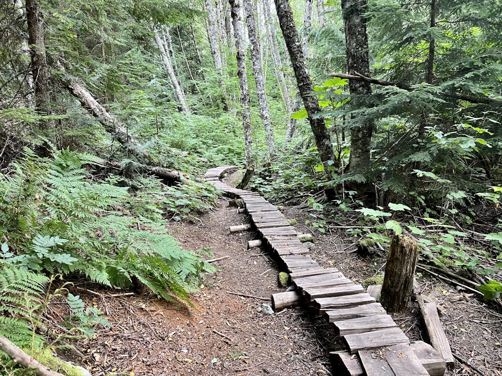
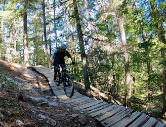
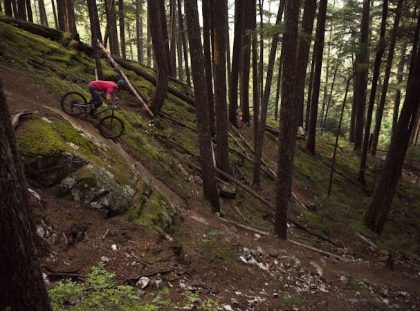
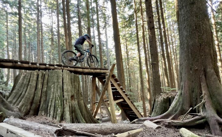
The climb up Comfortably Numb is quite entertaining in and of itself, with some cool wooden bridges and a few fun rock slabs to ride up and over. While it's a bit steep in places, but it is actually quite climbable in comparison to some of the other climbing trails in the valley.
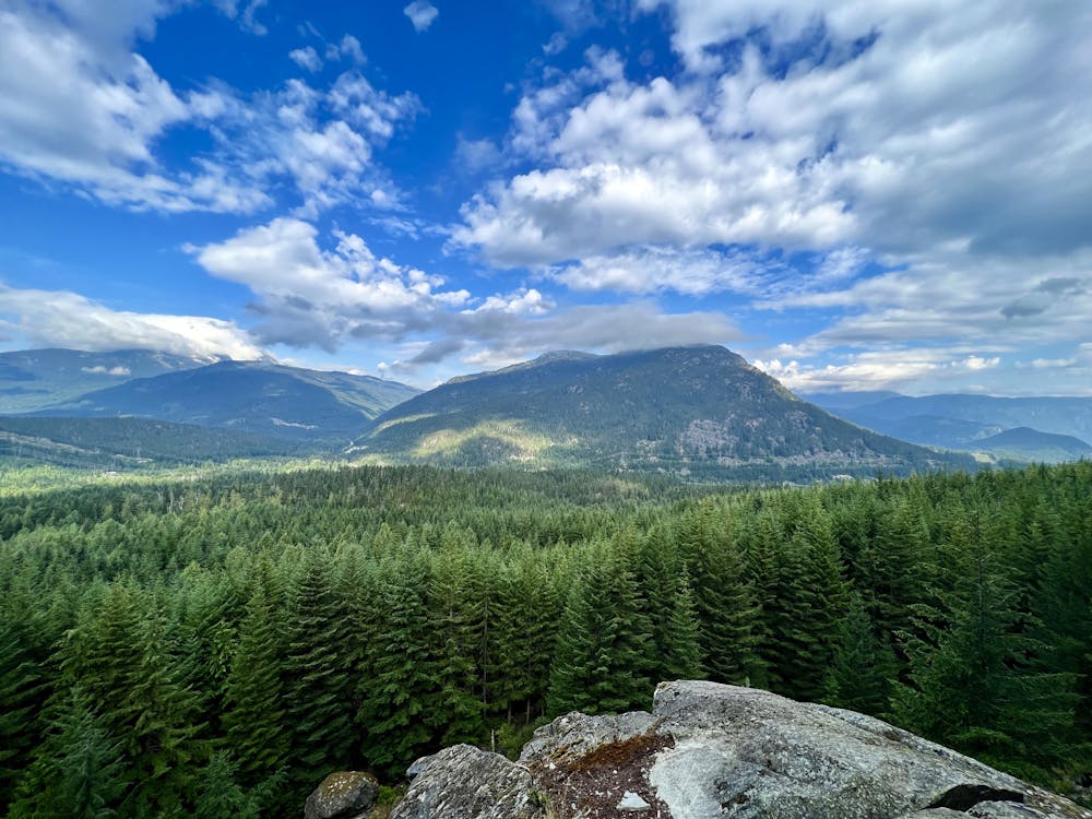
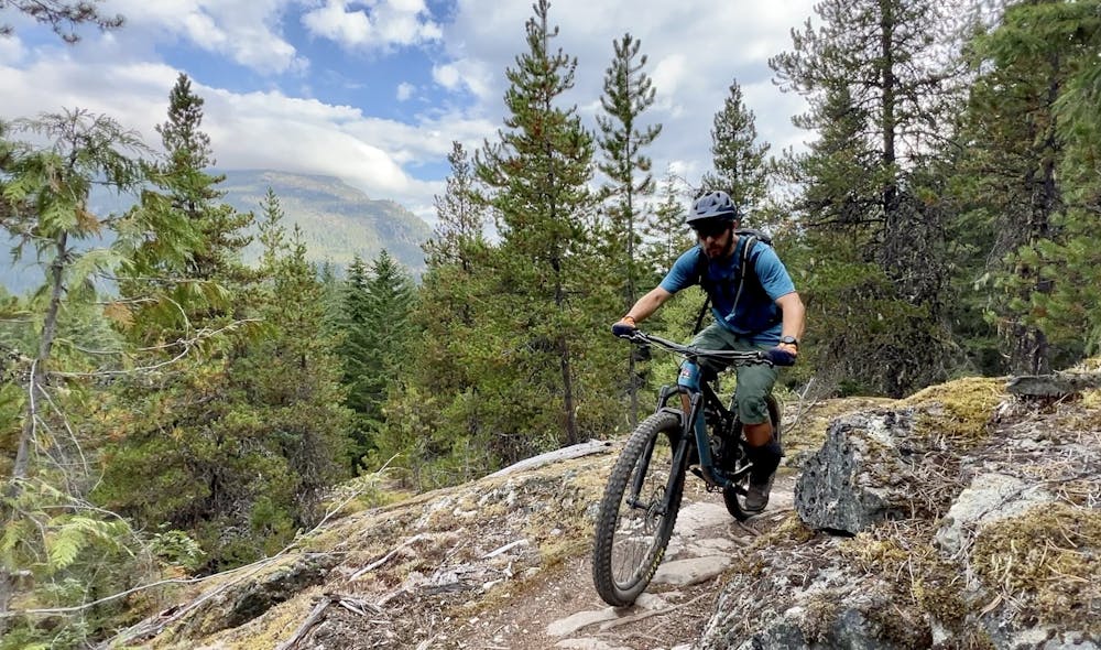
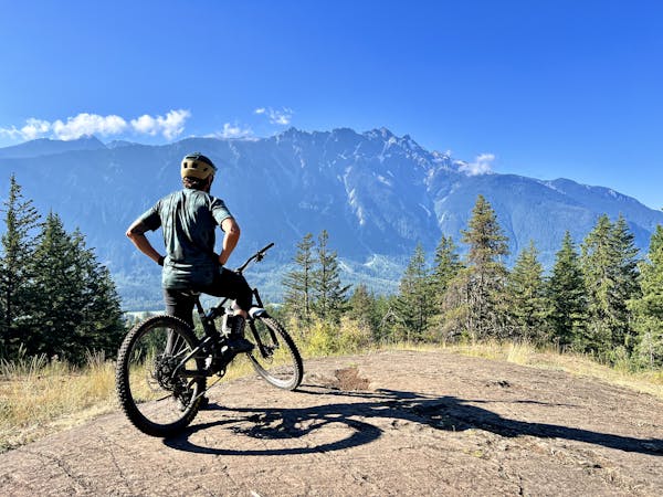
After crossing the road, you'll turn onto Out There, and then continue climbing to reach the high point. At the very top of the loop, you'll reach an impressive vista that looks out over the valley and the mountains to the northwest, which is truly spectacular! This is the perfect place to have a snack, pull up the pads, and get ready to rip.
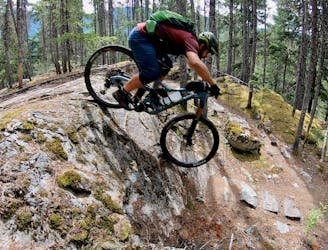
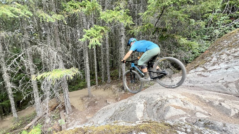
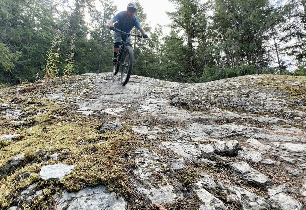
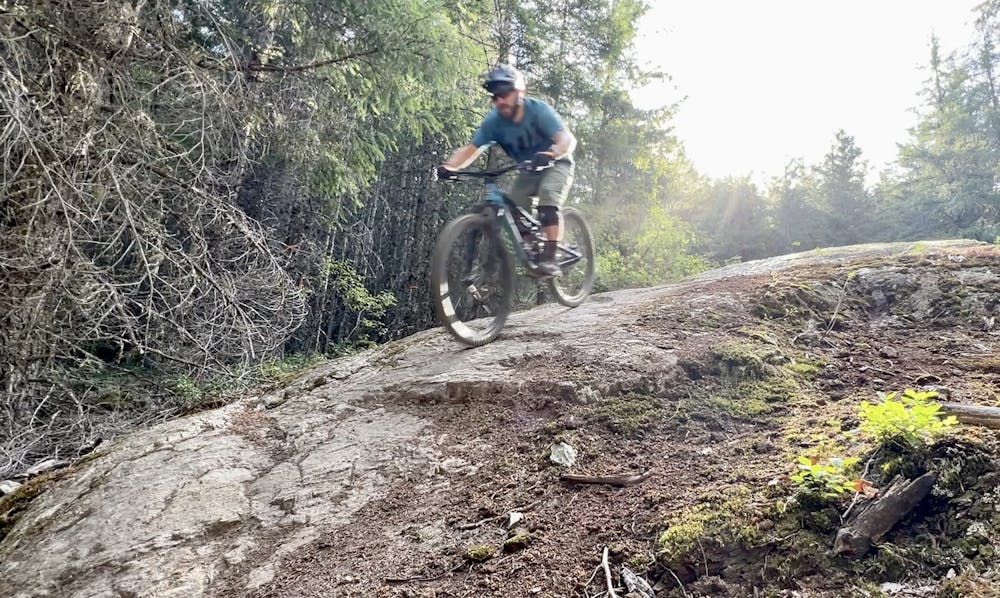
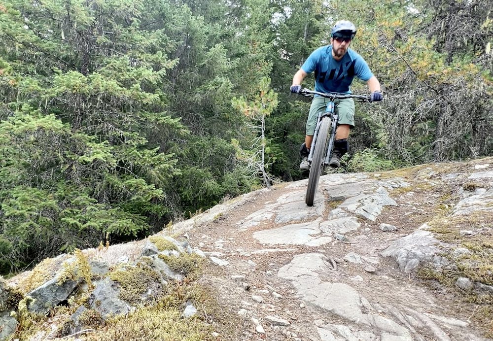
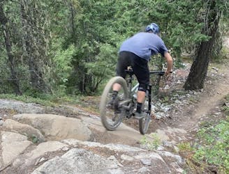
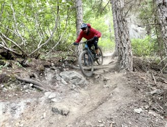
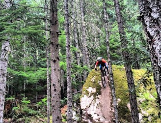
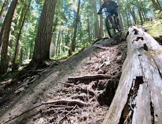
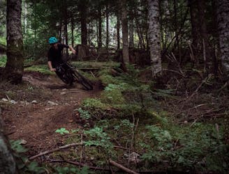
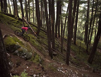
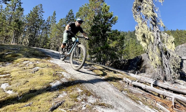
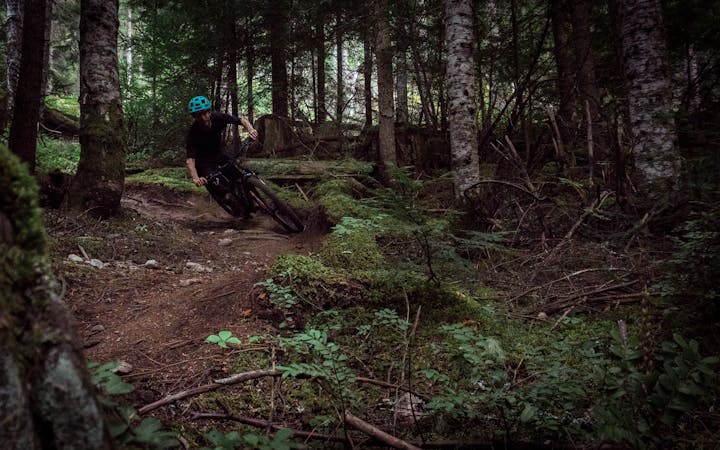
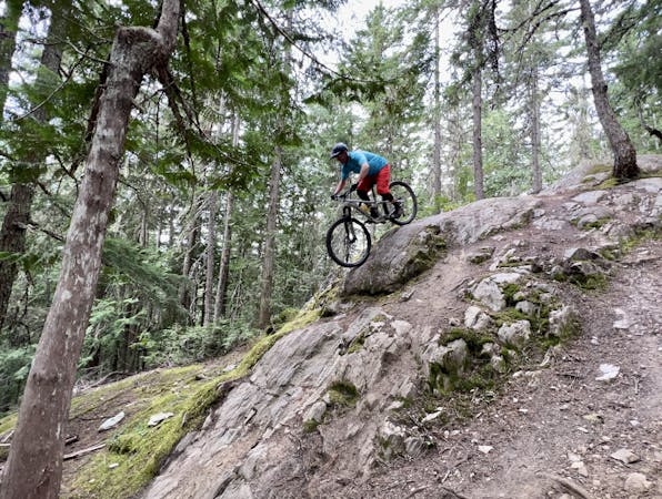
The descent down Out There is magnificent! It seems like the entire trail is an endless cascade of gorgeous granite slabs with stupendous roller lines that are incredibly aesthetic. Sure, there's a bit of singletrack interspersed to connect the slabs, but the beautiful rolls down the elevated rock domes will stick in your memory for a long time to come.
These rolls and rock rides aren't insanely technical on the grand spectrum of Sea-to-Sky mountain biking, and this trail pegs a solid single black diamond rating. However, a few of the lines are definitely a bit tricky on your first run through. A few of the more difficult lines require you to link multiple rocks and slabs together, thread through some narrow trees, and simply nail the line to get it right. This is technical, challenging Whistler mountain biking at its finest, and this line is quickly becoming an iconic descent favored by the locals.
Severe
Widely variable, narrow trail tread with steeper grades and unavoidable obstacles of 15in/38cm tall or less. Obstacles may include unavoidable bridges 24in/61cm wide or less, large rocks, gravel, difficult root sections, and more. Ideal for advanced-level riders.

Some trail sections have exposed ledges or steep ascents/descents where falling could cause serious injury.

Away from help but easily accessed.
2.2 km away
A classic Whistler XC ride with a rewarding descent at the end.
Severe Mountain Biking
5.7 km away
The must-do XC epic in the Whistler valley
Severe Mountain Biking
6.1 km away
Whistler's worst kept secret trail is now on the map!
Difficult Mountain Biking
6.2 km away
A classic rock-filled descent with stunning views up high.
Severe Mountain Biking
6.2 km away
Whistler's top rock slab ride!
Extreme Mountain Biking
7.3 km away
The easiest singletrack trails in Whistler.
Difficult Mountain Biking
7.3 km away
Fantastic deep, dark singletrack and steep rock slabs make Micro Climate a local favorite.
Severe Mountain Biking
7.5 km away
A true Blackcomb Classic.
Severe Mountain Biking
7.5 km away

Classic Enduro stage on Blackcomb Mountain.
Difficult Mountain Biking
7.7 km away
Rowdy EWS race route on Blackcomb Mountain.
Extreme Mountain Biking
14 routes · Mountain Biking

16 routes · Mountain Biking

25 routes · Mountain Biking
5 routes · Mountain Biking
5 routes · Mountain Biking
7 routes · Mountain Biking
9 routes · Mountain Biking
10 routes · Mountain Biking
6 routes · Mountain Biking
14 routes · Mountain Biking
10 routes · Mountain Biking