7 m away
Switcheroo
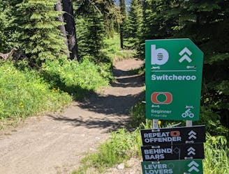
Probably the easiest top-to-bottom route at Sun Peaks bike park, this is a fun introduction to the area.
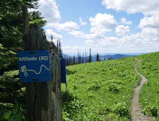
Moderate Mountain Biking
- Distance
- 5.8 km
- Ascent
- 0 m
- Descent
- 591 m
Type 1 fun right under the chairlift!
Mountain Biking Difficult

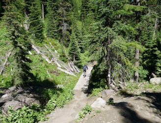
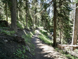
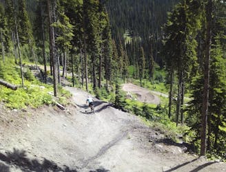
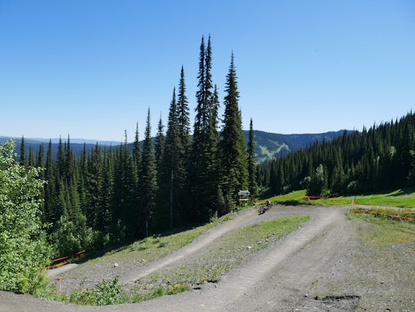
Both the American and Sun Peaks versions of Route 66 are fabulous adventures, but for very different reasons. The US iteration is famous for its big sky and straight roads, but the - admittedly less famous - Sun Peaks route is the exact opposite, with more bends and berms than we could count!
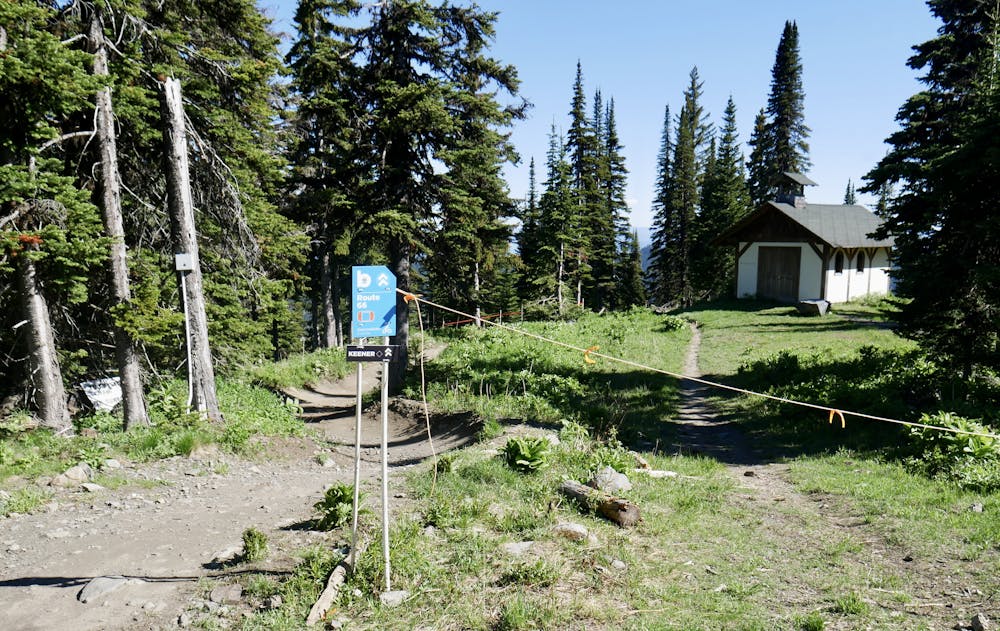
The route begins right next to the Sunburst Lodge, and there's a small church right by the top of the line too. Only the most superstitious of riders will need to pray for safety on this line, however, because it's a fun, flowy trip down the mountain with relatively minimal technical challenge.
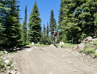
The berms on the are superbly built so they can be close together but roll and flow into each other beautifully, making this trail which puts a smile on your face. We heard it described by a local as "hero riding" and it's an apt description - you let your bike run a bit you'll be rewarded with fast, furious and surprisingly easy-feeling fun. There are some jumps too but you can roll over them if you're not feeling confident and want to suss the trail out before committing a bit more on your second or third time down the trail.
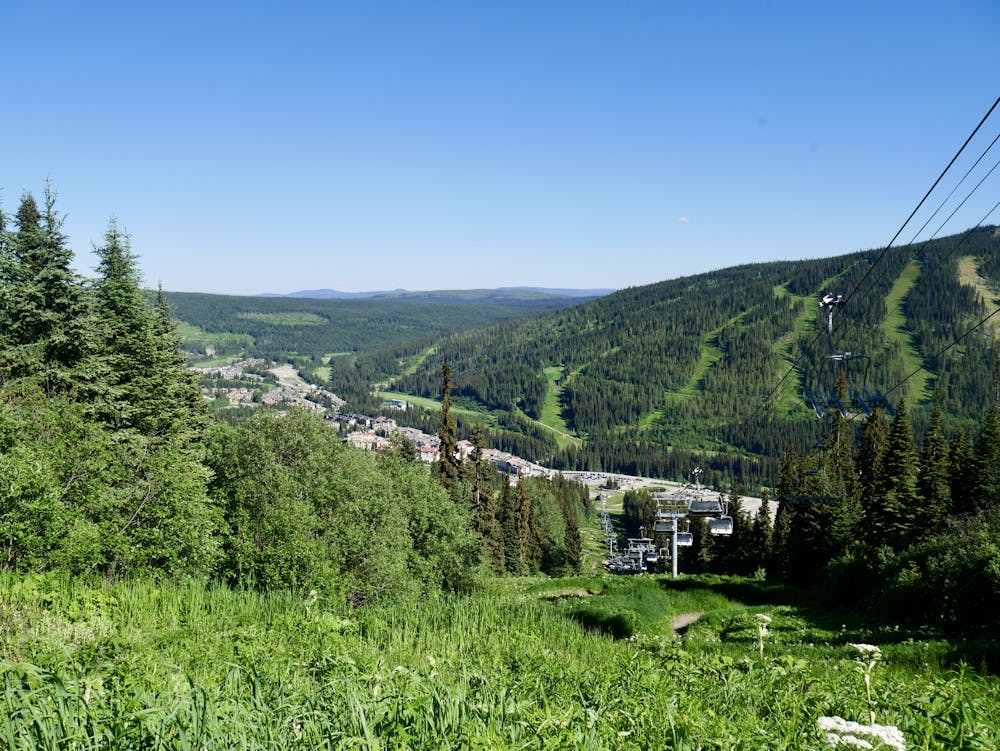
Route 66 ends up merging with Canada Line towards the bottom of the run. When the routes meet there are several options to get to the village - we've shown the line going down Root Dog (which is well named!) but Swithceroo, Canada Line or Resurrection would all work too.
Difficult
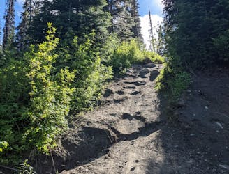
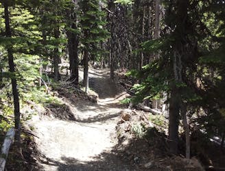
Mostly stable trail tread with some variability featuring larger and more unavoidable obstacles that may include, but not be limited to: bigger stones, roots, steps, and narrow curves. Compared to lower intermediate, technical difficulty is more advanced and grades of slopes are steeper. Ideal for upper intermediate riders.

The trail contains some obstacles such as outcroppings and rock which could cause injury.
Away from help but easily accessed.
7 m away
Probably the easiest top-to-bottom route at Sun Peaks bike park, this is a fun introduction to the area.
Moderate Mountain Biking
10 m away
Fast and furious - this is a Sun Peaks classic
Difficult Mountain Biking
11 m away
A steep, rocky, root-y and technical descent for those who like a challenge!
Severe Mountain Biking
13 m away
Explore a remote part of the mountain on this varied and straightforward trail
Moderate Mountain Biking
15 m away
Aptly-named! Huge berms and countless mini (optional) airs make this a classic ride.
Difficult Mountain Biking
29 m away
A fun and varied alternative entry to the classic Sun Peaks blues.
Difficult Mountain Biking
110 m away
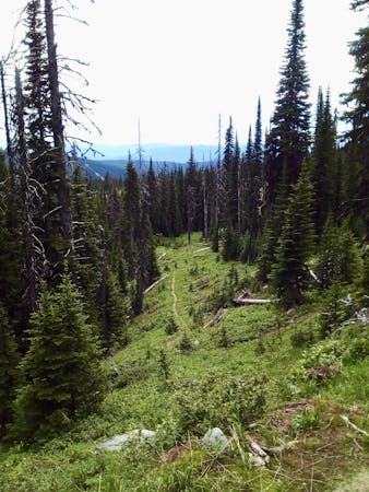
Enjoy the wonderful ambience of the Sun Peaks backcountry and some excellent trail riding too.
Difficult Mountain Biking
2 km away
Big jumps....and lots of them! Plus some fun trail riding right at the end.
Severe Mountain Biking
2.1 km away
An ideal introduction to freeride jump lines
Moderate Mountain Biking
3.3 km away
Get some exercise and enjoy the forests
Moderate Mountain Biking
6 routes · Mountain Biking
3 routes · Mountain Biking