1.2 km away
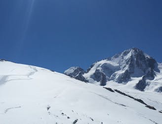
Petite Verte
Although short, this route packs in plenty of adventure and has a wonderful high mountain ambience.
Moderate Alpine Climbing
- Distance
- 1.2 km
- Ascent
- 264 m
- Descent
- 264 m
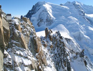
A breathtaking viewpoint via an interesting (but never particularly hard) route.
Alpine Climbing Difficult

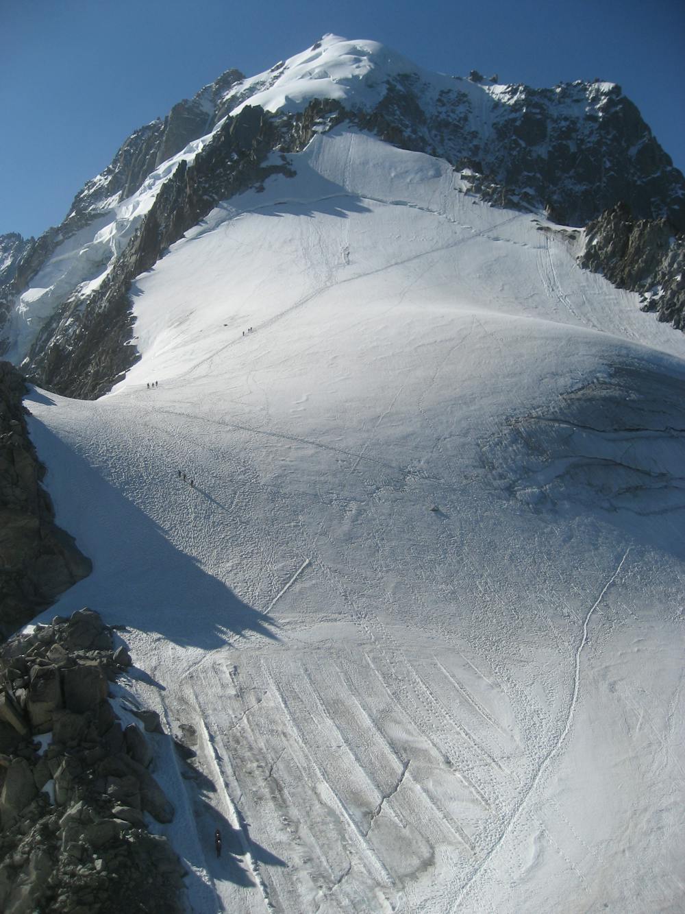
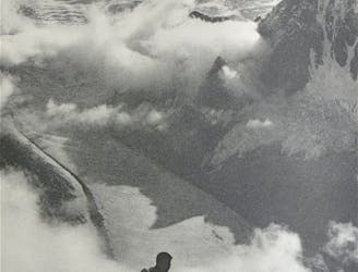
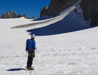
This previously very popular summit has now become considerably less so, following the devastating fire, closing the Grands Montets cable car. So now you must access this from the old mid station of the cable car, Lognan, 1975m, in summer. This is rarely done as it is a huge walk to the Col des Grands Montets, where the old cable car used to take you. More commonly this peak is climbed in the winter and spring, as described here, accessed from the top of the Bochard bubble lift, which takes you to 2785m, and continuing by skinning. From the exit of the Bochard lift duck under the ropes and, taking a long diagonal ski downwards, losing as little height as possible, reach a logical place to put your skins on. You will soon be on the glacier, so pick a canny route diagonally upwards, avoiding any obvious seracs and crevasses, aiming for the notch in the ridge at about 3000m, where the old black piste used to come through. You now find yourself on the opposite side of the mountain, with great views of Col Chardonnet and the big peaks either side. Continue diagonally upwards, passing below steep ground, then more easily, leading to a final steepening, then up to the Col des Grands Montets. Your peak now lies above you up and R. Depending on conditions you may or may not be able to continue skinning, a little distance up the lower N facing slopes, below the bergschrund. At some point you will be forced to transition to crampons. There is no exact line of ascent, but broadly you aim straight for the summit directly from below. Your exact choice will probably be influenced by the presence of other tracks or, assuming there are none, where the bergschrund looks the least threatening. There is a short section of mixed scrambling at the very top. The view from the summit more than justifies the effort to get there, with a stunning panorama and the Dru and Aiguille Verte particularly fine, due to their dominant position above you. The descent route takes the NW ridge and is an easy mixed scramble, but with significant exposure. Most of the difficulties can be avoided on the shady N side, but there is a steep wall at the start of the descent. You may choose to abseil this.
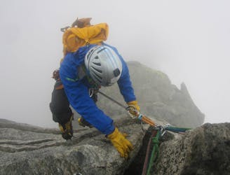
Difficult
The beginning of truly technical terrain which might involve pitched climbing on rock and/or ice, exposed terrain and complex route finding in ascent and descent. Equivalent to AD, AD+

The route features some exposed and/or difficult to protect sections.
Away from help but easily accessed.
1.2 km away
Although short, this route packs in plenty of adventure and has a wonderful high mountain ambience.
Moderate Alpine Climbing
2.8 km away
A journey up the Vallée Blanche then ladders up to a remote hut in a wild and beautiful place
Easy Alpine Climbing
4.5 km away
One of the toughest classic 4000m peaks which enjoys some of the finest views in the range.
Difficult Alpine Climbing
4.5 km away
A classic route up a rocky peak with legendary views of the Mont Blanc Massif
Moderate Alpine Climbing
4.5 km away
A remote mountain, famed by the routes on its N Face, is a challenging climb from any side.
Difficult Alpine Climbing
6.3 km away
A short introductory North Face with a long approach and descent.
Difficult Alpine Climbing
6.3 km away
A classic introductory alpine peak, with stunning views from the summit.
Easy Alpine Climbing
6.3 km away
A classic easy peak which provides a wonderful journey through high and beautiful mountains.
Moderate Alpine Climbing
6.3 km away
A gorgeous day across a wild glacier.
Moderate Alpine Climbing
8.8 km away
An iconic and accessible route with great and varied climbing, with amazing exposure down to Chamonix
Difficult Alpine Climbing

12 routes · Alpine Climbing · Hiking

15 routes · Alpine Climbing · Hiking

6 routes · Alpine Climbing · Hiking

9 routes · Alpine Climbing · Hiking

9 routes · Alpine Climbing · Hiking