2.9 km away
Buvette de la Floria
A short and pleasant hike up to a picturesque little mountain hut.
Moderate Hiking
- Distance
- 8.5 km
- Ascent
- 364 m
- Descent
- 364 m
Packed with incredible views—likely the best bang-for-your-buck hike in Chamonix!
Hiking Difficult

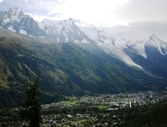
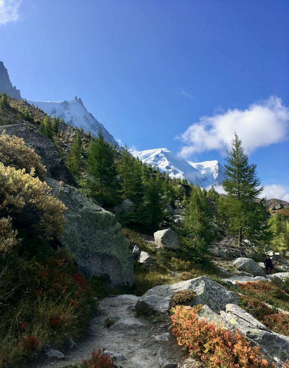
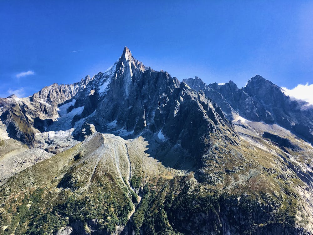
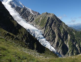
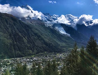
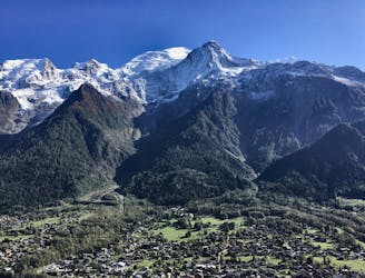
Grand Balcon Nord may be the best bang-for-your-buck hike in the Chamonix area. This stunning high alpine traverse is packed with unbelievable views of the Chamonix Valley, the surrounding mountains, the Mer de Glace glacier, and so much more!
While of course you can always access any trail in Chamonix under your own power (check out this trail running route for a loop of the Grand Balcon Nord from the valley floor), the appeal of the Grand Balcon Nord to most tourists is that unlike almost every other hike in Chamonix, you don’t have to climb over a thousand meters to access the views. Instead, you can purchase a round trip ticket to the mid-station of the Aiguille du Midi for €33.50. Then, you can hike across the Grand Balcon Nord, enjoy the stunning views, and down load on the Montenvers cog railway with the same round trip ticket. A stunning hike without the gut-wrenching climb? That's a winning formula for many people!
While by Chamonix standards this hike is about as easy as it gets, you’ll still need to be prepared to do some work. At about 6km long, and with 178 meters of climbing and 574 meters of descending, this hike will still leave you feeling as if you’ve accomplished something at the end of the day. It’s not like riding up the Midi and looking at the views. Here, you actually have to do a little bit of work.
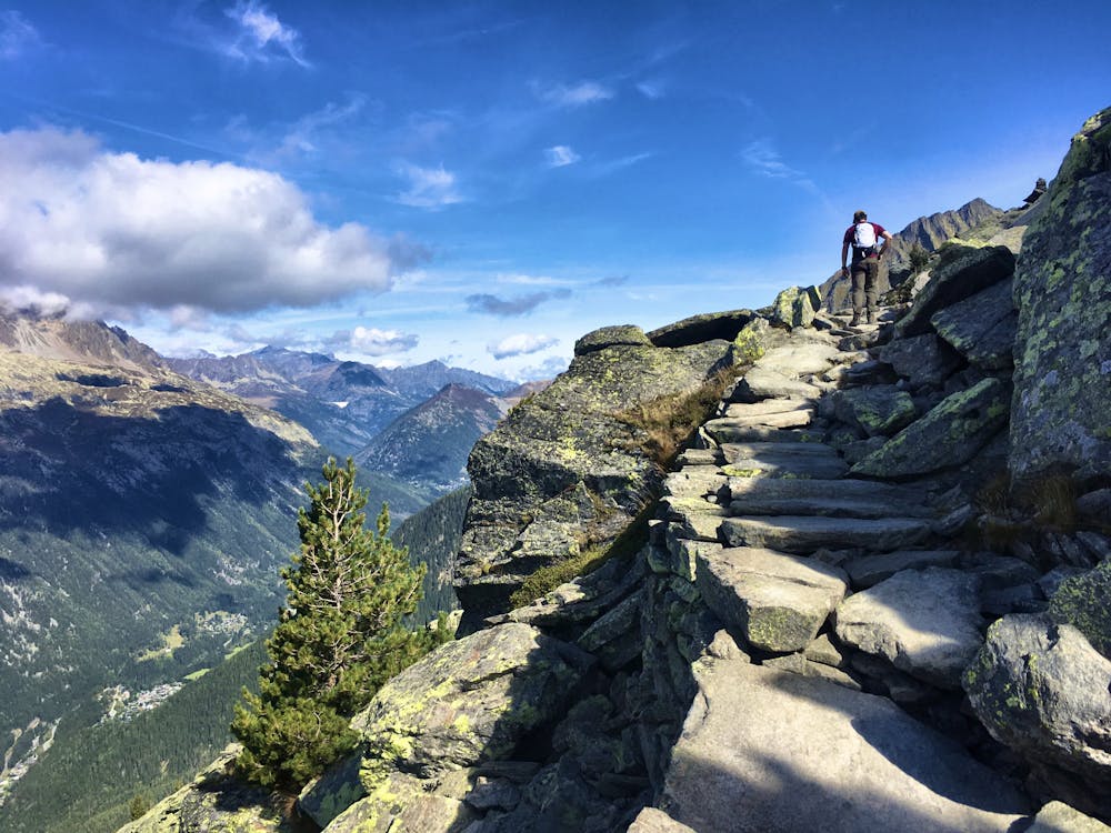
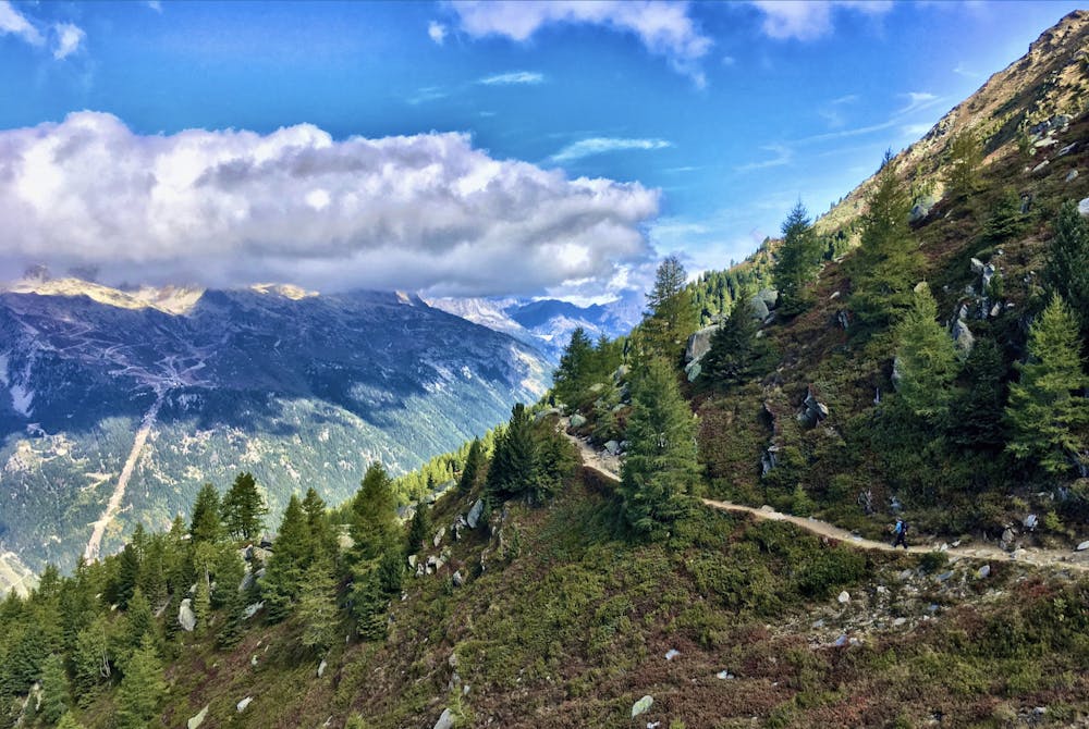
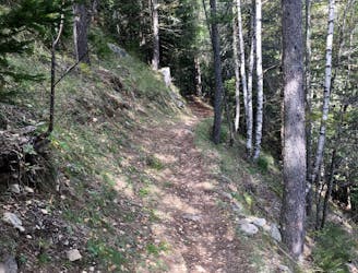
The Grand Balcon Nord trail traverses across the mountainside, undulating up and down along a rocky bench. Some of the rocks and small ups-and-downs can be steep and bouldery, requiring some care to navigate. However, in most places the trail is reinforced with beautiful rockwork that almost makes it feel like a cobblestone road.
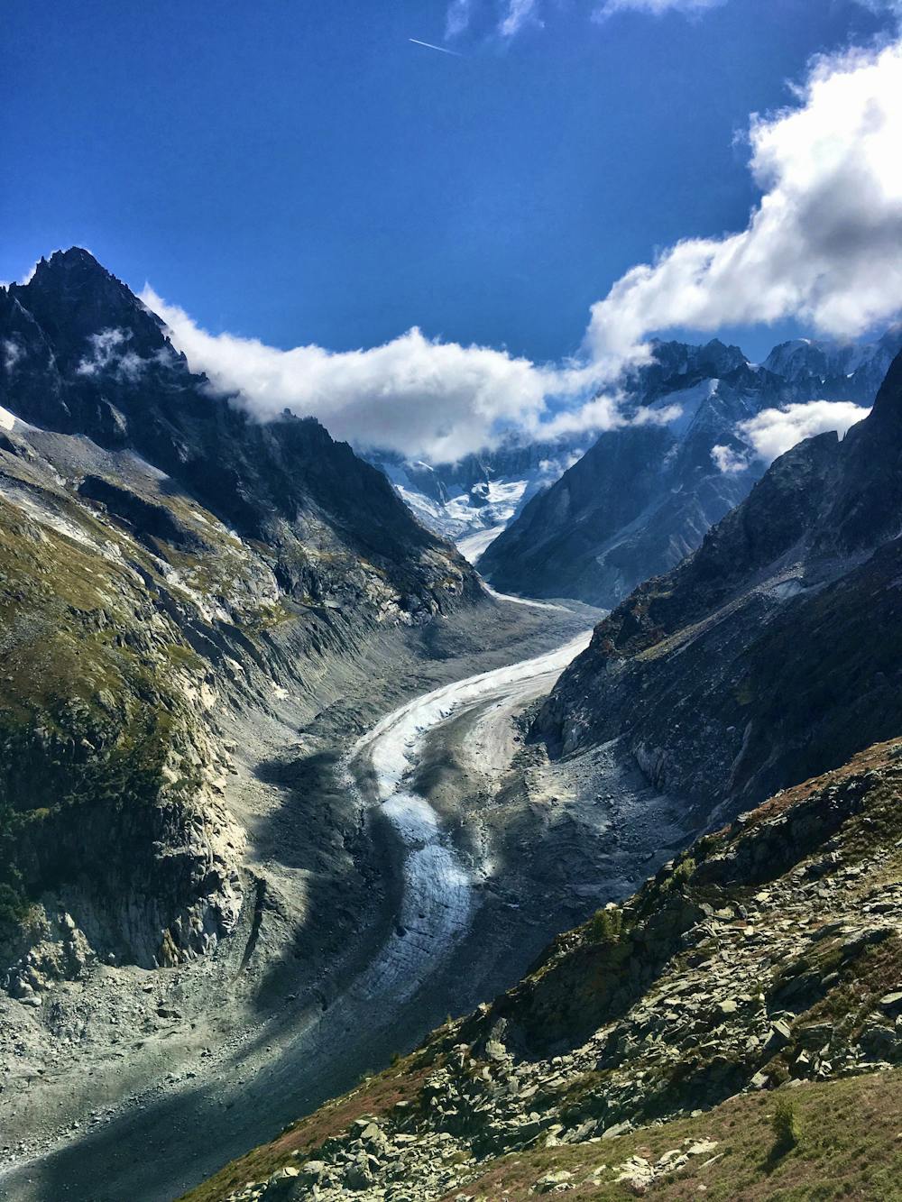
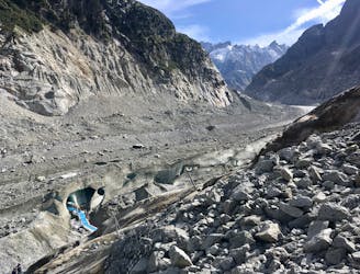
About two-thirds of the way into the trail, you’ll reach a fork where both signs point toward Montenvers. The recommended itinerary follows the upper fork in order to reach a stunning overlook of the Mer de Glace glacier. This ascent to the overlook is the one somewhat significant climb on the trail, and can be steep and rocky in places. Enjoy the stunning views along the exposed rocky sections of trail.
Once you get to the top, a mind-blowing panorama will open up below you. Be sure to stop, grab a bite to eat, and savor this surreal location.
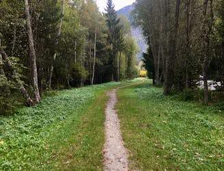
From here, it’s downhill all the way to Montenvers. The descent can be steep and loose in places, and you can expect to encounter uphill traffic from Montenvers. Be sure to share the trail with all of the other hikers and bikers.
Once at Montenvers, consider adding on the Grotte de Glace as an additional bonus hike!
Difficult
Hiking trails where obstacles such as rocks or roots are prevalent. Some obstacles can require care to step over or around. At times, the trail can be worn and eroded. The grade of the trail is generally quite steep, and can often lead to strenuous hiking.

The trail contains some obstacles such as outcroppings and rock which could cause injury.
Away from help but easily accessed.
2.9 km away
A short and pleasant hike up to a picturesque little mountain hut.
Moderate Hiking
2.9 km away
A famous hike which was the starting point for Jacques Balmat and Michel Paccard when they made the first ascent of Mont Blanc in 1786.
Difficult Hiking
3.2 km away
The easiest hike in Chamonix.
Easy Hiking
3.3 km away
A classic loop around the Chamonix Valley.
Moderate Hiking
4.2 km away
A must-do visit to an ice cave carved in the Mer de Glace glacier.
Easy Hiking
4.5 km away
A short loop on one of the best sections of the Petit Balcon Sud trail.
Moderate Hiking
4.6 km away

Escape the crowds at Lac Blanc by hiking to Lac Cornu instead.
Severe Hiking
5 km away
While one of the less interesting sections of the TMB, this stretch still offers a few hidden trail gems.
Moderate Hiking
5.2 km away

Day 1: A gentle downhill day on the sun-kissed south-facing slopes of the Brévent peak.
Moderate Hiking
5.2 km away

Circumnavigate the iconic Mont Blanc massif on this epic multi-day route.
Severe Hiking

6 routes · Hiking

14 routes · Hiking

5 routes · Hiking

12 routes · Hiking

10 routes · Hiking