14 m away
Chamonix Valley Gravel Ride
A mellow ride up and down the Chamonix valley that's mostly on gravel.
Easy Mountain Biking
- Distance
- 32 km
- Ascent
- 751 m
- Descent
- 751 m
Mostly smooth, flowy singletrack trails rolling through deep forests.
Mountain Biking Moderate

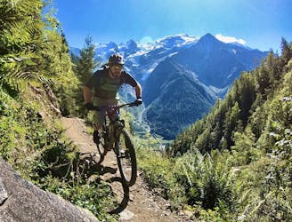
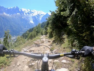
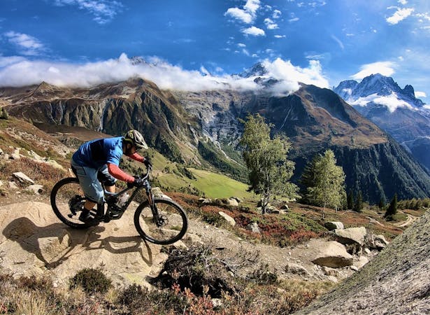
There’s no two ways about it: Chamonix’s singletrack trails are, on the whole, gnarly. Generally, you can expect an endless sea of rocks, roots, and chunder. But what if you don’t mind a steep climb up but would prefer some smooth, flowy singletrack instead of the stereotypical gnar? Well, check out this loop incorporating trails in the La Flatiere and Christ-Roi area!
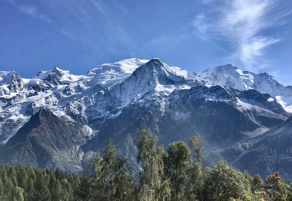
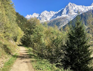
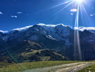
The grind from the valley floor to the top of this route is plenty demanding. Thankfully, tackling most of the climb on the pavement helps the grind to go by a bit quicker. Once you reach the higher elevations, you’ll be so stunned by the scenery and the deep forest that you’ll forget all about the pain you’re in!
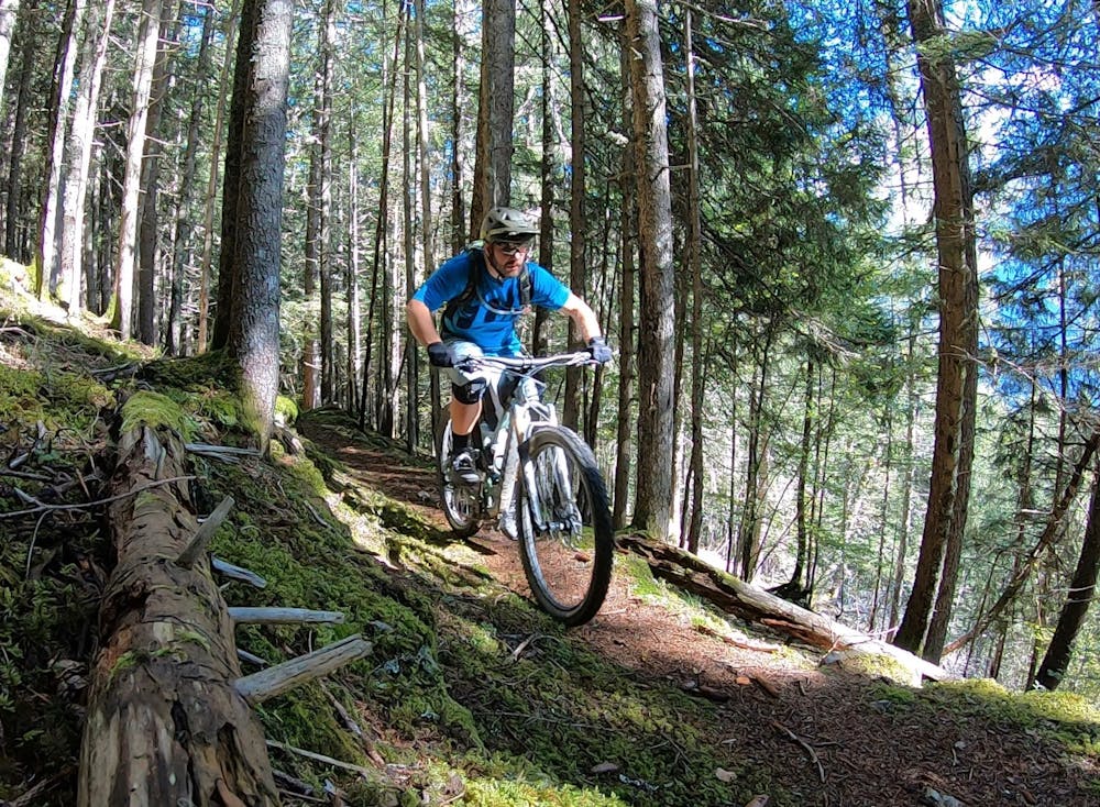
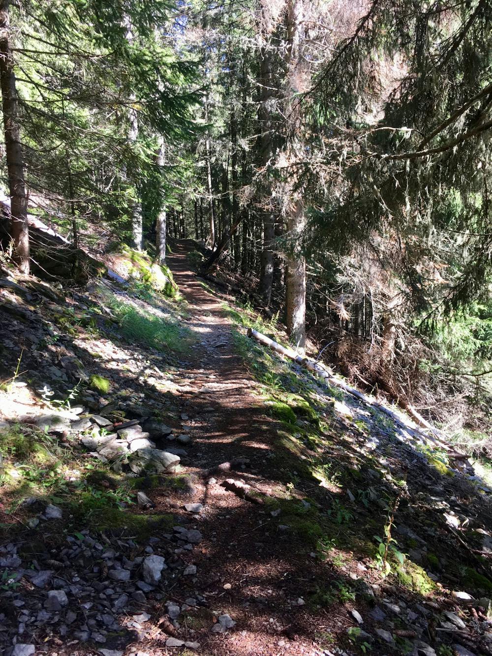
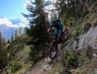
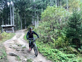
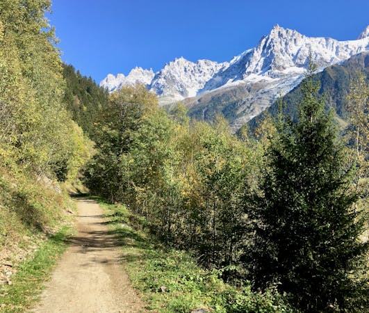
This route crisscrosses the mountainside, following delightfully narrow singletrack trails that time forgot. Rolling through the deep, dark forest, these narrow strips of loam will let you swoop and flow along on your two-wheeled rig.
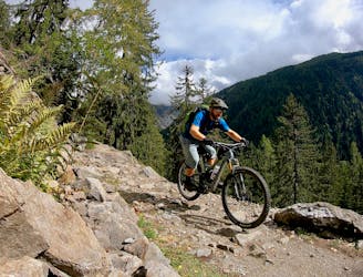
While overall these trails are much tamer than most of the singletrack you’ll find in Chamonix, the difficulty of this ride is somewhere on the line between “moderate" and "difficult.” Some uphill rock gardens are quite technical, and a few of the switchbacks are quite sharp. However, the difficulty rating has been rounded down just a touch due to the challenge of the other trails in the region.
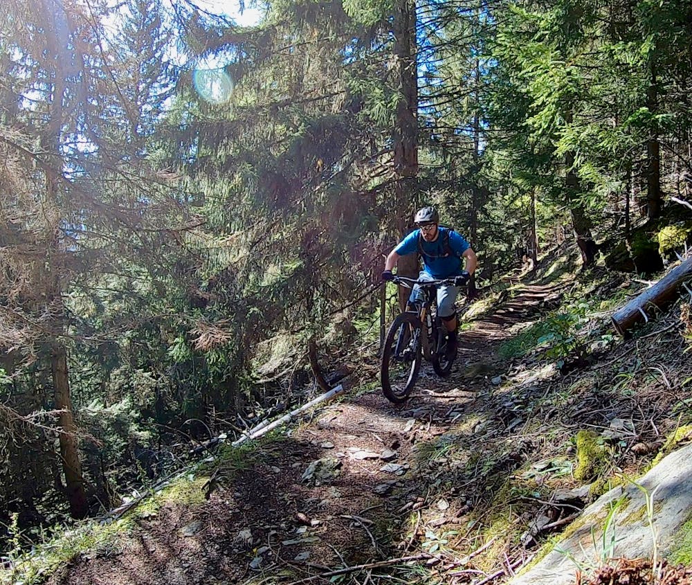
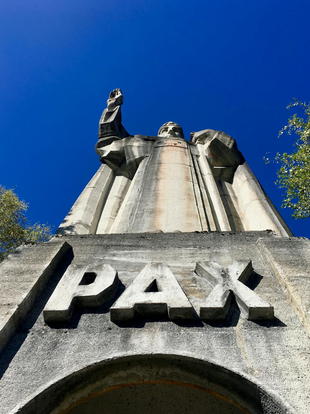
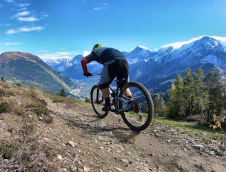
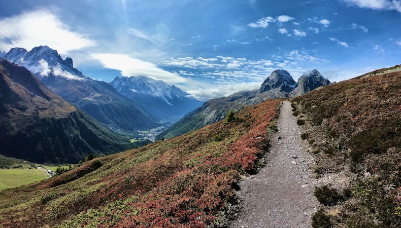
After crossing the paved road, the main descent down the mountain follows a few sections of sweet singletrack, but mostly descends a wild doubletrack grade. One or two sections feature steep, technical bits, but they’re easy to navigate by Chamonix standards. Be sure to take a break at the Christ-Roi statue during your descent—the view of Mont Blanc and the valley below is just stunning!
For a more engaging descent while still hitting the sweet sections of loamy track up high, opt to turn left on the paved road and climb back up the mountainside to access the Merlet Trail—a fantastic enduro-style rip down the mountainside. To complete this route combination, at the junction with the paved road during the descent, you’ll then merge onto the Merlet Loop route and complete that route as mapped.
Moderate
Mostly stable trail tread with some variability, with unavoidable obstacles 8in/20cm tall or less. Other obstacles such as rock gullies and steep sections may exist. Ideal for lower intermediate riders.

The trail contains some obstacles such as outcroppings and rock which could cause injury.
Away from help but easily accessed.
14 m away
A mellow ride up and down the Chamonix valley that's mostly on gravel.
Easy Mountain Biking
1.3 km away
If you have a motor on your bike, or you prefer to just do things the hard way, loop Alpage Respect with this route.
Difficult Mountain Biking
1.3 km away
An ambitious lollipop route that crosses le Prarion ridge twice.
Easy Mountain Biking
3.4 km away
An iconic Chamonix singletrack descent.
Severe Mountain Biking
3.6 km away
The primary downhill trail at Les Houches.
Difficult Mountain Biking
6.1 km away
If the lifts are closed or you have a motor attached to your bike, use this loop route to access Charlanon.
Severe Mountain Biking
6.3 km away
Brevent’s only designated mountain bike trail, this enduro-style descent on fully natural singletrack is sure to test even the best riders.
Severe Mountain Biking
6.3 km away
An ultra-technical switchbacked descent from the Planpraz lift.
Extreme Mountain Biking
7 km away
A classic loop around Chamonix that's approachable for intermediate riders.
Difficult Mountain Biking
7 km away
An easy tour through Chamonix valley, followed by two hard and long climbs to Lax des Champex.
Moderate Mountain Biking
4 routes · Mountain Biking
14 routes · Mountain Biking
4 routes · Mountain Biking · Gravel Biking
5 routes · Mountain Biking