2 m away
Charlanon
Brevent’s only designated mountain bike trail, this enduro-style descent on fully natural singletrack is sure to test even the best riders.
Severe Mountain Biking
- Distance
- 6.6 km
- Ascent
- 58 m
- Descent
- 1 km
An ultra-technical switchbacked descent from the Planpraz lift.
Mountain Biking Extreme

This route, known colloquially as "Le Brevent," runs from the top of the Planpraz Gondola back to the bottom. While the more popular route off the top of the Planpraz is Charlanon, this alternative offers some variety in case you purchase a parapent lift ticket and pack in a bunch of laps into one day.

This rugged run loses a whopping 972 meters of vert in just 5.8km. While you'll have to climb a bit to reach the top of the trail, this brutal downhill will blow your mind!
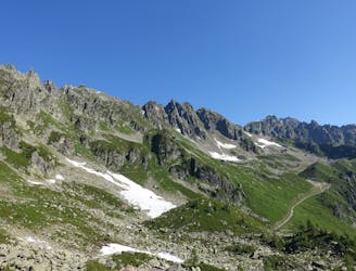
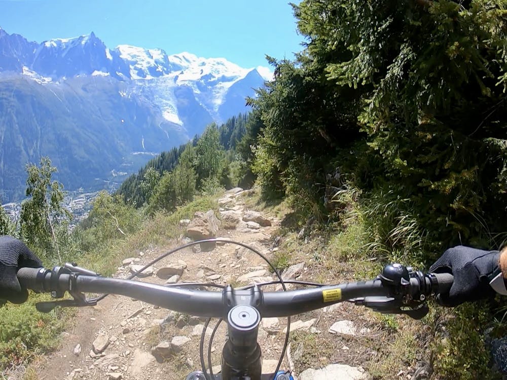
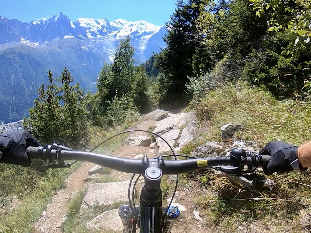
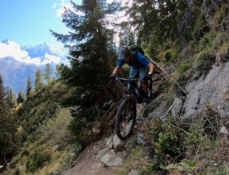
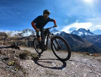
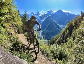
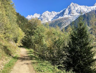
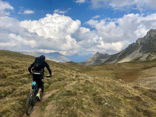
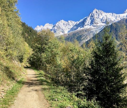
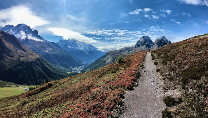
The upper section of Le Brevent begins on a wide switchbacked trail that squirrels its way down the mountainside. It's difficult to get too much speed in this section due to the constant turns. However, the views from this upper portion are fantastic if you can tear your eyes away from the loose, rolling rocks.
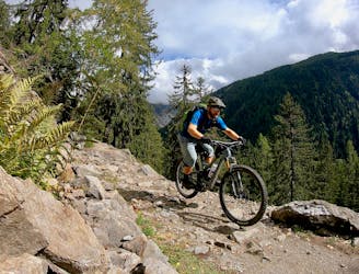
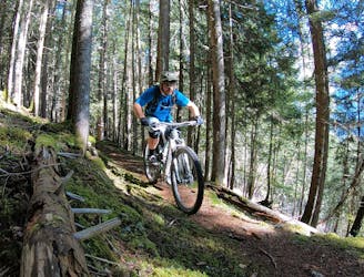
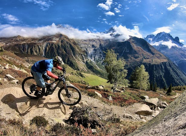
About the time the trail opens up a bit with longer sections in between the switchbacks, the technicality of the singletrack gets cranked up to 11! This mid-section contains some brutally-difficult rock moves that aren't bike-optimized in the slightest. Some of the most difficult trail features, which are basically miniature cliffs, are situated in the corners themselves. These brutal rock features earn Le Brevent a true "Extreme" mountain bike difficulty rating. The vast majority of riders will be forced to do some downhill hiking in this middle section. Thankfully, the brutal gnar doesn't last too long, and it's back to a more standard level of intimidating Chamonix gnar after this.
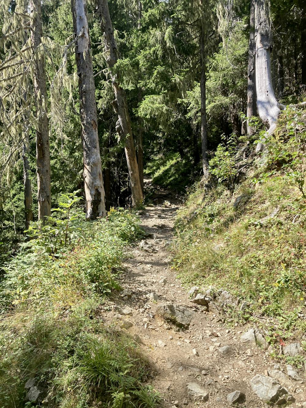
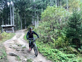
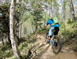
Soon, the route drops into the trees, and the singletrack takes on a dramatically different character. The soil gets darker and richer, with roots crisscrossing the trail in many places. You'll encounter a few sections of fast, smooth singletrack interspersed between the big root webs and embedded rock gardens. Snake down this fantastic section of switchbacked trail, enjoying the beauty of the forest and the delightful singletrack. This lower section is definitely the highlight of the route!
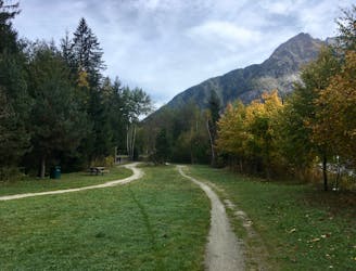
The route as shown leads directly back to the Planpraz lift, so you can hop back on and ride back to the top for another lap.
Extreme
Very steep, difficult, narrow singletrack with widely variable and unpredictable trail conditions. Unavoidable obstacles could be 15in/38cm tall or greater, and unavoidable obstacles with serious consequences are likely to be present. Obstacles could include big rocks, difficult root sections, drops, jumps, sharp switchbacks, and more. Ideal for expert-level riders.

Some trail sections have exposed ledges or steep ascents/descents where falling could cause serious injury.

Close to help in case of emergency.
2 m away
Brevent’s only designated mountain bike trail, this enduro-style descent on fully natural singletrack is sure to test even the best riders.
Severe Mountain Biking
1.6 km away
If the lifts are closed or you have a motor attached to your bike, use this loop route to access Charlanon.
Severe Mountain Biking
1.6 km away
A classic loop around Chamonix that's approachable for intermediate riders.
Difficult Mountain Biking
1.6 km away
An easy tour through Chamonix valley, followed by two hard and long climbs to Lax des Champex.
Moderate Mountain Biking
1.6 km away
An epic loop ride with a stunning high alpine singletrack traverse as a reward
Severe Mountain Biking
2 km away
The easiest mountain bike ride in Chamonix.
Easy Mountain Biking
2.5 km away
A quick hit of singletrack gnar accessible directly from downtown Chamonix.
Severe Mountain Biking
3.4 km away
An iconic Chamonix singletrack descent.
Severe Mountain Biking
6.3 km away
Mostly smooth, flowy singletrack trails rolling through deep forests.
Moderate Mountain Biking
6.3 km away
A mellow ride up and down the Chamonix valley that's mostly on gravel.
Easy Mountain Biking
4 routes · Mountain Biking
14 routes · Mountain Biking
4 routes · Mountain Biking · Gravel Biking
5 routes · Mountain Biking