392 m away
Les Perrins South Face

A slightly easier entry to the Perrins bowl, via a lovely short couloir, but still through serious terrain
Difficult Freeride Skiing
- Distance
- 951 m
- Ascent
- 4 m
- Descent
- 221 m
A classic steep colour, for expert skiers only and with tricky route-finding
Freeride Skiing Extreme
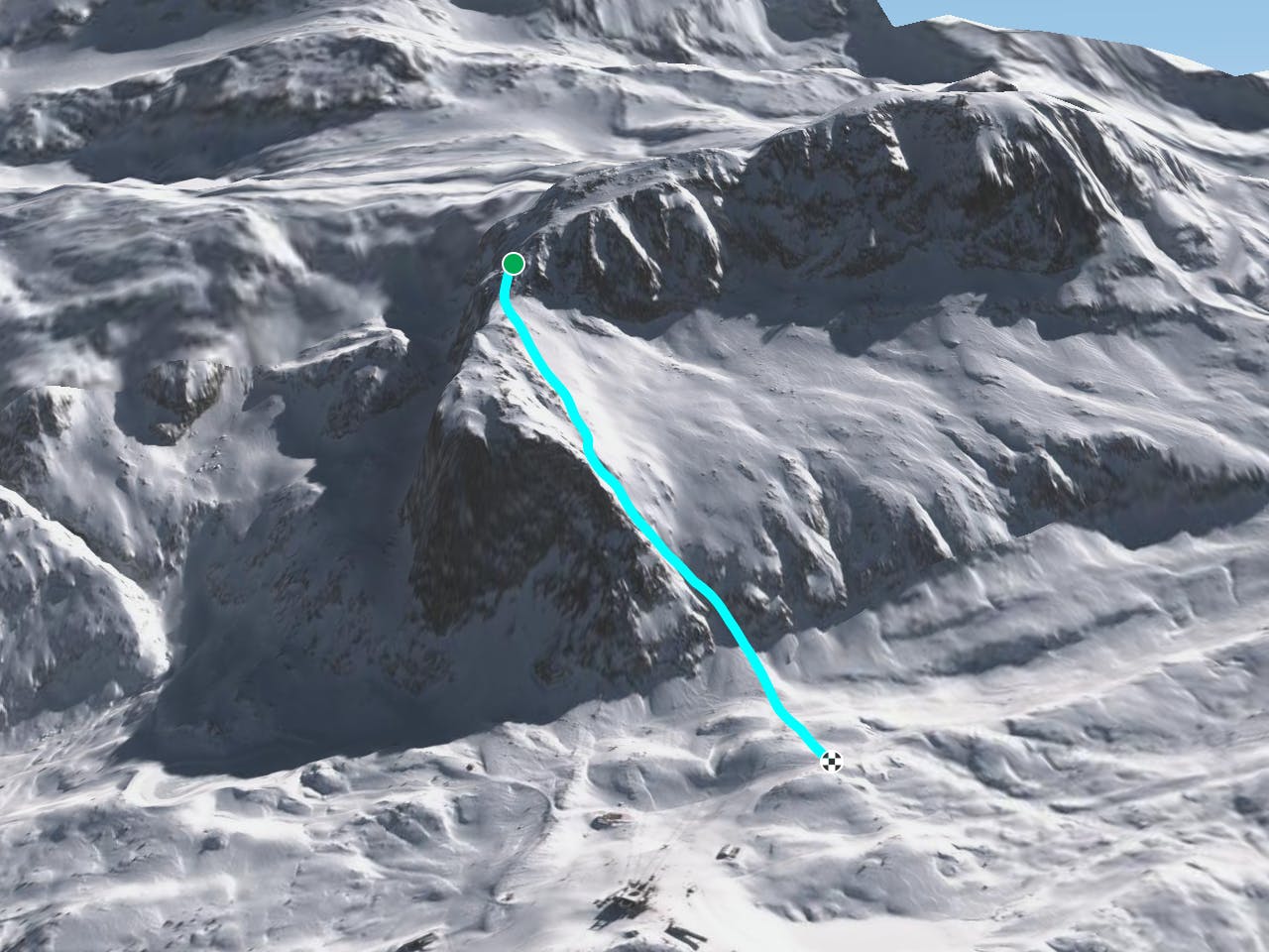
A classic couloir; steep, straight and narrow, facing south-west. In addition to the technical difficulties of the couloir itself, the approach is complex, through serious terrain and requires good route-finding skills. From the Dôme des Petites Rousses follow the Les Perrins North route until the steep traverse above the Perrins bowl. Instead of turning right into the bowl, pop over the ridge on your left to gain the Plateau de La Plate. Keep right below the rocks, until the couloir starts to appear at the far right of the plateau, with a short rock-face bounding it on the right. Ski the couloir direct, and from the exit slopes cross flattish ground to reach the Les Rousses piste.
Extreme
Extreme skiing terrain above 45 degrees. These routes are reserved for experienced experts.

As well as the slope itself, there are some obstacles (such as rock outcrops) which could aggravate injury.

Little chance of being seen or helped in case of an accident.
392 m away
A slightly easier entry to the Perrins bowl, via a lovely short couloir, but still through serious terrain
Difficult Freeride Skiing
758 m away

A fine but tricky route in serious terrain
Severe Freeride Skiing
905 m away

A great companion route to La Fare Canyon, sharing the same approach
Difficult Freeride Skiing
951 m away

A fantastic off piste adventure, in serious terrain
Difficult Freeride Skiing
953 m away

A great off-piste adventure, but in serious terrain
Difficult Freeride Skiing
2.7 km away

One of the hardest off-pistes in Alpe d'Huez
Extreme Freeride Skiing
3.3 km away

An easy access and gentle off-piste route.
Moderate Freeride Skiing
4.6 km away

A very nice off-piste with a 15 min walk up a steep section.
Difficult Freeride Skiing
6.1 km away

A beautiful, sunny route away from the crowds, but be aware of the avalanche risk.
Difficult Freeride Skiing
7.8 km away

A lovely off-piste run in a quiet corner of the ski area
Moderate Freeride Skiing
8 routes · Freeride Skiing

15 routes · Freeride Skiing · Ski Touring