2 m away
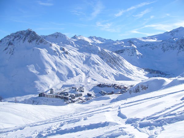
Pays Desert

A classic easy off-piste at a mellow gradient
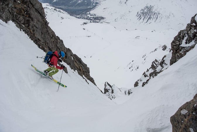
Difficult Freeride Skiing
- Distance
- 2.6 km
- Ascent
- 10 m
- Descent
- 567 m
A good introduction to off-piste skiing at high altitude
Freeride Skiing Difficult

Enjoy off-piste skiing without straying too far from the lifts. Apart from a short section, the skiing is not very steep and so it is to be avoided in deep snow. The Westerly aspect and high altitude helps keep the snow good for a while after it's snowed. From the lift, descend and then traverse to the left. Continue traversing, aware of the cliff band. Turn right in to the fall line to pass through a break in the rock band. The slope is relatively steep but short lived (beware of avalanche risk in the steeper section). Continue down to rejoin the Pays Desert lift.
Difficult
Serious gradient of 30-38 degrees where a real risk of slipping exists.

As well as the slope itself, there are some obstacles (such as rock outcrops) which could aggravate injury.
Away from help but easily accessed.
2 m away
A classic easy off-piste at a mellow gradient
Difficult Freeride Skiing
15 m away

The central line down slightly steeper terrain than the classic "Pays Desert".
Difficult Freeride Skiing
30 m away

A long adventurous journey; a Val d'Isère MEGA Classic!
Difficult Freeride Skiing
40 m away

A fantastic journey for those willing to put in a bit of effort.
Severe Freeride Skiing
1.8 km away

The Val mega classic avoiding the gorge
Difficult Freeride Skiing
2.6 km away

Easy access off piste run on a large north facing slope often with fantastic cold snow
Difficult Freeride Skiing
2.7 km away

A long ski descent away from the lifts with a lot of space for exploration.
Difficult Freeride Skiing
2.8 km away

More technical variant of Grand Vallon
Difficult Freeride Skiing
2.8 km away

Easy access off piste run on a large north facing slope often offering fantastic cold snow.
Difficult Freeride Skiing
3.3 km away

An easily-accessed bowl to lap straight after snowfall.
Difficult Freeride Skiing
70 routes · Freeride Skiing
6 routes · Freeride Skiing