10 m away
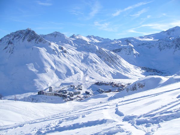
Col Pers Classic

A long adventurous journey; a Val d'Isère MEGA Classic!
Difficult Freeride Skiing
- Distance
- 7.6 km
- Ascent
- 70 m
- Descent
- 1.2 km
A fantastic journey for those willing to put in a bit of effort.
Freeride Skiing Severe

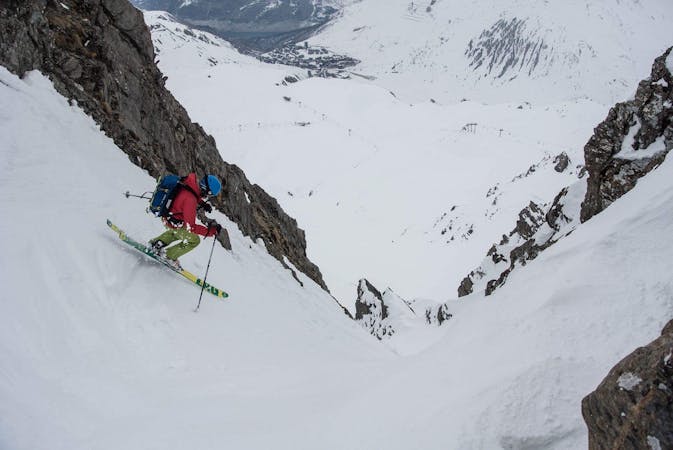
A fantastic journey for experienced skiers down the North Face of the Pointe Pers and to more excellent skiing below, but you'll need to earn your turns as around 20-25 mins of walking is needed to access the line. From the top of the Montet lift, take a gentle line towards the Pointe Pers. Cross under the summit and reach the ridge lookers left of the main summit. Whilst it's only a short hike, skins can be useful. From the ridge, locate the entrance to the North Face - which is not always easy if you are the first. Beware of the cornices and make sure you pick the right entrance. The start of the line is steep and over 40 degrees for a short time but the angle quickly eases off. The north facing terrain holds great snow and the you'll be pleased you took the short walk as you ski the fall-line almost straight down towards the Prariond refuge via the alternative line from Col Pers. As with the Col Pers make sure the Malpasset gorge is passable or you won't be able to get out back to Val d'Isere.
Severe
Steep skiing at 38-45 degrees. This requires very good technique and the risk of falling has serious consequences.

As well as the slope itself, there are some obstacles (such as rock outcrops) which could aggravate injury.

Little chance of being seen or helped in case of an accident.
10 m away
A long adventurous journey; a Val d'Isère MEGA Classic!
Difficult Freeride Skiing
40 m away

A good introduction to off-piste skiing at high altitude
Difficult Freeride Skiing
41 m away

A classic easy off-piste at a mellow gradient
Difficult Freeride Skiing
53 m away

The central line down slightly steeper terrain than the classic "Pays Desert".
Difficult Freeride Skiing
1.8 km away

The Val mega classic avoiding the gorge
Difficult Freeride Skiing
2.6 km away

Easy access off piste run on a large north facing slope often with fantastic cold snow
Difficult Freeride Skiing
2.7 km away

A long ski descent away from the lifts with a lot of space for exploration.
Difficult Freeride Skiing
2.7 km away

More technical variant of Grand Vallon
Difficult Freeride Skiing
2.8 km away

Easy access off piste run on a large north facing slope often offering fantastic cold snow.
Difficult Freeride Skiing
3.3 km away

An easily-accessed bowl to lap straight after snowfall.
Difficult Freeride Skiing
70 routes · Freeride Skiing
6 routes · Freeride Skiing